Isle Royale, National park island in Lake Superior, Michigan, United States.
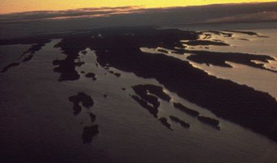
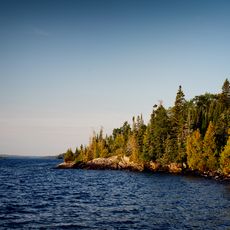
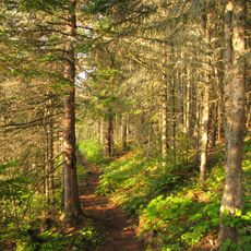
Isle Royale is an island in Lake Superior within the state of Michigan, measuring 45 miles (72 km) in length and 9 miles (14 km) in width. The terrain consists of rocky shorelines, quiet inland lakes, and ridges covered with dense conifer forest.
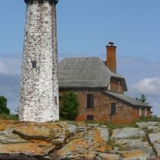
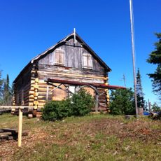
Native peoples from regions west and north of the lake mined copper here over many centuries, leaving pits that remain visible today. Europeans explored the island from the 17th century onward, but permanent settlement never took hold.
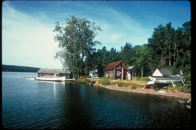
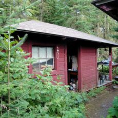
The name comes from French and means royal island, a reference to early European explorers who passed through these waters. Visitors today follow footpaths that wind through dense forest and stay in simple cabins or campsites along the shore.
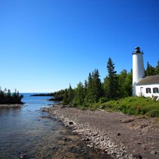
Ferries and seaplanes bring visitors to the island between May and September, while it closes from November through April. Those planning to hike should bring sturdy footwear and gear for changing weather, as shelters are spaced far apart.
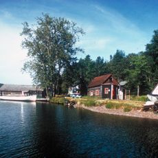
The island sits closer to the Canadian shore than to the American side, yet belongs politically to Michigan. Moose and wolves live here with no natural land connection, forming a biological system that researchers have watched for decades.
Location: Michigan
GPS coordinates: 48.00000,-88.91667
Latest update: December 4, 2025 19:06
Michigan holds a wide array of natural and historical sites across its two peninsulas. The shoreline runs for hundreds of miles along the Great Lakes, showing sand beaches, rocky cliffs, and dune formations. In the north, dense forests, waterfalls, and rock formations shaped by erosion dominate the landscape. Lighthouses from the 19th century mark key points along the waterways. Historical sites document the region's development, from military posts to industrial monuments. Visitors can explore places like Pictured Rocks, where colored sandstone cliffs rise directly above the water, or Sleeping Bear Dunes, where sand piles up to 450 feet (137 meters) high. Mackinac Bridge connects the two peninsulas with a span of roughly 5 miles (8 kilometers). At Hartwick Pines State Park, pine trees stand several centuries old. Tahquamenon Falls ranks among the larger waterfalls east of the Mississippi. On Mackinac Island, Fort Mackinac dates to the 18th century, while the Heidelberg Project in Detroit presents contemporary art in an urban setting. This collection presents both natural and human-made sites across a region that stretches over both of Michigan's peninsulas.
Sleeping Giant Provincial Park
37.5 km
Mount McKay
47.2 km
Northwestern Ontario Sports Hall of Fame
49 km
Rock of Ages Light
33.1 km
Fort William Gardens
49.6 km
Greenstone Ridge Trail
9 km
Fort Kaministiquia
49.9 km
Isle Royale Light
12.9 km
Jackknife Bascule Bridge
48.3 km
St. Patrick's Cathedral
49.2 km
Rock Harbor Light
27 km
Chippewa Park
43 km
Royal Edward Arms
49.1 km
Passage Island Light
47.9 km
Edisen Fishery
26.8 km
Thunder Bay Historical Museum
49.1 km
Johns Hotel
27.2 km
Grain Exchange Building
49.4 km
Ojibway Fire Tower
26 km
Tobin Harbor Historic District
38.6 km
New Feldtmann Fire Tower
20.3 km
Ishpeming Fire Tower
648 m
Le Pate Provincial Nature Reserve
31.5 km
Fort William Collegiate Institute
48.8 km
Carnelian Beach
12.5 km
St. Andrew's Presbyterian Church
49.1 km
425 Donald Street East
49.1 km
Brodie Resource Library
49 kmReviews
Visited this place? Tap the stars to rate it and share your experience / photos with the community! Try now! You can cancel it anytime.
Discover hidden gems everywhere you go!
From secret cafés to breathtaking viewpoints, skip the crowded tourist spots and find places that match your style. Our app makes it easy with voice search, smart filtering, route optimization, and insider tips from travelers worldwide. Download now for the complete mobile experience.
A unique approach to discovering new places❞
— Le Figaro
All the places worth exploring❞
— France Info
A tailor-made excursion in just a few clicks❞
— 20 Minutes