Enable Location

We need your location to show you interesting places around you

Discover nearby places

Find interesting locations and hidden gems around you

Precise directions

Get accurate directions and distances to places

Your location is never shared with other users. It's only used when you tap the location button.

Adams County

Log in to your account

Start exploring — it's free

Trusted by 61,854 travelers worldwide

Continue with Google
Continue with Apple
or

We will send you a code to connect

By continuing, you accept our Terms and Conditions and our Privacy Policy

Check your inbox

We've sent a pincode in your inbox. Please enter the code below.

Adams County, County in southwestern Iowa, United States

Description

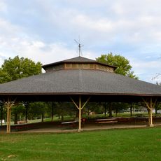
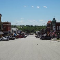
Adams County is an administrative division in southwestern Iowa with gently rolling hills, scattered woodlands, and several small streams running through its landscape. Agricultural land dominates the terrain and defines the rural character of the region.

History

The Iowa State Legislature established Adams County in 1851 and later organized it as an independent administrative unit in 1853. This separation allowed the area to develop its own governance and local institutions.

Culture

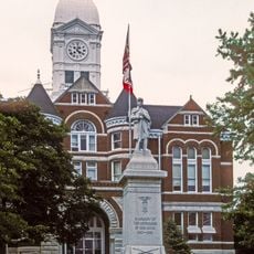
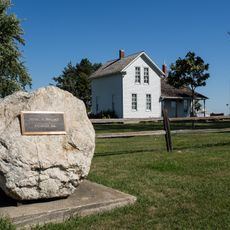
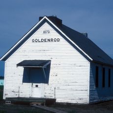
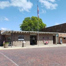
The county seat of Corning keeps local traditions alive through efforts to document and share stories of early settlers with visitors. This work shows how the community values its connection to the people who first shaped this land.

Practical

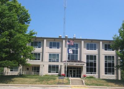
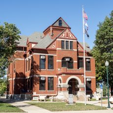
The local administration in the county seat of Corning handles essential services such as property tax collection and vehicle registration. When visiting, it helps to check office hours in advance for administrative services.

Did you know?

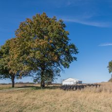
The area remains sparsely populated with small farms making up most of the land, creating a quiet rural landscape that has changed little over time. This agricultural character defines how the place looks and feels when traveling through it.

Location
Inception
March 12, 1853
Capital city
Corning
Shares border with
Adair County, Taylor County, Cass County, Montgomery County, Page County, Union County, Ringgold County
GPS coordinates
41.02917,-94.69917
Latest update
December 7, 2025 20:40

AroundUs brings together thousands of curated places, local tips, and hidden gems, enriched daily by 60,000 contributors worldwide. Discover all places nearby (Iowa).

Around this place
Josiah B. and Sara Moore House
United States of America

Josiah B. and Sara Moore House

25.4 km
Iowa Aviation Museum
United States of America

Iowa Aviation Museum

39.3 km
Lenox Round Barn
United States of America

Lenox Round Barn

39.2 km
Adams County Jail
United States of America

Adams County Jail

5.1 km
Adair County Courthouse
United States of America

Adair County Courthouse

36.7 km
Page County Courthouse
United States of America

Page County Courthouse

43.2 km
William P. Hepburn House
United States of America

William P. Hepburn House

43.1 km
Taylor County Courthouse
United States of America

Taylor County Courthouse

40.4 km
Jefferson Elementary School
United States of America

Jefferson Elementary School

29 km
United States Post Office
United States of America

United States Post Office

28.4 km
Clarinda Carnegie Library
United States of America

Clarinda Carnegie Library

43 km
Hotel Greenfield
United States of America

Hotel Greenfield

36.7 km
Nodaway River Bridge
United States of America

Nodaway River Bridge

31.6 km
Edmund B. Osborne House
United States of America

Edmund B. Osborne House

44 km
Adams County Courthouse
United States of America

Adams County Courthouse

5.2 km
Snider Bridge
United States of America

Snider Bridge

8.6 km
Bedford House
United States of America

Bedford House

40.4 km
Chautauqua Park
United States of America

Chautauqua Park

43.9 km
Noah Odell House
United States of America

Noah Odell House

17.2 km
Catalpa
United States of America

Catalpa

36.3 km
Goldenrod Schoolhouse
United States of America

Goldenrod Schoolhouse

44.5 km
Warren Opera House Block and Hetherington Block
United States of America

Warren Opera House Block and Hetherington Block

36.7 km
Bedford Commercial Historic District
United States of America

Bedford Commercial Historic District

40.4 km
Alfred Hebard House
United States of America

Alfred Hebard House

44 km
W.T.S. White House and Carriage House
United States of America

W.T.S. White House and Carriage House

42.9 km
Corning Commercial Historic District
United States of America

Corning Commercial Historic District

5.4 km
Frontier Lanes
United States of America

Frontier Lanes

44 km
Bedford City Hall
United States of America

Bedford City Hall

40.3 km
Show the full map
« Adams County - County in southwestern Iowa, United States » is provided by Around Us (aroundus.com). Images and texts are derived from Wikimedia project under a Creative Commons license. You are allowed to copy, distribute, and modify copies of this page, under the conditions set by the license, as long as this note is clearly visible.

Discover hidden gems everywhere you go!

From secret cafés to breathtaking viewpoints, skip the crowded tourist spots and find places that match your style. Our app makes it easy with voice search, smart filtering, route optimization, and insider tips from travelers worldwide. Download now for the complete mobile experience.

Around Us App Screenshot

A unique approach to discovering new places

Le Figaro

All the places worth exploring

France Info

A tailor-made excursion in just a few clicks

20 Minutes

Around Us
Travel Guide & Maps
Download

Send to your phone

QR Code
1

Open the camera app on your mobile.

2

Point at the QR code with your camera. A notification will appear.

3

Tap the notification to open the link.