Enable Location

We need your location to show you interesting places around you

Discover nearby places

Find interesting locations and hidden gems around you

Precise directions

Get accurate directions and distances to places

Your location is never shared with other users. It's only used when you tap the location button.

Green County

Log in to your account

Start exploring — it's free

Trusted by 62,937 travelers worldwide

Continue with Google
Continue with Apple
or

We will send you a code to connect

By continuing, you accept our Terms and Conditions and our Privacy Policy

Check your inbox

We've sent a pincode in your inbox. Please enter the code below.

Discussion Reviews 1 Photos
16.2k Popularity

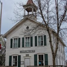
Green County, Administrative division in southern Wisconsin, United States

Green County is an administrative division in southern Wisconsin with Monroe serving as its county seat. The area encompasses several towns and communities connected by major highways that link it to neighboring counties.

The area became Green County in 1837, named after General Nathanael Greene from the Revolutionary War era. Before that, the Ho-Chunk people lived in the region for generations, using the land for hunting and gathering.

The Ho-Chunk Native Americans initially owned all the territory of Green County, referring to the local mining areas as the Sac Diggings.

The area is crossed by several major highways including Routes 11, 39, and 69, which connect it to other parts of the state. Monroe Municipal Airport provides air access for those needing to fly in or out.

The county experienced a remarkable political shift starting in 1992, moving from its long tradition of Republican support to voting Democratic in every presidential election since then. This change reflects broader shifts in the region's voters and their priorities.

The community of curious travelers

AroundUs brings together thousands of curated places, local tips, and hidden gems, enriched daily by 60,000 contributors worldwide.

Start exploring
Location
Inception
1836
Capital city
Monroe
Shares border with
Dane County, Rock County, Winnebago County, Stephenson County, Lafayette County, Iowa County
GPS coordinates
42.68000,-89.60000
Latest update
December 7, 2025 19:27
Around this place
New Glarus Woods State Park
United States of America

New Glarus Woods State Park

12.4 km
Abraham's Woods
United States of America

Abraham's Woods

9.5 km
Cadiz Springs State Recreation Area
United States of America

Cadiz Springs State Recreation Area

17.7 km
Chalet of the Golden Fleece
United States of America

Chalet of the Golden Fleece

15.2 km
First Methodist Church
United States of America

First Methodist Church

9.4 km
Frank L. Chenoweth House
United States of America

Frank L. Chenoweth House

9.1 km
Green County Courthouse
United States of America

Green County Courthouse

9.3 km
New Glarus Town Hall
United States of America

New Glarus Town Hall

15.6 km
Freitag's Pure Oil Service Station
United States of America

Freitag's Pure Oil Service Station

9.2 km
Cleveland's Hall and Blacksmith Shop
United States of America

Cleveland's Hall and Blacksmith Shop

14 km
Monroe Water Tower
United States of America

Monroe Water Tower

10 km
Hefty–Blum Farmstead
United States of America

Hefty–Blum Farmstead

11 km
Francis West Smith House
United States of America

Francis West Smith House

19.4 km
Cadiz Township Joint District No. 2 School
United States of America

Cadiz Township Joint District No. 2 School

19.4 km
General Francis H. West House
United States of America

General Francis H. West House

9.6 km
Gen. James Bintliff House
United States of America

Gen. James Bintliff House

9 km
Jacob Regez, Sr. House
United States of America

Jacob Regez, Sr. House

8.7 km
Exchange Square Historic District
United States of America

Exchange Square Historic District

19.5 km
C.D. Hulburt House
United States of America

C.D. Hulburt House

9.6 km
Monroe Commercial District
United States of America

Monroe Commercial District

9.4 km
Albert and Minna Ten Eyck Round Barn
United States of America

Albert and Minna Ten Eyck Round Barn

18.6 km
Janet Jennings House
United States of America

Janet Jennings House

8.7 km
Dr. Samuel Blumer House
United States of America

Dr. Samuel Blumer House

15.3 km
Judge John A. Bingham House
United States of America

Judge John A. Bingham House

8.9 km
John C. and Barbara Steinman House
United States of America

John C. and Barbara Steinman House

7 km
The Toy Train Barn
United States of America

The Toy Train Barn

17 km
Green County Welcome Center
United States of America

Green County Welcome Center

10.7 km
Albany Wildlife Area
United States of America

Albany Wildlife Area

12.5 km
Show the full map
Reviews
Share your experience

No review yet

Discussions
Start a discussion...

No discussion yet

« Green County - Administrative division in southern Wisconsin, United States » is provided by Around Us (aroundus.com). Images and texts are derived from Wikimedia project under a Creative Commons license. You are allowed to copy, distribute, and modify copies of this page, under the conditions set by the license, as long as this note is clearly visible.

Discover hidden gems everywhere you go!

From secret cafés to breathtaking viewpoints, skip the crowded tourist spots and find places that match your style. Our app makes it easy with voice search, smart filtering, route optimization, and insider tips from travelers worldwide. Download now for the complete mobile experience.

Around Us App Screenshot

A unique approach to discovering new places

Le Figaro

All the places worth exploring

France Info

A tailor-made excursion in just a few clicks

20 Minutes

Around Us
Travel Guide & Maps
Download

Send to your phone

QR Code
1

Open the camera app on your mobile.

2

Point at the QR code with your camera. A notification will appear.

3

Tap the notification to open the link.