Enable Location

We need your location to show you interesting places around you

Discover nearby places

Find interesting locations and hidden gems around you

Precise directions

Get accurate directions and distances to places

Your location is never shared with other users. It's only used when you tap the location button.

Waseca County

Log in to your account

Start exploring — it's free

Trusted by 61,900 travelers worldwide

Continue with Google
Continue with Apple
or

We will send you a code to connect

By continuing, you accept our Terms and Conditions and our Privacy Policy

Check your inbox

We've sent a pincode in your inbox. Please enter the code below.

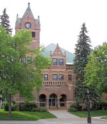
Waseca County, Administrative county in southern Minnesota, United States.

Waseca County is an administrative division in southern Minnesota featuring gently rolling terrain, river systems, and productive farmland. The landscape includes multiple waterways that flow through extensive agricultural areas.

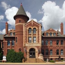
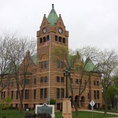
The county was established on February 27, 1857, when it was separated from western Steele County. Its first government seat was located in the Wilton settlement.

The name Waseca comes from Dakota language roots and refers to the fertile soils found here. This linguistic heritage reflects the historical presence of Native peoples in the region.

The area is best explored by car since properties and services are spread across the region. Visitors can check the county website for local information and maps before visiting.

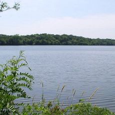
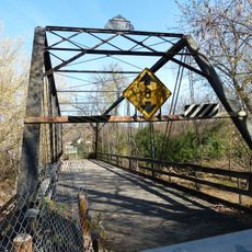
The Le Sueur River runs through this area and connects to the Blue Earth River, forming a significant water corridor. This river system has shaped settlement and travel patterns throughout the county's history.

The community of curious travelers

AroundUs brings together thousands of curated places, local tips, and hidden gems, enriched daily by 60,000 contributors worldwide.

Start exploring
Location
Inception
February 27, 1857
Capital city
Waseca
Shares border with
Rice County, Faribault County, Steele County, Freeborn County, Le Sueur County, Blue Earth County
GPS coordinates
44.02000,-93.59000
Latest update
December 10, 2025 15:57
Around this place
National Farmers' Bank of Owatonna
United States of America

National Farmers' Bank of Owatonna

30 km
Sakatah Lake State Park
United States of America

Sakatah Lake State Park

22.8 km
Minnesota State Public School for Dependent and Neglected Children
United States of America

Minnesota State Public School for Dependent and Neglected Children

29.2 km
Blue Earth County Courthouse
United States of America

Blue Earth County Courthouse

36.4 km
Daniel S. Piper House
United States of America

Daniel S. Piper House

32 km
Dodd Road Discontiguous District
United States of America

Dodd Road Discontiguous District

34.4 km
Clarks Grove Cooperative Creamery
United States of America

Clarks Grove Cooperative Creamery

35.4 km
William R. Wolf House
United States of America

William R. Wolf House

9.7 km
Vista Lutheran Church
United States of America

Vista Lutheran Church

12.2 km
Steele County Courthouse
United States of America

Steele County Courthouse

30 km
Waseca County Courthouse
United States of America

Waseca County Courthouse

9.4 km
Owatonna Public Library
United States of America

Owatonna Public Library

30.3 km
Seha Sorghum Mill
United States of America

Seha Sorghum Mill

19.9 km
Old Main
United States of America

Old Main

36.4 km
Dr. John H. Adair House
United States of America

Dr. John H. Adair House

30.5 km
Bridge No. L-5573
United States of America

Bridge No. L-5573

30.8 km
Owatonna City and Firemen's Hall
United States of America

Owatonna City and Firemen's Hall

29.9 km
Hofmann Apiaries
United States of America

Hofmann Apiaries

17.8 km
Peter Kremer House
United States of America

Peter Kremer House

27.7 km
John W. Aughenbaugh House
United States of America

John W. Aughenbaugh House

10.1 km
Philo C. Bailey House
United States of America

Philo C. Bailey House

9.5 km
Lucas Troendle House
United States of America

Lucas Troendle House

31 km
Roscoe P. Ward House
United States of America

Roscoe P. Ward House

9.8 km
Janesville Free Public Library
United States of America

Janesville Free Public Library

14.4 km
Ezra Abbott House
United States of America

Ezra Abbott House

30.5 km
Strangers Refuge Lodge Number 74, IOOF
United States of America

Strangers Refuge Lodge Number 74, IOOF

16.1 km
Adolph O. Eberhart House
United States of America

Adolph O. Eberhart House

36.6 km
Mapleton Public Library
United States of America

Mapleton Public Library

31.4 km
Show the full map
« Waseca County - Administrative county in southern Minnesota, United States » is provided by Around Us (aroundus.com). Images and texts are derived from Wikimedia project under a Creative Commons license. You are allowed to copy, distribute, and modify copies of this page, under the conditions set by the license, as long as this note is clearly visible.

Discover hidden gems everywhere you go!

From secret cafés to breathtaking viewpoints, skip the crowded tourist spots and find places that match your style. Our app makes it easy with voice search, smart filtering, route optimization, and insider tips from travelers worldwide. Download now for the complete mobile experience.

Around Us App Screenshot

A unique approach to discovering new places

Le Figaro

All the places worth exploring

France Info

A tailor-made excursion in just a few clicks

20 Minutes

Around Us
Travel Guide & Maps
Download

Send to your phone

QR Code
1

Open the camera app on your mobile.

2

Point at the QR code with your camera. A notification will appear.

3

Tap the notification to open the link.