Johnson County

Log in to your account

AroundUs is a community-driven map of interesting places, built by curious explorers like you. It grows with every review, story, and photo you share.
Connect to save your favorite spots, contribute locations, and create personalized routes.
By continuing, you accept our Terms and Conditions and our Privacy Policy
Add to collection
Map
Suggest a change
Share

Johnson County, County administrative division in Kentucky, US.

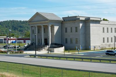
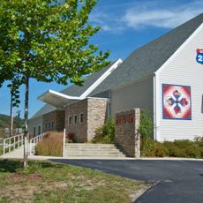
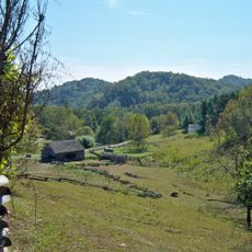
Johnson County is an administrative division in eastern Kentucky where Paint Creek flows through its territory. Paintsville functions as the governmental center and houses the main offices for law enforcement, emergency services, and public works departments.

The county was established on February 24, 1843, when Kentucky authorities created it as an administrative unit and designated Paintsville as its seat. This founding was part of the state's expansion and reorganization of administrative structures in the region during the 1800s.

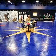
The Apple Festival held each October in Paintsville draws visitors who browse local craft booths, taste regional food, and listen to live music performances. This celebration reflects the farming traditions of the region and shows how the community maintains its connection to apple growing.

Paintsville is the main location for government services and administrative matters in the county. The town provides good access to surrounding areas and serves as a convenient base for exploring rural attractions and outdoor activities in the region.

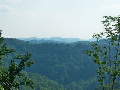
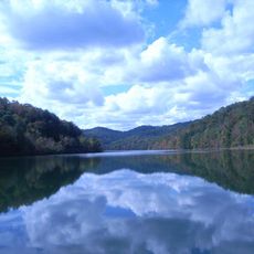
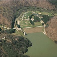
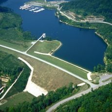
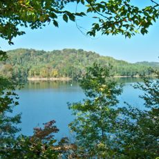
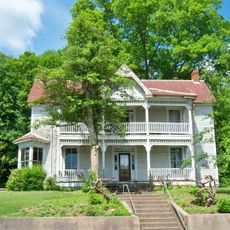
Paintsville Lake State Park provides water recreation and leisure facilities for visitors exploring the natural surroundings. The nearby Butcher Hollow, where country singer Loretta Lynn grew up, attracts music enthusiasts interested in her story and heritage.

Location: Kentucky

Inception: February 24, 1843

Capital city: Paintsville

Shares border with: Lawrence County, Martin County, Floyd County, Magoffin County, Morgan County

Website: http://johnsoncountyky.com

GPS coordinates: 37.84000,-82.83000

Latest update: December 7, 2025 09:20

Photos
Around this place
Show the full map
Eastern Kentucky Coal Field region
United States of America

Eastern Kentucky Coal Field region

24.4 km
Jenny Wiley State Resort Park
United States of America

Jenny Wiley State Resort Park

18.4 km
U.S. 23 Country Music Highway Museum
United States of America

U.S. 23 Country Music Highway Museum

1.6 km
Dewey Lake
United States of America

Dewey Lake

14.7 km
Paintsville Lake
United States of America

Paintsville Lake

6 km
Mayo Mansion
United States of America

Mayo Mansion

3.2 km
Paintsville Lake State Park
United States of America

Paintsville Lake State Park

3.6 km
Yatesville Lake State Park
United States of America

Yatesville Lake State Park

30 km
Mountain Homeplace
United States of America

Mountain Homeplace

3.9 km
Francis M. Stafford House
United States of America

Francis M. Stafford House

3.7 km
Samuel May House
United States of America

Samuel May House

18.2 km
Magoffin County Pioneer Village and Museum
United States of America

Magoffin County Pioneer Village and Museum

23.2 km
First United Methodist Church
United States of America

First United Methodist Church

3.5 km
Johnson County Public Library
United States of America

Johnson County Public Library

3.5 km
Salyersville National Bank
United States of America

Salyersville National Bank

23.2 km
David McKenzie Log Cabin
United States of America

David McKenzie Log Cabin

8.6 km
Martin Himler House
United States of America

Martin Himler House

34.3 km
First National Bank Building
United States of America

First National Bank Building

3.6 km
Methodist Episcopal Church, South
United States of America

Methodist Episcopal Church, South

20 km
Paintsville City Hall
United States of America

Paintsville City Hall

3.7 km
Paintsville Public Library Building
United States of America

Paintsville Public Library Building

3.4 km
Foster Hardware
United States of America

Foster Hardware

11.5 km
H.B. Rice Insurance Building
United States of America

H.B. Rice Insurance Building

3.6 km
Front Street Historic District
United States of America

Front Street Historic District

19.9 km
Martin County Courthouse
United States of America

Martin County Courthouse

25.7 km
Fitzpatrick-Harmon House
United States of America

Fitzpatrick-Harmon House

19.7 km
Loretta Lynn's Homeplace
United States of America

Loretta Lynn's Homeplace

12.7 km
Mine No. 5 Store
United States of America

Mine No. 5 Store

11.7 km
Show the full map
Reviews

Visited this place? Tap the stars to rate it and share your experience / photos with the community! Try now! You can cancel it anytime.

« Johnson County - County administrative division in Kentucky, US » is provided by Around Us (aroundus.com). Images and texts are derived from Wikimedia project under a Creative Commons license. You are allowed to copy, distribute, and modify copies of this page, under the conditions set by the license, as long as this note is clearly visible.

Discover hidden gems everywhere you go!

From secret cafés to breathtaking viewpoints, skip the crowded tourist spots and find places that match your style. Our app makes it easy with voice search, smart filtering, route optimization, and insider tips from travelers worldwide. Download now for the complete mobile experience.

Around Us App Screenshot

A unique approach to discovering new places

Le Figaro

All the places worth exploring

France Info

A tailor-made excursion in just a few clicks

20 Minutes