DeKalb County

Log in to your account

AroundUs is a community-driven map of interesting places, built by curious explorers like you. It grows with every review, story, and photo you share.
Connect to save your favorite spots, contribute locations, and create personalized routes.
Continue with Google
Continue with Apple
Continue with X
Continue with Facebook
Continue with email
By continuing, you accept our Terms and Conditions and our Privacy Policy
Create an account
Add to collection
Map
Suggest a change
Share

DeKalb County, County administrative division in Indiana, United States.

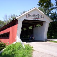
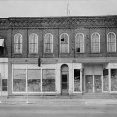
DeKalb County is an administrative area in northeastern Indiana with Auburn as its county seat, stretching across a mix of rural areas and small towns. The region includes various communities with typical infrastructure for housing, commerce, and services.

The county was established in 1837 during Indiana's period of territorial reorganization as a new administrative region. Its formation reflected the broader movement to restructure the state's government and settlement patterns.

The county's identity is shaped by its mix of rural traditions and small-town community life that visitors notice throughout its neighborhoods. Family-oriented gatherings and local business districts reflect how residents maintain connections across the region.

Visitors can find government offices and public services centered in Auburn, typically open on weekdays. It's useful to check ahead for specific departments when seeking particular assistance.

The Joiner History Room houses documents and artifacts that trace the area's development over time. This collection offers deeper insights into local history for those interested in the county's past.

Location: Indiana

Inception: 1837

Capital city: Auburn

Shares border with: LaGrange County, Steuben County, Williams County, Defiance County, Allen County, Noble County

Website: https://co.dekalb.in.us

GPS coordinates: 41.36694,-85.05889

Latest update: December 7, 2025 20:24

Photos
Around this place
Auburn Cord Duesenberg Automobile Museum
United States of America

Auburn Cord Duesenberg Automobile Museum

1.2 km
Spencerville Covered Bridge
United States of America

Spencerville Covered Bridge

15.4 km
Gump House
United States of America

Gump House

10.9 km
Garrett Historic District
United States of America

Garrett Historic District

6.8 km
Eckhart Public Library and Park
United States of America

Eckhart Public Library and Park

359 m
Downtown Auburn Historic District
United States of America

Downtown Auburn Historic District

326 m
Edward Kelham House
United States of America

Edward Kelham House

11 km
Samuel Bevier House
United States of America

Samuel Bevier House

7.4 km
Brethren in Christ Church
United States of America

Brethren in Christ Church

8 km
Auburn Community Mausoleum
United States of America

Auburn Community Mausoleum

326 m
Waterloo Community Mausoleum
United States of America

Waterloo Community Mausoleum

8.4 km
Dutch Ridge Historic District
United States of America

Dutch Ridge Historic District

13.3 km
Garrett Community Mausoleum
United States of America

Garrett Community Mausoleum

7.5 km
J.H. Haag House
United States of America

J.H. Haag House

7.6 km
Joseph Bowman Farmhouse
United States of America

Joseph Bowman Farmhouse

3.7 km
Henry Peters House
United States of America

Henry Peters House

5.4 km
Downtown Butler Historic District
United States of America

Downtown Butler Historic District

17.1 km
William Cornell Homestead
United States of America

William Cornell Homestead

10.2 km
Mountz House
United States of America

Mountz House

6.3 km
Maria and Franklin Wiltrout Polygonal Barn
United States of America

Maria and Franklin Wiltrout Polygonal Barn

15.3 km
John Wilderson House
United States of America

John Wilderson House

7.4 km
William Fountain House
United States of America

William Fountain House

9.9 km
DeKalb County Home and Barn
United States of America

DeKalb County Home and Barn

2.5 km
Keyser Township School 8
United States of America

Keyser Township School 8

5.2 km
Orin Clark House
United States of America

Orin Clark House

10 km
Rakestraw House
United States of America

Rakestraw House

3.3 km
Charles Lehmback Farmstead
United States of America

Charles Lehmback Farmstead

5.5 km
Breechbill-Davidson House
United States of America

Breechbill-Davidson House

8.1 km
Show the full map
Reviews

Visited this place? Tap the stars to rate it and share your experience / photos with the community! Try now! You can cancel it anytime.

Administrative divisions
« DeKalb County - County administrative division in Indiana, United States » is provided by Around Us (aroundus.com). Images and texts are derived from Wikimedia project under a Creative Commons license. You are allowed to copy, distribute, and modify copies of this page, under the conditions set by the license, as long as this note is clearly visible.

Discover hidden gems everywhere you go!

From secret cafés to breathtaking viewpoints, skip the crowded tourist spots and find places that match your style. Our app makes it easy with voice search, smart filtering, route optimization, and insider tips from travelers worldwide. Download now for the complete mobile experience.

Around Us App Screenshot

A unique approach to discovering new places

Le Figaro

All the places worth exploring

France Info

A tailor-made excursion in just a few clicks

20 Minutes