Sawyer County

Log in to your account

AroundUs is a community-driven map of interesting places, built by curious explorers like you. It grows with every review, story, and photo you share.
Connect to save your favorite spots, contribute locations, and create personalized routes.
By continuing, you accept our Terms and Conditions and our Privacy Policy
Add to collection
Map
Suggest a change
Share

Sawyer County, County administrative division in northern Wisconsin, United States.

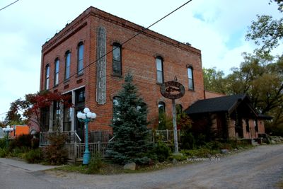
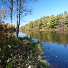
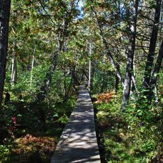
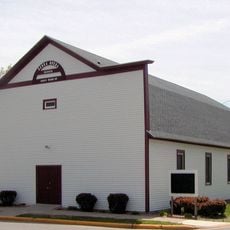
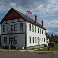
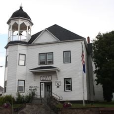
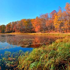
Sawyer County is an administrative division in northern Wisconsin that spans a large area with numerous lakes and waterways throughout. The region centers on Hayward, where major administrative facilities and economic activity are concentrated.

This area was established in 1883 and named after a prominent politician who served Wisconsin in both the House and Senate. The naming reflects the tradition of honoring influential figures when creating new administrative divisions.

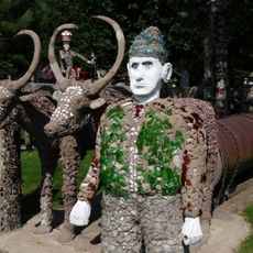
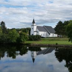
The Lac Courte Oreilles Reservation shapes community life here with its own traditions and gatherings that you can experience during a visit. The community keeps its customs alive through regular ceremonies and events where visitors can learn about local heritage.

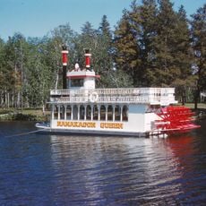
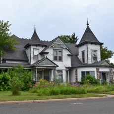
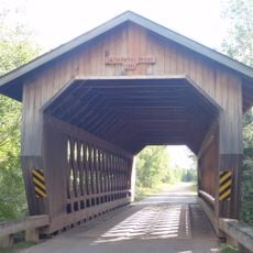
To explore the region, U.S. Highway 63 and several state routes help you move around and reach different areas. Hayward serves as the best base for getting to know the region and accessing basic services.

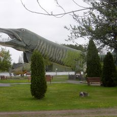
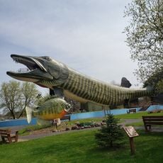
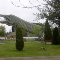
Hayward is home to an unusual attraction: a large fiberglass musky sculpture that visitors can climb and use as an observation platform. This artwork belongs to the National Fresh Water Fishing Hall of Fame and stands as a surprising symbol of fishing tradition in this area.

Location: Wisconsin

Inception: 1883

Capital city: Hayward

Shares border with: Bayfield County, Ashland County, Price County, Rusk County, Barron County, Washburn County, Douglas County

Website: http://sawyercountygov.org

GPS coordinates: 45.90000,-91.14000

Latest update: December 7, 2025 20:25

Photos
Around this place
Show the full map
Copper Falls State Park
United States of America

Copper Falls State Park

65.4 km
National Fresh Water Fishing Hall of Fame
United States of America

National Fresh Water Fishing Hall of Fame

28.9 km
Lidice Memorial
United States of America

Lidice Memorial

61.3 km
Flambeau River State Forest
United States of America

Flambeau River State Forest

33.7 km
Wisconsin Concrete Park
United States of America

Wisconsin Concrete Park

63.7 km
Lake Hayward
United States of America

Lake Hayward

28.3 km
Park Theater
United States of America

Park Theater

29.1 km
Brule Glacial Spillway State Natural Area
United States of America

Brule Glacial Spillway State Natural Area

72.4 km
Flambeau Mission Church
United States of America

Flambeau Mission Church

66.7 km
Wisconsin Canoe Heritage Museum
United States of America

Wisconsin Canoe Heritage Museum

58.6 km
Beaser School
United States of America

Beaser School

78.2 km
ZCBJ Hall
United States of America

ZCBJ Hall

59.3 km
Fifield Fire Lookout Tower
United States of America

Fifield Fire Lookout Tower

63.2 km
Chapple and MacArthur Avenues Residential Historic District
United States of America

Chapple and MacArthur Avenues Residential Historic District

78.4 km
Fifield Town Hall
United States of America

Fifield Town Hall

55.8 km
Mellen City Hall
United States of America

Mellen City Hall

60.2 km
Jump River Town Hall
United States of America

Jump River Town Hall

66.4 km
Marion Park Pavilion
United States of America

Marion Park Pavilion

49.9 km
Forest Lodge Library
United States of America

Forest Lodge Library

36.2 km
Mrs. Richard Polson House
United States of America

Mrs. Richard Polson House

57.4 km
Chippewa Moraine Lakes State Natural Area
United States of America

Chippewa Moraine Lakes State Natural Area

77.8 km
Freshwater Fishing Hall of Fame
United States of America

Freshwater Fishing Hall of Fame

28.9 km
George V. Siegner House
United States of America

George V. Siegner House

58.9 km
Glidden State Bank
United States of America

Glidden State Bank

51.1 km
Rice Lake station
United States of America

Rice Lake station

64 km
Pioneer Village Museum
United States of America

Pioneer Village Museum

74.1 km
North Star Camp For Boys
United States of America

North Star Camp For Boys

22.1 km
Smith Rapids Covered Bridge
United States of America

Smith Rapids Covered Bridge

75 km
Show the full map
Reviews

Visited this place? Tap the stars to rate it and share your experience / photos with the community! Try now! You can cancel it anytime.

Administrative divisions
« Sawyer County - County administrative division in northern Wisconsin, United States » is provided by Around Us (aroundus.com). Images and texts are derived from Wikimedia project under a Creative Commons license. You are allowed to copy, distribute, and modify copies of this page, under the conditions set by the license, as long as this note is clearly visible.

Discover hidden gems everywhere you go!

From secret cafés to breathtaking viewpoints, skip the crowded tourist spots and find places that match your style. Our app makes it easy with voice search, smart filtering, route optimization, and insider tips from travelers worldwide. Download now for the complete mobile experience.

Around Us App Screenshot

A unique approach to discovering new places

Le Figaro

All the places worth exploring

France Info

A tailor-made excursion in just a few clicks

20 Minutes