Wirt County

Log in to your account

AroundUs is a community-driven map of interesting places, built by curious explorers like you. It grows with every review, story, and photo you share.
Connect to save your favorite spots, contribute locations, and create personalized routes.
Continue with Google
Continue with Apple
Continue with X
Continue with Facebook
Continue with email
By continuing, you accept our Terms and Conditions and our Privacy Policy
Create an account
Add to collection
Map
Suggest a change
Share

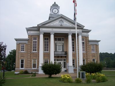
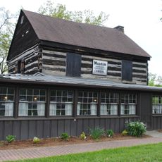
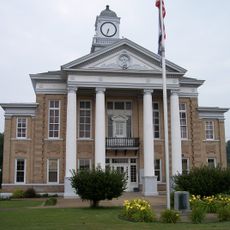
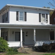
Wirt County, County seat and administrative center in Elizabeth, West Virginia.

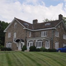
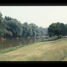
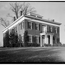
Wirt County is an administrative division in West Virginia with Elizabeth as its county seat, where government offices handle local affairs. The Little Kanawha River flows through the territory, shaping a rural landscape of rolling terrain and scattered communities.

The county was established in 1848 when the Virginia General Assembly carved it from parts of neighboring counties to form a new administrative area. It was named after William Wirt, who served as the nation's Attorney General.

The Burning Springs area holds memories of oil drilling days during the 1860s, when the discovery brought industrial activity and workers to the region. This chapter of resource extraction became part of how local communities view their place in the wider story of Appalachia.

Elizabeth serves as the administrative hub where you can find local government services for permits, documents, and property matters. A car is helpful for exploring the scattered communities and following the river through the countryside.

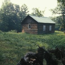
This administrative division ranks among West Virginia's least populated areas, a fact that may surprise visitors expecting larger settlements. The sparse population has allowed it to retain a rural character with open land and minimal urban development.

Location: West Virginia

Inception: January 19, 1848

Capital city: Elizabeth

Shares border with: Ritchie County, Calhoun County, Roane County, Jackson County, Wood County

Website: http://wirtcounty.wv.gov

GPS coordinates: 39.02000,-81.38000

Latest update: December 7, 2025 20:41

Photos
Around this place
Blennerhassett Hotel
United States of America

Blennerhassett Hotel

31.4 km
Fort Boreman
United States of America

Fort Boreman

31.4 km
Wood County Courthouse
United States of America

Wood County Courthouse

31.5 km
W. H. Bickel Estate
United States of America

W. H. Bickel Estate

31.1 km
Carnegie Library
United States of America

Carnegie Library

31.3 km
Peter G. Van Winkle House
United States of America

Peter G. Van Winkle House

31.6 km
Albert S. Heck Mansion
United States of America

Albert S. Heck Mansion

23.1 km
Henry Cooper House
United States of America

Henry Cooper House

30.9 km
Bank of Cairo
United States of America

Bank of Cairo

28.5 km
First Presbyterian Church
United States of America

First Presbyterian Church

31.5 km
Sarvis Fork Covered Bridge
United States of America

Sarvis Fork Covered Bridge

25.4 km
Burning Springs Complex
United States of America

Burning Springs Complex

6.4 km
Union Trust National Bank
United States of America

Union Trust National Bank

31.5 km
Ruble Church
United States of America

Ruble Church

6.5 km
Wirt County Courthouse
United States of America

Wirt County Courthouse

5 km
House at 10th and Avery Streets
United States of America

House at 10th and Avery Streets

31.5 km
Sharon Lodge No. 28 IOOF
United States of America

Sharon Lodge No. 28 IOOF

31.4 km
Citizens National Bank
United States of America

Citizens National Bank

31.5 km
Dr. W. W. Monroe House
United States of America

Dr. W. W. Monroe House

30.7 km
Beauchamp-Newman House
United States of America

Beauchamp-Newman House

5.1 km
Tavenner House
United States of America

Tavenner House

30.1 km
Smith Building
United States of America

Smith Building

31.4 km
Parkersburg High School-Washington Avenue Historic District
United States of America

Parkersburg High School-Washington Avenue Historic District

31.7 km
Oeldorf Building
United States of America

Oeldorf Building

31.5 km
Rankin Octagonal Barn
United States of America

Rankin Octagonal Barn

28.5 km
Parkersburg Women's Club
United States of America

Parkersburg Women's Club

31.4 km
Oakland
United States of America

Oakland

30.6 km
Masonic Temple
United States of America

Masonic Temple

31.5 km
Show the full map
Reviews

Visited this place? Tap the stars to rate it and share your experience / photos with the community! Try now! You can cancel it anytime.

« Wirt County - County seat and administrative center in Elizabeth, West Virginia » is provided by Around Us (aroundus.com). Images and texts are derived from Wikimedia project under a Creative Commons license. You are allowed to copy, distribute, and modify copies of this page, under the conditions set by the license, as long as this note is clearly visible.

Discover hidden gems everywhere you go!

From secret cafés to breathtaking viewpoints, skip the crowded tourist spots and find places that match your style. Our app makes it easy with voice search, smart filtering, route optimization, and insider tips from travelers worldwide. Download now for the complete mobile experience.

Around Us App Screenshot

A unique approach to discovering new places

Le Figaro

All the places worth exploring

France Info

A tailor-made excursion in just a few clicks

20 Minutes