Enable Location

We need your location to show you interesting places around you

Discover nearby places

Find interesting locations and hidden gems around you

Precise directions

Get accurate directions and distances to places

Your location is never shared with other users. It's only used when you tap the location button.

Washington County

Log in to your account

Save your favorite places
Create custom travel routes
Rate and review places
Access the full interactive map
Continue with Google
Continue with Apple
Continue with email
By continuing, you accept our Terms and Conditions and our Privacy Policy
Create an account
Add to collection
Map
Suggest a change
Share

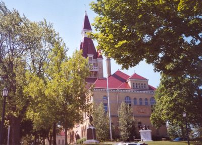
Washington County, Administrative division in southeastern Wisconsin, US

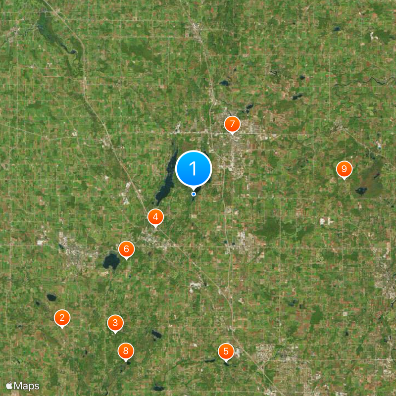
Washington County is an administrative region in southeastern Wisconsin with West Bend as its county seat, encompassing multiple municipalities and natural areas. The territory spans roughly 112,900 hectares (278,700 acres) and mixes developed towns with open landscapes and preserved spaces.

The region was established as an administrative division in 1845 and transformed from purely agricultural lands into a mix of suburban and natural areas. This shift reflects the broader pattern of the Midwest changing from rural to partially developed territories.

The communities across this county show a strong sense of local involvement, where residents and organizations regularly participate in shaping decisions. This engagement is visible in how neighbors work together on shared concerns and community projects throughout the region.

The county seat of West Bend is where to find government offices and get information about the region if you need official services. The best way to explore the area is by car, as towns are spread across the territory and public transportation options are limited.

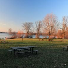
The territory contains roughly 1,300 hectares (3,200 acres) of water bodies that include lakes and wetlands forming an important part of the local ecosystem. These waters attract recreation seekers and nature observers, adding to the region's natural character.

Location: Wisconsin

Inception: 1845

Capital city: West Bend

Shares border with: Sheboygan County, Fond du Lac County, Ozaukee County, Milwaukee County, Waukesha County, Dodge County

Website: http://co.washington.wi.us

GPS coordinates: 43.37000,-88.23000

Latest update: December 20, 2025 15:04

Photos
Around this place
Erin Hills
United States of America

Erin Hills

19 km
Holy Hill National Shrine of Mary, Help of Christians
United States of America

Holy Hill National Shrine of Mary, Help of Christians

16.1 km
Slinger Speedway
United States of America

Slinger Speedway

5 km
YMCA Camp Minikani
United States of America

YMCA Camp Minikani

17.2 km
Pike Lake Unit, Kettle Moraine State Forest
United States of America

Pike Lake Unit, Kettle Moraine State Forest

9.4 km
Museum of Wisconsin Art
United States of America

Museum of Wisconsin Art

7.3 km
Loew Lake Unit, Kettle Moraine State Forest
United States of America

Loew Lake Unit, Kettle Moraine State Forest

18.2 km
St. Augustine Catholic Church and Cemetery
United States of America

St. Augustine Catholic Church and Cemetery

15.4 km
St. John of God Roman Catholic Church, Convent, and School
United States of America

St. John of God Roman Catholic Church, Convent, and School

18.7 km
Christ Evangelical Church
United States of America

Christ Evangelical Church

14.6 km
St. Peter's Church
United States of America

St. Peter's Church

15 km
Washington County Courthouse and Jail
United States of America

Washington County Courthouse and Jail

6.8 km
Gadow's Mill
United States of America

Gadow's Mill

9 km
Christian Turck House
United States of America

Christian Turck House

16.4 km
United States of America

Allenton State Wildlife Area

8.8 km
Barton Historic District
United States of America

Barton Historic District

8.9 km
United States of America

Edward H. Wolf Schleisingerville to Slinger Historical Museum

6.5 km
Lizard Mound County Park
United States of America

Lizard Mound County Park

12.7 km
Wisconsin Automotive Museum
United States of America

Wisconsin Automotive Museum

13.5 km
United States of America

Barton Pond 219

8.2 km
United States of America

West Bend Pond 222

8.4 km
United States of America

Lucas Lake

4.2 km
Richfield Historical Park
United States of America

Richfield Historical Park

12.1 km
United States of America

Silver Lake

2.4 km
United States of America

Druid Lake

17.6 km
United States of America

Washington County Golf Course

10.8 km
United States of America

Roden Barnyard Adventures LLC

15.4 km
United States of America

Tipi

22.1 km
Show the full map
Reviews

Visited this place? Tap the stars to rate it and share your experience / photos with the community! Try now! You can cancel it anytime.

Administrative divisions
« Washington County - Administrative division in southeastern Wisconsin, US » is provided by Around Us (aroundus.com). Images and texts are derived from Wikimedia project under a Creative Commons license. You are allowed to copy, distribute, and modify copies of this page, under the conditions set by the license, as long as this note is clearly visible.

Discover hidden gems everywhere you go!

From secret cafés to breathtaking viewpoints, skip the crowded tourist spots and find places that match your style. Our app makes it easy with voice search, smart filtering, route optimization, and insider tips from travelers worldwide. Download now for the complete mobile experience.

Around Us App Screenshot

A unique approach to discovering new places

Le Figaro

All the places worth exploring

France Info

A tailor-made excursion in just a few clicks

20 Minutes