Great Barrington

Log in to your account

AroundUs is a community-driven map of interesting places, built by curious explorers like you. It grows with every review, story, and photo you share.
Connect to save your favorite spots, contribute locations, and create personalized routes.
By continuing, you accept our Terms and Conditions and our Privacy Policy
Add to collection
Map
Suggest a change
Share

Great Barrington, New England town in Berkshire County, Massachusetts.

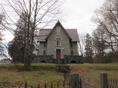
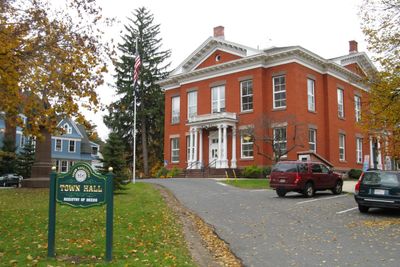
Great Barrington is a community in Berkshire County, Massachusetts, set within the Housatonic River valley and surrounded by forested hillsides. The town center features 19th-century brick buildings along Main Street, with residential neighborhoods extending into the nearby countryside.

The area was settled in 1724 when European colonists acquired the land from the Mahican people and established farming communities. William Stanley Jr. demonstrated a working alternating current transformer here in 1885, changing how electricity could be distributed.

The Mahaiwe Performing Arts Center presents concerts, films, and performances while local galleries showcase regional artists throughout the year.

The town center is accessible via Route 7 and Route 23, with parking available near Main Street and at trailheads for nearby walking paths. Several local trails connect to the Appalachian Trail, which passes through the wider region.

The town is considered the birthplace of the first African American newspaper in the state, The Berkshire Star, published in the 1820s. This early publication was one of the first Black-owned periodicals in New England.

Location: Berkshire County

Elevation above the sea: 221 m

Shares border with: Alford, Egremont, West Stockbridge, Stockbridge, Lee, Tyringham, Monterey, New Marlborough, Sheffield

Website: http://townofgb.org/Pages/index

GPS coordinates: 42.19580,-73.36250

Latest update: December 4, 2025 23:40

Around this place
Show the full map
Norman Rockwell Museum
United States of America

Norman Rockwell Museum

10.5 km
Sedgwick Pie
United States of America

Sedgwick Pie

10.6 km
Searles Castle
United States of America

Searles Castle

434 m
Naumkeag
United States of America

Naumkeag

11.1 km
Chesterwood
United States of America

Chesterwood

10 km
Mission House
United States of America

Mission House

10.5 km
W.E.B. Du Bois Boyhood Homesite
United States of America

W.E.B. Du Bois Boyhood Homesite

3.2 km
Berkshire Theatre Festival
United States of America

Berkshire Theatre Festival

10.8 km
Monument Mountain
United States of America

Monument Mountain

8.7 km
Old Covered Bridge
United States of America

Old Covered Bridge

8 km
Bidwell House Museum
United States of America

Bidwell House Museum

11.9 km
Tyringham Shaker Settlement Historic District
United States of America

Tyringham Shaker Settlement Historic District

12.6 km
Villa Virginia
United States of America

Villa Virginia

9.7 km
Stockbridge Casino
United States of America

Stockbridge Casino

10.8 km
South Lee Historic District
United States of America

South Lee Historic District

11.6 km
Mahaiwe Block
United States of America

Mahaiwe Block

213 m
Merwin House (Stockbridge, Massachusetts)
United States of America

Merwin House (Stockbridge, Massachusetts)

10.5 km
Clinton African Methodist Episcopal Zion Church
United States of America

Clinton African Methodist Episcopal Zion Church

103 m
Housatonic Congregational Church
United States of America

Housatonic Congregational Church

6.9 km
Ramsdell Public Library
United States of America

Ramsdell Public Library

6.9 km
South Egremont Village Historic District
United States of America

South Egremont Village Historic District

5.8 km
Glendale Power House
United States of America

Glendale Power House

9.5 km
Rock Ridge
United States of America

Rock Ridge

11.6 km
Dwight-Henderson House
United States of America

Dwight-Henderson House

552 m
North Egremont Historic District
United States of America

North Egremont Historic District

6.4 km
Elm-Maple-South Streets Historic District
United States of America

Elm-Maple-South Streets Historic District

10.2 km
Taconic and West Avenues Historic District
United States of America

Taconic and West Avenues Historic District

718 m
Wheeler Family Farmstead
United States of America

Wheeler Family Farmstead

1.9 km
Show the full map

Reviews

Visited this place? Tap the stars to rate it and share your experience / photos with the community! Try now! You can cancel it anytime.

« Great Barrington - New England town in Berkshire County, Massachusetts » is provided by Around Us (aroundus.com). Images and texts are derived from Wikimedia project under a Creative Commons license. You are allowed to copy, distribute, and modify copies of this page, under the conditions set by the license, as long as this note is clearly visible.

Discover hidden gems everywhere you go!

From secret cafés to breathtaking viewpoints, skip the crowded tourist spots and find places that match your style. Our app makes it easy with voice search, smart filtering, route optimization, and insider tips from travelers worldwide. Download now for the complete mobile experience.

Around Us App Screenshot

A unique approach to discovering new places

Le Figaro

All the places worth exploring

France Info

A tailor-made excursion in just a few clicks

20 Minutes