Chest opened
+${chestReward.xp} XP
Explorer
NOUVEAU ×${chestReward.collectible.quantity}
tapez pour fermer
Chest locked

Open chests in the app

Around Us is built for your phone — chests unlock when you walk, explore and capture nearby places.

Enable Location

We need your location to show you interesting places around you

Discover nearby places

Find interesting locations and hidden gems around you

Precise directions

Get accurate directions and distances to places

Your location is never shared with other users. It's only used when you tap the location button.

Roanoke River

Log in to your account

Start exploring — it's free

Trusted by 72,889 travelers worldwide

Continue with Google
Continue with Apple
or

We will send you a code to connect

By continuing, you accept our Terms and Conditions and our Privacy Policy

Check your inbox

We've sent a pincode in your inbox. Please enter the code below.

Roanoke River
Discussion Reviews 1 Photos
26.1k Popularity

Roanoke River, Major river system in North Carolina, United States

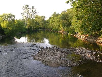
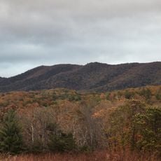
The Roanoke River is a major river system that flows from the Blue Ridge Mountains through Virginia and into North Carolina, eventually reaching Albemarle Sound. Water flow is regulated by several dams near the state border, which also create lakes for recreation.

In 1804, the Roanoke Navigation Company undertook projects to clear obstacles from the river and improve transportation of goods. These early efforts established the foundation for the river's economic use.

The name comes from an Algonquian language and reflects the tribes who made the river valley their home for centuries. Visitors can still trace connections to this heritage along the riverbanks today.

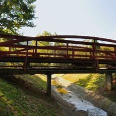
Water levels vary along the river, with shallow sections good for wading and paddling while other stretches are deeper and faster-moving. Check local conditions before visiting and bring appropriate gear for your activity.

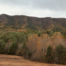
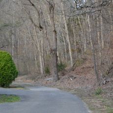
The river contains the largest surviving bottomland hardwood forest in the mid-Atlantic region, home to plants and animals found nowhere else nearby. Few visitors realize how ecologically significant this forest is to the river's ecosystem.

The community of curious travelers

AroundUs brings together thousands of curated places, local tips, and hidden gems, enriched daily by 60,000 contributors worldwide.

Start exploring
Location
GPS coordinates
37.23760,-80.21370
Latest update
December 20, 2025 15:33
Around this place
Dixie Caverns
United States of America

Dixie Caverns

3.8 km
United States of America

Poor Mountain

7 km
Brush Mountain Wilderness
United States of America

Brush Mountain Wilderness

12.6 km
Brush Mountain East Wilderness
United States of America

Brush Mountain East Wilderness

13.8 km
Bowstring Truss Bridge
United States of America

Bowstring Truss Bridge

965 m
Twelve O'clock Knob
United States of America

Twelve O'clock Knob

11.5 km
Walnut Grove Farm
United States of America

Walnut Grove Farm

8.3 km
McVitty Home
United States of America

McVitty Home

14.3 km
William Barnett House
United States of America

William Barnett House

11.5 km
Preston House
United States of America

Preston House

12.3 km
Pompey Callaway House
United States of America

Pompey Callaway House

2.8 km
Alleghany Springs Springhouse
United States of America

Alleghany Springs Springhouse

12.9 km
Barnett House
United States of America

Barnett House

3.5 km
Big Spring Baptist Church
United States of America

Big Spring Baptist Church

2.7 km
Evans House
United States of America

Evans House

15.1 km
Earhart House
United States of America

Earhart House

14.3 km
Johnsville Meetinghouse
United States of America

Johnsville Meetinghouse

9.2 km
Virginian Railway Underpass
United States of America

Virginian Railway Underpass

14 km
Academy Street School
United States of America

Academy Street School

14.9 km
Lafayette Historic District (Lafayette, Virginia)
United States of America

Lafayette Historic District (Lafayette, Virginia)

363 m
Blankenship Farm
United States of America

Blankenship Farm

14.6 km
Nealy Gordon Farm
United States of America

Nealy Gordon Farm

9.2 km
Rife House
United States of America

Rife House

7 km
Blair Apartments
United States of America

Blair Apartments

14.6 km
Shawsville Historic District
United States of America

Shawsville Historic District

8.5 km
George Earhart House
United States of America

George Earhart House

13.6 km
Anderson-Doosing Farm
United States of America

Anderson-Doosing Farm

10.5 km
Piedmont Camp Meeting Grounds Historic District
United States of America

Piedmont Camp Meeting Grounds Historic District

14.9 km
Show the full map
Reviews
Share your experience

No review yet

Discussions
Start a discussion...

No discussion yet

« Roanoke River - Major river system in North Carolina, United States » is provided by Around Us (aroundus.com). Images and texts are derived from Wikimedia project under a Creative Commons license. You are allowed to copy, distribute, and modify copies of this page, under the conditions set by the license, as long as this note is clearly visible.

Discover hidden gems everywhere you go!

From secret cafés to breathtaking viewpoints, skip the crowded tourist spots and find places that match your style. Our app makes it easy with voice search, smart filtering, route optimization, and insider tips from travelers worldwide. Download now for the complete mobile experience.

Around Us App Screenshot

A unique approach to discovering new places

Le Figaro

All the places worth exploring

France Info

A tailor-made excursion in just a few clicks

20 Minutes

Around Us
Travel Guide & Maps
Download

Send to your phone

QR Code
1

Open the camera app on your mobile.

2

Point at the QR code with your camera. A notification will appear.

3

Tap the notification to open the link.