Chest opened
+${chestReward.xp} XP
Explorer
NOUVEAU ×${chestReward.collectible.quantity}
tapez pour fermer
Chest locked

Open chests in the app

Around Us is built for your phone — chests unlock when you walk, explore and capture nearby places.

Enable Location

We need your location to show you interesting places around you

Discover nearby places

Find interesting locations and hidden gems around you

Precise directions

Get accurate directions and distances to places

Your location is never shared with other users. It's only used when you tap the location button.

Moorefield

Log in to your account

Start exploring — it's free

Trusted by 72,876 travelers worldwide

Continue with Google
Continue with Apple
or

We will send you a code to connect

By continuing, you accept our Terms and Conditions and our Privacy Policy

Check your inbox

We've sent a pincode in your inbox. Please enter the code below.

Discussion Reviews 1 Photos
16.7k Popularity

Moorefield, town in Hardy County, West Virginia, United States of America

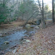
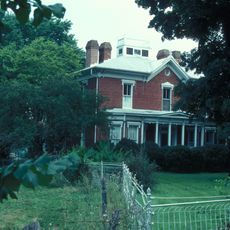
Moorefield is a town in Hardy County, West Virginia, established on about 62 acres of land that belonged to Conrad Moore. It sits in a flat valley along the South Branch of the Potomac River, surrounded by rolling hills and mountains.

The town was officially established in 1777 by the government of Virginia and is one of the oldest settlements in West Virginia. During the Civil War, Moorefield was a contested area, and the 1864 Battle of Moorefield weakened Confederate forces in the region.

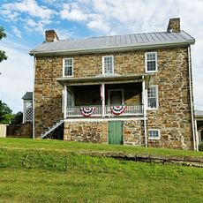
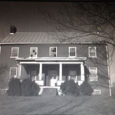
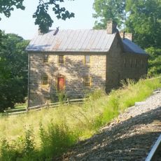
The town takes its name from Conrad Moore, an early landowner whose Stone Tavern still stands on Main Street today. The poultry industry, which became central to the community starting in the 1930s, remains woven into local identity and is celebrated through annual festivals.

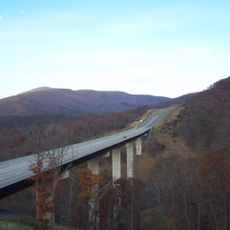
You can reach Moorefield most easily by car; U.S. Highway 48 runs directly through the town. There are no public transportation services, so having your own vehicle is necessary to explore the town and surrounding areas.

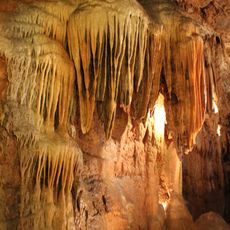
About 6 miles south of town, visitors can collect fossils from the Devonian period, including shells, trilobites, and corals, in a quarry site. This unexpected hands-on experience connects the area to ancient prehistoric history.

The community of curious travelers

AroundUs brings together thousands of curated places, local tips, and hidden gems, enriched daily by 60,000 contributors worldwide.

Start exploring
Location
Elevation above the sea
247 m
GPS coordinates
39.06306,-78.96583
Latest update
February 17, 2026 01:40
Around this place
Smoke Hole Caverns
United States of America

Smoke Hole Caverns

27.4 km
Sloan–Parker House
United States of America

Sloan–Parker House

29.6 km
Lost River State Park
United States of America

Lost River State Park

19.1 km
Bear Rocks Preserve
United States of America

Bear Rocks Preserve

28.7 km
Big Schloss
United States of America

Big Schloss

29.3 km
Fort Pleasant
United States of America

Fort Pleasant

8 km
Lighthorse Harry Lee Cabin
United States of America

Lighthorse Harry Lee Cabin

19.1 km
Fort Van Meter
United States of America

Fort Van Meter

22 km
John Mathias House
United States of America

John Mathias House

22.3 km
Clifford Hollow Bridge
United States of America

Clifford Hollow Bridge

8.2 km
Kuykendall Polygonal Barn
United States of America

Kuykendall Polygonal Barn

21.9 km
Garrett VanMeter House
United States of America

Garrett VanMeter House

8.6 km
Weaver's Antique Service Station
United States of America

Weaver's Antique Service Station

30.8 km
Grant County Courthouse
United States of America

Grant County Courthouse

15.5 km
Nathaniel and Isaac Kuykendall House
United States of America

Nathaniel and Isaac Kuykendall House

29.4 km
Buena Vista Farms
United States of America

Buena Vista Farms

7.5 km
Hickory Hill
United States of America

Hickory Hill

11.5 km
P.W. Inskeep House
United States of America

P.W. Inskeep House

1.1 km
Thomas Maslin House
United States of America

Thomas Maslin House

448 m
Burlington Historic District
United States of America

Burlington Historic District

30.6 km
Old Stone Tavern
United States of America

Old Stone Tavern

399 m
Moorefield Historic District
United States of America

Moorefield Historic District

517 m
Old Hardy County Courthouse
United States of America

Old Hardy County Courthouse

234 m
Judge J. W. F. Allen House
United States of America

Judge J. W. F. Allen House

797 m
Wilson-Kuykendall Farm
United States of America

Wilson-Kuykendall Farm

3.2 km
Hardy County Public Library
United States of America

Hardy County Public Library

352 m
McCoy's Grand Theatre
United States of America

McCoy's Grand Theatre

342 m
Grant County Public Library
United States of America

Grant County Public Library

15.9 km
Show the full map
Reviews
Share your experience

No review yet

Discussions
Start a discussion...

No discussion yet

« Moorefield - town in Hardy County, West Virginia, United States of America » is provided by Around Us (aroundus.com). Images and texts are derived from Wikimedia project under a Creative Commons license. You are allowed to copy, distribute, and modify copies of this page, under the conditions set by the license, as long as this note is clearly visible.

Discover hidden gems everywhere you go!

From secret cafés to breathtaking viewpoints, skip the crowded tourist spots and find places that match your style. Our app makes it easy with voice search, smart filtering, route optimization, and insider tips from travelers worldwide. Download now for the complete mobile experience.

Around Us App Screenshot

A unique approach to discovering new places

Le Figaro

All the places worth exploring

France Info

A tailor-made excursion in just a few clicks

20 Minutes

Around Us
Travel Guide & Maps
Download

Send to your phone

QR Code
1

Open the camera app on your mobile.

2

Point at the QR code with your camera. A notification will appear.

3

Tap the notification to open the link.