Chest opened
+${chestReward.xp} XP
Explorer
NOUVEAU ×${chestReward.collectible.quantity}
tapez pour fermer
Chest locked

Open chests in the app

Around Us is built for your phone — chests unlock when you walk, explore and capture nearby places.

Enable Location

We need your location to show you interesting places around you

Discover nearby places

Find interesting locations and hidden gems around you

Precise directions

Get accurate directions and distances to places

Your location is never shared with other users. It's only used when you tap the location button.

Log in to your account

Start exploring — it's free

Trusted by 72,880 travelers worldwide

Continue with Google
Continue with Apple
or

We will send you a code to connect

By continuing, you accept our Terms and Conditions and our Privacy Policy

Check your inbox

We've sent a pincode in your inbox. Please enter the code below.

Camp Nawaka
Discussion Reviews Photo
1.8k Popularity

Camp Nawaka, Summer camp in East Otis, Massachusetts, United States

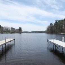
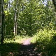
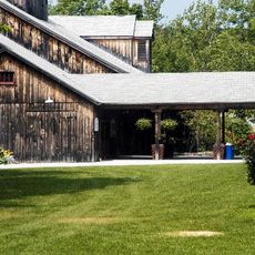
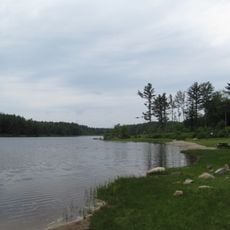
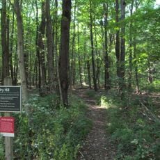
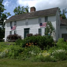
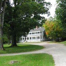
Camp Nawaka was a recreational facility situated in the forested area of East Otis, spread across grounds that included a private 16-acre pond called Larkum Pond. The property featured cabin lodging with bathrooms, sports fields, and a health center to serve visitors' medical needs.

The facility opened in 1967, building on the legacy of a former boys' swimming camp that operated during the 1940s and 1950s. This predecessor shaped the early identity and purpose of what became the new campground.

During the final week of summer, campers divided into two teams to compete in various games and contests against each other. This tradition helped build bonds between participants and created lasting memories of shared experiences.

The camp provided pine cabins with private bathrooms, electricity, and wireless internet for guest stays, along with sports facilities for recreation. Medical support was also available on site to assist visitors during their time there.

The camp maintained a staff of 40 people overseeing 120 campers and offered specialized programs such as Senior Camp. This advanced option required tent camping and off-site activities to provide older participants with additional challenges.

The community of curious travelers

AroundUs brings together thousands of curated places, local tips, and hidden gems, enriched daily by 60,000 contributors worldwide.

Start exploring
Location
GPS coordinates
42.16650,-73.05980
Latest update
December 14, 2025 11:20
Around this place
Otis Reservoir
United States of America

Otis Reservoir

2.1 km
Tolland State Forest
United States of America

Tolland State Forest

4.4 km
Jacob's Pillow
United States of America

Jacob's Pillow

11.9 km
Sandisfield State Forest
United States of America

Sandisfield State Forest

13.1 km
Dry Hill
United States of America

Dry Hill

14.2 km
Bidwell House Museum
United States of America

Bidwell House Museum

13.9 km
Tyringham Shaker Settlement Historic District
United States of America

Tyringham Shaker Settlement Historic District

16.3 km
Chester Factory Village Historic District
United States of America

Chester Factory Village Historic District

14.3 km
Mill River Historic District
United States of America

Mill River Historic District

18.2 km
New Boston Village Historic District
United States of America

New Boston Village Historic District

8.2 km
Philemon Sage House
United States of America

Philemon Sage House

14.5 km
Middlefield-Becket Stone Arch Railroad Bridge District
United States of America

Middlefield-Becket Stone Arch Railroad Bridge District

16.6 km
Phelps Farms Historic District
United States of America

Phelps Farms Historic District

17.4 km
Becket Center Historic District
United States of America

Becket Center Historic District

13.1 km
West Granville Historic District
United States of America

West Granville Historic District

14.1 km
Western Railroad Stone Arch Bridges and Chester Factory Village Depot
United States of America

Western Railroad Stone Arch Bridges and Chester Factory Village Depot

17.2 km
New Marlborough Village
United States of America

New Marlborough Village

14.6 km
Chester Center Historic District
United States of America

Chester Center Historic District

17.8 km
Methodist Episcopal Society of Tyringham
United States of America

Methodist Episcopal Society of Tyringham

14.6 km
Rock Ridge
United States of America

Rock Ridge

13.5 km
Montville Baptist Church
United States of America

Montville Baptist Church

6.9 km
Capt. John Brewer House
United States of America

Capt. John Brewer House

12.3 km
Huntington Village Historic District
United States of America

Huntington Village Historic District

16.6 km
Arah Phelps Inn
United States of America

Arah Phelps Inn

17.2 km
John and Ruth Rose House
United States of America

John and Ruth Rose House

16.8 km
Russell Center Historic District
United States of America

Russell Center Historic District

17 km
Francis Benedict Jr. House
United States of America

Francis Benedict Jr. House

17.2 km
Tyringham Library
United States of America

Tyringham Library

14.8 km
Show the full map
Reviews
Share your experience

No review yet

Discussions
Start a discussion...

No discussion yet

« Camp Nawaka - Summer camp in East Otis, Massachusetts, United States » is provided by Around Us (aroundus.com). Images and texts are derived from Wikimedia project under a Creative Commons license. You are allowed to copy, distribute, and modify copies of this page, under the conditions set by the license, as long as this note is clearly visible.

Discover hidden gems everywhere you go!

From secret cafés to breathtaking viewpoints, skip the crowded tourist spots and find places that match your style. Our app makes it easy with voice search, smart filtering, route optimization, and insider tips from travelers worldwide. Download now for the complete mobile experience.

Around Us App Screenshot

A unique approach to discovering new places

Le Figaro

All the places worth exploring

France Info

A tailor-made excursion in just a few clicks

20 Minutes

Around Us
Travel Guide & Maps
Download

Send to your phone

QR Code
1

Open the camera app on your mobile.

2

Point at the QR code with your camera. A notification will appear.

3

Tap the notification to open the link.