Enable Location

We need your location to show you interesting places around you

Discover nearby places

Find interesting locations and hidden gems around you

Precise directions

Get accurate directions and distances to places

Your location is never shared with other users. It's only used when you tap the location button.

Tyringham Shaker Settlement Historic District

Log in to your account

Start exploring — it's free

Trusted by 63,212 travelers worldwide

Continue with Google
Continue with Apple
or

We will send you a code to connect

By continuing, you accept our Terms and Conditions and our Privacy Policy

Check your inbox

We've sent a pincode in your inbox. Please enter the code below.

Tyringham Shaker Settlement Historic District
Discussion Reviews 1 Photos
1.8k Popularity

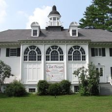
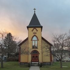
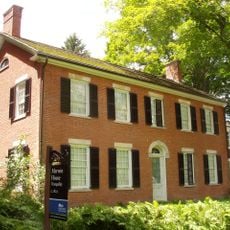
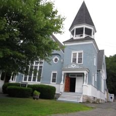
Tyringham Shaker Settlement Historic District, Historic district in Tyringham, Massachusetts, United States.

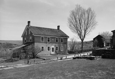
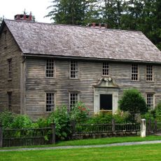
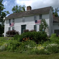
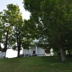
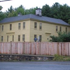
The Tyringham Shaker Settlement Historic District is a group of community buildings spread along Jerusalem Road, with the Church Family complex as its center. The structures sit roughly half a mile apart and display typical Shaker architecture from the late 1700s.

The settlement was founded in 1792 as Massachusetts fourth Shaker community and grew quickly into a significant center. The community declined over time and finally closed in 1874 as the Shaker way of life faded away.

The buildings reflect Shaker beliefs through their plain design with wooden beams, peaked roofs, and stone foundations that you can see today. This style shows how the community valued simplicity and honest craftsmanship in everything they built.

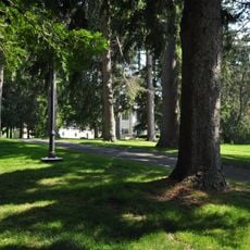
The site is best explored on foot, with clear paths between the different building groups along the road. Visiting is straightforward because of the open fields and simple layout, letting you move freely from one area to the next.

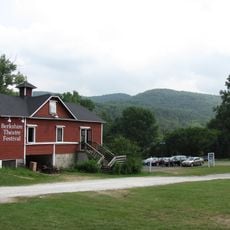
The settlement used water power from nearby springs through dams to run tools like lathes, planers, and saws in the Red House workshops. This clever water system let residents operate machinery that made their crafts more efficient.

The community of curious travelers

AroundUs brings together thousands of curated places, local tips, and hidden gems, enriched daily by 60,000 contributors worldwide.

Start exploring
Location
GPS coordinates
42.24611,-73.22500
Latest update
December 14, 2025 12:24
Around this place
The Mount
United States of America

The Mount

10.6 km
Norman Rockwell Museum
United States of America

Norman Rockwell Museum

10.3 km
Sedgwick Pie
United States of America

Sedgwick Pie

8.8 km
Naumkeag
United States of America

Naumkeag

8.9 km
Chesterwood
United States of America

Chesterwood

11.4 km
October Mountain State Forest
United States of America

October Mountain State Forest

11.7 km
Mission House
United States of America

Mission House

8.6 km
Berkshire Theatre Festival
United States of America

Berkshire Theatre Festival

7.4 km
Monument Mountain
United States of America

Monument Mountain

10.9 km
Berkshire Botanical Garden
United States of America

Berkshire Botanical Garden

11 km
Bidwell House Museum
United States of America

Bidwell House Museum

4.3 km
Villa Virginia
United States of America

Villa Virginia

7.8 km
Stockbridge Casino
United States of America

Stockbridge Casino

7.5 km
South Lee Historic District
United States of America

South Lee Historic District

5.5 km
Merwin House (Stockbridge, Massachusetts)
United States of America

Merwin House (Stockbridge, Massachusetts)

8.3 km
Housatonic Congregational Church
United States of America

Housatonic Congregational Church

11.7 km
Golden Hill Bridge
United States of America

Golden Hill Bridge

8.5 km
Ramsdell Public Library
United States of America

Ramsdell Public Library

11.6 km
Glendale Power House
United States of America

Glendale Power House

11.2 km
Hyde House
United States of America

Hyde House

6.8 km
Methodist Episcopal Society of Tyringham
United States of America

Methodist Episcopal Society of Tyringham

1.8 km
Rock Ridge
United States of America

Rock Ridge

6.7 km
Capt. John Brewer House
United States of America

Capt. John Brewer House

7.7 km
Elm-Maple-South Streets Historic District
United States of America

Elm-Maple-South Streets Historic District

8.1 km
East Otis Schoolhouse
United States of America

East Otis Schoolhouse

7.1 km
Tyringham Library
United States of America

Tyringham Library

1.7 km
Monument Mountain
United States of America

Monument Mountain

9.5 km
Main Street Historic District
United States of America

Main Street Historic District

9 km
Show the full map
Reviews
Share your experience

No review yet

Discussions
Start a discussion...

No discussion yet

« Tyringham Shaker Settlement Historic District - Historic district in Tyringham, Massachusetts, United States » is provided by Around Us (aroundus.com). Images and texts are derived from Wikimedia project under a Creative Commons license. You are allowed to copy, distribute, and modify copies of this page, under the conditions set by the license, as long as this note is clearly visible.

Discover hidden gems everywhere you go!

From secret cafés to breathtaking viewpoints, skip the crowded tourist spots and find places that match your style. Our app makes it easy with voice search, smart filtering, route optimization, and insider tips from travelers worldwide. Download now for the complete mobile experience.

Around Us App Screenshot

A unique approach to discovering new places

Le Figaro

All the places worth exploring

France Info

A tailor-made excursion in just a few clicks

20 Minutes

Around Us
Travel Guide & Maps
Download

Send to your phone

QR Code
1

Open the camera app on your mobile.

2

Point at the QR code with your camera. A notification will appear.

3

Tap the notification to open the link.