Enable Location

We need your location to show you interesting places around you

Discover nearby places

Find interesting locations and hidden gems around you

Precise directions

Get accurate directions and distances to places

Your location is never shared with other users. It's only used when you tap the location button.

Dudleytown Historic District

Log in to your account

Start exploring — it's free

Trusted by 61,579 travelers worldwide

Continue with Google
Continue with Apple
or

We will send you a code to connect

By continuing, you accept our Terms and Conditions and our Privacy Policy

Check your inbox

We've sent a pincode in your inbox. Please enter the code below.

Dudleytown Historic District, Historic district in Guilford, Connecticut, US.

Description

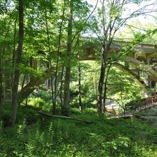
Dudleytown Historic District is an area that extends along Clapboard Hill Road and includes rural residences and farm buildings from earlier centuries. The East River flows through the region and several roads like Duck Hill Road and Tanner Marsh Road cross through the historic properties.

History

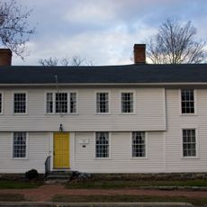
William Dudley, an English settler, arrived in 1639 and established the settlement in this area, which remained in his family's hands for a long time. Starting in the 1860s, the population and land use began to change.

Culture

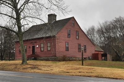
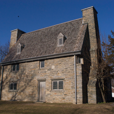
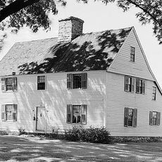
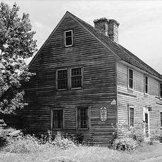
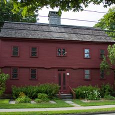
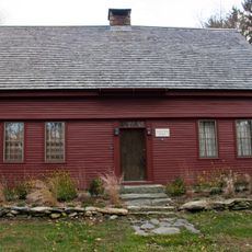
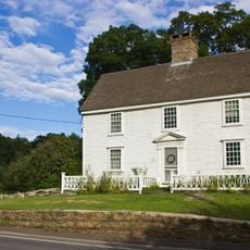
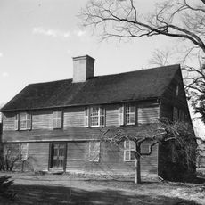
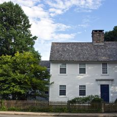
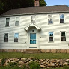
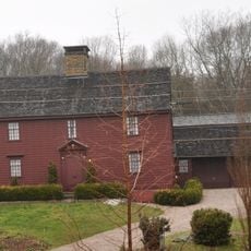
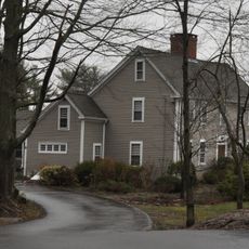
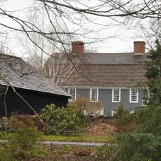
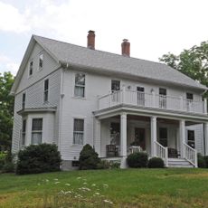
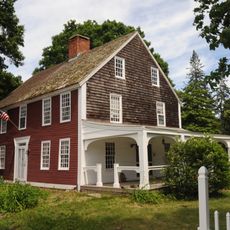
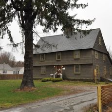
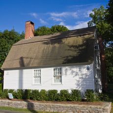
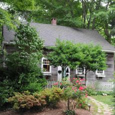
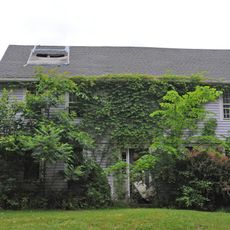
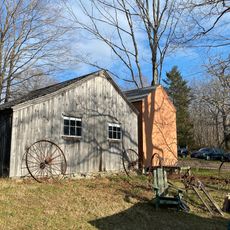
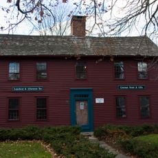
The buildings show how rural families lived in the 18th and 19th centuries, with a schoolhouse from 1835 and farm buildings that still shape the village character today. These structures tell the story of everyday life from that era.

Practical

The area is today mostly built with residential properties spread along several roads that give a sense of the original settlement pattern. Visitors should explore on foot to properly observe the historic buildings and surrounding landscape.

Did you know?

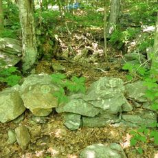
The area preserves over 100 acres of marshland with stone walls that were historically used to control tidal water during salt hay harvesting. This ancient land management practice shaped the landscape and remains visible in the terrain structure today.

Location
GPS coordinates
41.29944,-72.65806
Latest update
December 14, 2025 11:21

AroundUs brings together thousands of curated places, local tips, and hidden gems, enriched daily by 60,000 contributors worldwide. Discover all places nearby (Connecticut).

Around this place
Henry Whitfield House
United States of America

Henry Whitfield House

2.9 km
Comfort Starr House
United States of America

Comfort Starr House

2.4 km
Acadian House
United States of America

Acadian House

2.4 km
Hyland-Wildman House
United States of America

Hyland-Wildman House

2.6 km
Guilford Historic Town Center
United States of America

Guilford Historic Town Center

2.7 km
Jonathan Murray House
United States of America

Jonathan Murray House

6.7 km
Griswold House
United States of America

Griswold House

2.3 km
Deacon John Graves House
United States of America

Deacon John Graves House

5 km
Allis-Bushnell House
United States of America

Allis-Bushnell House

5.9 km
Madison Green Historic District
United States of America

Madison Green Historic District

5.2 km
Pine Orchard Union Chapel
United States of America

Pine Orchard Union Chapel

7.8 km
Norcross Brothers Granite Quarry
United States of America

Norcross Brothers Granite Quarry

7.3 km
Stick Style House at Stony Creek
United States of America

Stick Style House at Stony Creek

8.2 km
Thomas Burgis II House
United States of America

Thomas Burgis II House

2.5 km
John Rogers House
United States of America

John Rogers House

7.4 km
Pelatiah Leete House
United States of America

Pelatiah Leete House

6.7 km
Bridge No. 1132
United States of America

Bridge No. 1132

7.5 km
Jared Eliot House
United States of America

Jared Eliot House

4 km
Elisha Pitkin House
United States of America

Elisha Pitkin House

4.1 km
Route 146 Historic District
United States of America

Route 146 Historic District

5.8 km
Edward Frisbie House
United States of America

Edward Frisbie House

8.2 km
Hammonasset Paper Mill Site
United States of America

Hammonasset Paper Mill Site

6.1 km
Shelley House
United States of America

Shelley House

3.4 km
Sabbathday House
United States of America

Sabbathday House

2.5 km
House at 29 Flat Rock Road
United States of America

House at 29 Flat Rock Road

8.3 km
Eliphalet Howd House
United States of America

Eliphalet Howd House

8.3 km
Dudley Farm
United States of America

Dudley Farm

8 km
Meigs-Bishop House
United States of America

Meigs-Bishop House

5.7 km
Show the full map
« Dudleytown Historic District - Historic district in Guilford, Connecticut, US » is provided by Around Us (aroundus.com). Images and texts are derived from Wikimedia project under a Creative Commons license. You are allowed to copy, distribute, and modify copies of this page, under the conditions set by the license, as long as this note is clearly visible.

Discover hidden gems everywhere you go!

From secret cafés to breathtaking viewpoints, skip the crowded tourist spots and find places that match your style. Our app makes it easy with voice search, smart filtering, route optimization, and insider tips from travelers worldwide. Download now for the complete mobile experience.

Around Us App Screenshot

A unique approach to discovering new places

Le Figaro

All the places worth exploring

France Info

A tailor-made excursion in just a few clicks

20 Minutes

Around Us
Travel Guide & Maps
Download

Send to your phone

QR Code
1

Open the camera app on your mobile.

2

Point at the QR code with your camera. A notification will appear.

3

Tap the notification to open the link.