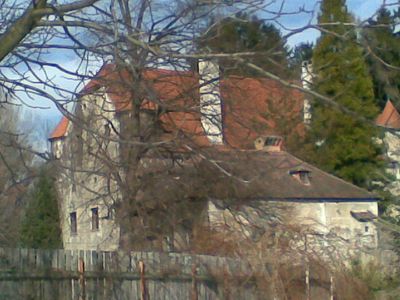
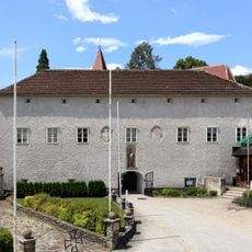
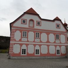
Schloss Pottschach, Renaissance water castle in Ternitz, Austria
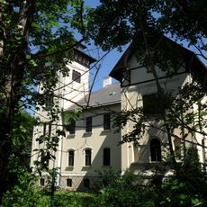
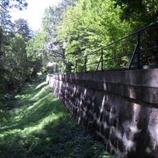
Schloss Pottschach is a three-story rectangular water castle in Ternitz, featuring corner turrets at the upper level and surrounded by walls with four defensive towers. The structure displays typical Renaissance architectural details with its heavy defensive elements.
The castle was founded in 1134 as a water fortress and later transformed into a Renaissance structure under Bernhard Ursenbeck's ownership. This conversion reflects the shift from purely defensive fortifications to more residential estates.
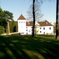
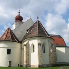
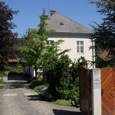
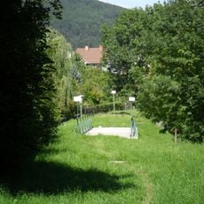
The castle and the Pottschach parish church sit together as one complex, showing how buildings were deliberately planned as a unit in medieval times. You can still see today how these two structures relate to each other in the landscape.
The castle remains in private ownership and is not open to visitors, but you can view its exterior from Pottschacher Street. A walk along the street offers the best vantage point to see the facade and defensive towers.
The third floor contains only spy windows and arrow slits, revealing that the fortress never fully abandoned its defensive purpose. These hidden openings were easy to miss but served practical security functions.
Location: Gemeinde Ternitz
GPS coordinates: 47.70391,15.99958
Latest update: December 9, 2025 20:25
Schloss Vöstenhof
2 km
Gfieder
1.5 km
Saint John the Baptist Church
2.5 km
Pfarrkirche Pottschach
76 m
Pfarrkirche Wimpassing im Schwarzatale
1.7 km
Parish church St. Valentin-Landschach
2.4 km
Flur-/Wegkapelle
2.8 km
Kalvarienbergkapelle
801 m
Schuberthof
1.8 km
Scherz-Villa (Welzl-Villa)
2.3 km
Herrenhaus Ternitz
2.9 km
Teil der 1. Wiener Hochquellenleitung, Aquädukt 10a
1.2 km
Pfarrhof
1.7 km
Hochhaus
2.2 km
Ruine Neudegg
2.5 km
Bildstock Christus an der Geißelsäule
552 m
Pfarrhof
74 m
Ehem. Pfarrhof
2.2 km
Teil der 1. Wiener Hochquellenleitung
1.4 km
Fundzone Gfiederäcker
2.1 km
Ölberggruppe
474 m
Figurengruppe Christi Abschied von hl. Maria
287 m
Pfarrhof mit Wirtschaftsgebäude und Umfassungsmauer
2.4 km
Teil der 1. Wiener Hochquellenleitung
2.4 km
Teil der 1. Wiener Hochquellenleitung
888 m
Befestigte Höhensiedlung Burgstall
709 m
Teil der 1. Wiener Hochquellenleitung, Aquädukt 10a
1.2 km
Befestigte Höhensiedlung Burgstall
882 mVisited this place? Tap the stars to rate it and share your experience / photos with the community! Try now! You can cancel it anytime.
Discover hidden gems everywhere you go!
From secret cafés to breathtaking viewpoints, skip the crowded tourist spots and find places that match your style. Our app makes it easy with voice search, smart filtering, route optimization, and insider tips from travelers worldwide. Download now for the complete mobile experience.
A unique approach to discovering new places❞
— Le Figaro
All the places worth exploring❞
— France Info
A tailor-made excursion in just a few clicks❞
— 20 Minutes