Weiße Spitze, Mountain peak in Villgraten Mountains, Austria
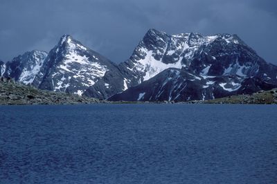
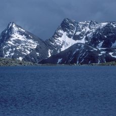
The Weiße Spitze is a mountain peak in the Villgraten Mountains at 2,962 meters elevation and stands as the highest point of this range in East Tyrol. The mountain displays steep slopes and rocky formations that define its appearance.
The mountain was first documented climbed on August 25, 1894, when mountaineer J. Erlsbacher reached the summit. This ascent marked the beginning of organized climbing activity in this part of East Tyrol.
The mountain is known by several names in the region, and local people have developed their own terms that differ from official designations. These varied names show how deeply connected the local community is to this place.
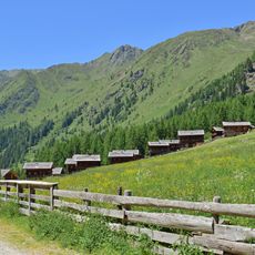
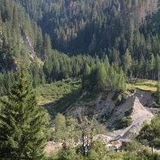
The climb begins at Oberstaller Alm at approximately 1,820 meters elevation and follows gravel paths before turning to block climbing near the top. For this route you should have sturdy footwear and basic experience with mountain terrain.
Local residents sometimes confuse this peak with the neighboring Rote Spitze, even though both summits have separate identities. This mix-up developed from their close proximity and how they appear differently from various valleys below.
Location: Sankt Veit in Defereggen
Location: Innervillgraten
Elevation above the sea: 2,962 m
GPS coordinates: 46.87189,12.35797
Latest update: December 14, 2025 14:24
Oberstalleralm
2 km
Rote Spitze
1.1 km
Brugger Almbach
1.9 km
Stemmeringer Almbach
3.1 km
Oberstalleralm
2 km
Raut
4.9 km
Kirche St. Leonhard, St. Jakob in Defereggen
4.8 km
Schutzengelkapelle Oberstalleralm
2 km
Fatima-Kapelle Kamelisenalm
3.5 km
Kapelle hll. Chrysanth und Daria, Innervillgraten
3.1 km
Bauernhaus Jagerreith
4.7 km
Almhütte vulgo Peintner
2 km
Almhütte vulgo Mitter-Gasser
2 km
Almhütte vulgo Unter-Untergruber
2 km
Almhütte
2 km
Almhütte vulgo Außer-Walder
2 km
Bildsäule Kamelisenalm
3.5 km
Almhütte vulgo Inner-Ober-Gruber
2 km
Almhütte vulgo Groß-Bachlet
2.1 km
Almhütte vulgo Inner-Obergruber
2.1 km
Almhütte vulgo Außer-Obergruber
2.1 km
Almhütte vulgo Unter-Haider
2.1 km
Almhütte
2 km
Almhütte vulgo Mitter-Bachlet
2 km
Almhütte vulgo Mitter-Haider
2.1 km
Nepomukbildstock Feistritz
4.7 km
Almhütte vulgo Unter-Milet
2.1 km
Almhütte
2 kmVisited this place? Tap the stars to rate it and share your experience / photos with the community! Try now! You can cancel it anytime.
Discover hidden gems everywhere you go!
From secret cafés to breathtaking viewpoints, skip the crowded tourist spots and find places that match your style. Our app makes it easy with voice search, smart filtering, route optimization, and insider tips from travelers worldwide. Download now for the complete mobile experience.
A unique approach to discovering new places❞
— Le Figaro
All the places worth exploring❞
— France Info
A tailor-made excursion in just a few clicks❞
— 20 Minutes