Traunstein, Mountain summit in Gmunden, Austria
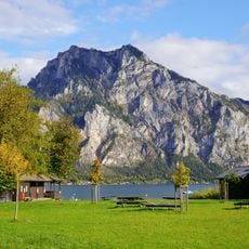
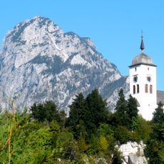
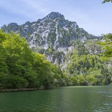
Traunstein rises to 1,691 meters above sea level and is known for steep rock walls that drop almost vertically toward the Traunsee lake below. The mountain's distinctive shape comes from these sheer cliffs that descend directly into the water.
The peak has served as a natural boundary marker for the Traunsee lake's eastern edge since ancient geological times. Its prominent location made it an important reference point for people living in and traveling through the Salzkammergut region over many centuries.
The mountain serves as a gathering place for climbers and hikers from the surrounding region who follow established routes and connect at local mountain huts. The Gmundner Hütte acts as a social hub where visitors meet and share experiences on the slopes.
Access via the eastern ridge route requires advanced climbing skills and proper mountaineering equipment for safe passage. Visitors should prepare for significant physical effort and bring adequate experience in mountain climbing.
The mountain stands geographically isolated with considerable distance to its nearest higher neighbor, making it a striking landmark visible from many viewpoints. This separation gives it a distinctive visual presence that makes it recognizable across the landscape.
The community of curious travelers
AroundUs brings together thousands of curated places, local tips, and hidden gems, enriched daily by 60,000 contributors worldwide.