Katzenstein, Mountain summit in Gmunden, Austria
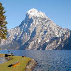
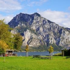
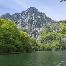
Katzenstein is a mountain summit near Gmunden rising to 1,349 meters with steep rocky paths throughout its terrain. The peak stands within the Upper Austrian Pre-Alps, positioned near the Traunstein massif.
The mountain formed during the Ladinian period and consists primarily of Wettersteinkalk limestone that shaped its current structure. This rock formation emerged as part of the region's broader geological development.
The Katzenstein is climbed from the Laudachsee via the Hohe Scharte, where the route branches left onto a steep, rocky path to the summit. The peak is linked with the Traunstein through the Hohe Scharte and continues eastward to the Steineck, so hikers often combine several summits in one tour.
The hike takes about 90 minutes along a 2.2 kilometer trail with 454 meters of elevation gain to the summit. Sturdy footwear is important due to the steep and rocky terrain throughout the route.
The summit sits just 1.1 km from the Traunstein and is linked to it via the Hohe Scharte, while the ridge continues east toward the Steineck. The Laudachsee lies directly at the foot of the mountain, so the lake appears straight below the viewpoint.
The community of curious travelers
AroundUs brings together thousands of curated places, local tips, and hidden gems, enriched daily by 92,687 contributors worldwide.