Trevélez, Mountain municipality in Alpujarras region, Granada, Spain
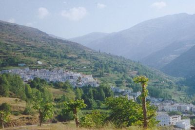
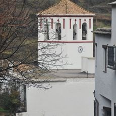
Trevélez is a mountain town in the Alpujarra region that splits into three distinct sections arranged at different elevations. Each quarter has its own character, with the lower level housing most shops and places to eat.
The town took shape as three separate settlements during medieval times, which explains its tiered layout today. The lower quarter later became the main hub for commerce and drew visitors seeking goods and rest.
The ham-making tradition here reflects skills that have been handed down over centuries, with curing rooms positioned to catch the cool mountain breezes. This craft forms a central part of daily life and shapes how the town looks and functions.
Bus services run regularly from Granada through Lanjarón and Órgiva, making arrival straightforward. Most lodging and eating spots sit in the lower quarter, which is also where you'll find supplies and basic services.
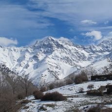
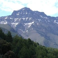
The altitude of around 1776 meters creates natural curing conditions shaped by cold mountain temperatures. This combination of location and craft produces a product with distinct qualities you won't find made the same way elsewhere.
Location: Province of Granada
Capital city: Trevélez
Elevation above the sea: 1,776 m
Part of: Alpujarras, distrito notarial de Órgiva, Alpujarra Granadina
Shares border with: Güéjar Sierra, Jérez del Marquesado, Bérchules, Juviles, Busquístar, Pórtugos, Capileira
Website: http://trevelez.es
GPS coordinates: 37.00250,-3.26694
Latest update: December 7, 2025 09:21
Mulhacén
6.9 km
Veleta
10.6 km
Sierra Nevada National and Natural Park
10 km
IRAM 30-meter telescope
13.2 km
Alcazaba
7.9 km
Sierra Nevada Observatory
12.5 km
Sierra Nevada Natural Park
12.6 km
Pico del Caballo
15.4 km
Conjunto Enclave de La Mezquita
8.6 km
Corral del Veleta glacier
10.4 km
Conjunto Baños del Piojo
9.1 km
Jardín Botánico de Endemismos de Sierra Nevada
14.9 km
Hoya de Pedraza
19.2 km
Conjunto Cortijo de los Arcos
9.6 km
Telar de Jarapas Hilacar
9.8 km
Sierra Nevada Biosphere Reserve
19.1 km
Monument of Our Lady of the Snows
14.2 km
El Fuerte (Lanteira)
21.8 km
Torre (Jérez del Marquesado)
22.3 km
Centro Histórico de Capileira
9.4 km
Centro Histórico de Bubión
9.4 km
Iglesia Parroquial de San Roque
9.1 km
Mulhacén II
6.1 km
Iglesia Parroquial de San Antonio
290 m
Ermita de la Virgen de Fátima
8 km
Iglesia Parroquial de Nuestra Señora del Rosario
10 km
Iglesia Parroquial de la Santa Cruz
10.9 km
Veleta
10.6 kmVisited this place? Tap the stars to rate it and share your experience / photos with the community! Try now! You can cancel it anytime.
Discover hidden gems everywhere you go!
From secret cafés to breathtaking viewpoints, skip the crowded tourist spots and find places that match your style. Our app makes it easy with voice search, smart filtering, route optimization, and insider tips from travelers worldwide. Download now for the complete mobile experience.
A unique approach to discovering new places❞
— Le Figaro
All the places worth exploring❞
— France Info
A tailor-made excursion in just a few clicks❞
— 20 Minutes