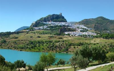
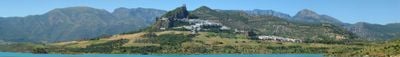
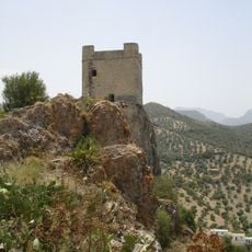
Zahara de la Sierra, Mountain village in Sierra de Grazalema Natural Park, Spain.
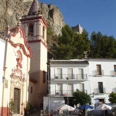
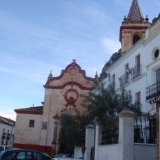
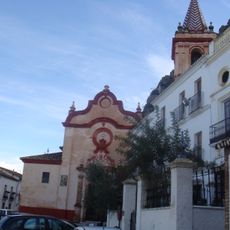
Zahara de la Sierra is a mountain village within Sierra de Grazalema Natural Park, with whitewashed buildings arranged in steps up a steep slope at roughly 500 meters elevation. The settlement is crowned by a medieval castle, and narrow pathways and stairs connect the different levels following the natural terrain.
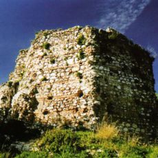
The settlement functioned as a Moorish stronghold until Christian forces captured it in 1407, though Arab control returned briefly in 1481. This contested past shaped both the architecture and layout that still reflect layers of different cultural influences today.
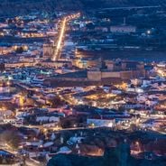
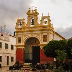
The village maintains its whitewashed character with houses clustered tightly along the slopes, showing traditional Andalusian building practices. Daily life unfolds in the narrow streets and central plaza, where locals and visitors move through spaces that have served the community for centuries.
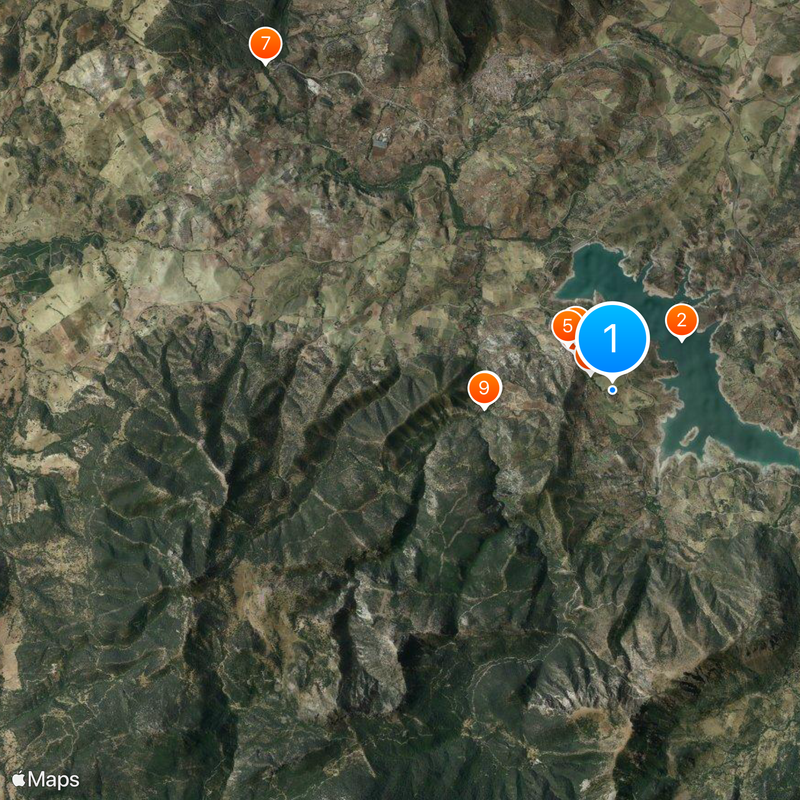
The best time to visit is early morning or late afternoon when temperatures are cooler and streets are less crowded. Parking is available at the lower areas of the village, from where you can walk upward or use the one-way road system to drive higher into the settlement.
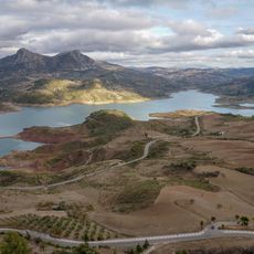
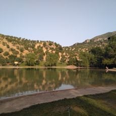
The Zahara-el Gastor reservoir beneath the village creates a water surface that reflects the white buildings and medieval castle, offering striking views under calm conditions. This reflection is especially visible in early morning hours when the water is smooth and light angles are favorable.
Location: Cádiz Province
Capital city: Zahara de la Sierra
Elevation above the sea: 500 m
Part of: Arcos de la Frontera notary district, Mancomunidad de Municipios de la Sierra de Cádiz, Sierra de Cádiz
Shares border with: Algodonales, El Gastor, Grazalema, El Bosque, Prado del Rey, Villamartín
Website: http://zaharadelasierra.es
GPS coordinates: 36.83333,-5.38333
Latest update: December 17, 2025 10:31
Zahara-El Gastor Reservoir
1.4 km
Castle of Zahara de la Sierra
871 m
Iglesia de Santa María de la Mesa
1 km
Capilla de San Juan de Letrán (Zahara)
1.1 kmPuente de los Palominos (Zahara)
2.2 kmPuente de La Nava sobre el Río Guadalete
8 kmFuente de la Calera (Zahara)
461 mPuente de Los Palominos sobre el arroyo de Esteros
2.2 kmLavadero de la Molineta (Zahara)
8.4 km
Centro Histórico de Zahara de la Sierra
1 kmPuente en Algodonales sobre el arroyo del Batán
4.7 km
Casa consistorial de Zahara de la Sierra
1 km
Playita de Arroyomolinos
2 km
Torre Hexagonal (Zahara)
926 mFuente del Altabacar (Zahara)
477 mFuente de la Higuera y Lavadero (Zahara)
1.3 kmEl Pilar de Zahara I (Zahara)
1.3 km
Cueva de la Garganta (Zahara)
2.8 km
Vivienda 0035 (Zahara)
1 kmScenic viewpoint
1.4 kmLa Garganta Verde
2.7 kmSagrado corazón
6.7 kmScenic viewpoint
942 mPuerto de los Acebuches
3.7 kmScenic viewpoint
1 kmScenic viewpoint
1.1 kmScenic viewpoint
2.6 kmCalera
4.3 kmVisited this place? Tap the stars to rate it and share your experience / photos with the community! Try now! You can cancel it anytime.
Discover hidden gems everywhere you go!
From secret cafés to breathtaking viewpoints, skip the crowded tourist spots and find places that match your style. Our app makes it easy with voice search, smart filtering, route optimization, and insider tips from travelers worldwide. Download now for the complete mobile experience.
A unique approach to discovering new places❞
— Le Figaro
All the places worth exploring❞
— France Info
A tailor-made excursion in just a few clicks❞
— 20 Minutes