Torrelodones

Log in to your account

AroundUs is a community-driven map of interesting places, built by curious explorers like you. It grows with every review, story, and photo you share.
Connect to save your favorite spots, contribute locations, and create personalized routes.
By continuing, you accept our Terms and Conditions and our Privacy Policy
Add to collection
Map
Suggest a change
Share

Torrelodones, Municipality in northwestern Madrid region, Spain

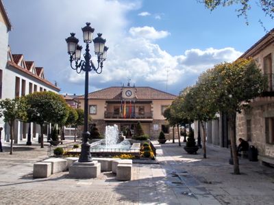
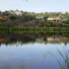
Torrelodones is a municipality in northwestern Madrid that sits between the Sierra de Guadarrama mountains and the Madrid metropolitan sprawl. The settlement spreads across three distinct neighborhoods at about 844 meters elevation, each with its own character and housing patterns.

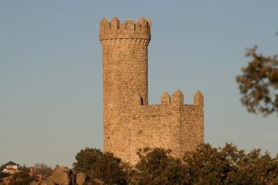
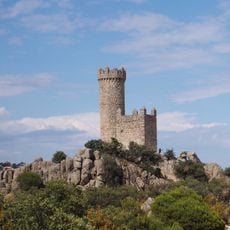
The municipality began as a 7th-century settlement protected by a Muslim watchtower during the Reconquista period. This defensive structure gave the place its name, which literally means 'tower' in Spanish.

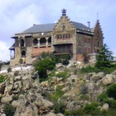
The name comes from an old tower that still shapes how locals see their town and its past. The three main neighborhoods feel quite different from each other: Pueblo and Colonia have a more traditional character, while Los Peñascales appears more modern and affluent.

The town connects easily to Madrid through public transportation, making it convenient for people who work in the capital but prefer a quieter living environment. The hilly terrain and higher elevation are worth keeping in mind when walking around, especially on warm days.

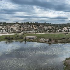
The area borders two protected natural reserves, Sierra de Hoyo and Monte del Pardo, where rare species like Spanish imperial eagles and European hedgehogs roam. This location makes it a significant buffer zone for wildlife conservation in the region.

Location: Community of Madrid

Capital city: Torrelodones

Elevation above the sea: 844 m

Part of: Mancomunidade de Servizos Sociais de Torrelodones, Hoyo de Manzanares, Alpedrete e Moralzarzal (T.H.A.M.), Mancomunidad del Noroeste para la gestión y tratamiento de los residuos urbanos

Shares border with: Madrid, Las Rozas de Madrid, Galapagar, Moralzarzal, Hoyo de Manzanares, Fuencarral-El Pardo

Website: https://torrelodones.es

GPS coordinates: 40.57639,-3.93000

Latest update: December 14, 2025 19:39

Photos
Reviews

Visited this place? Tap the stars to rate it and share your experience / photos with the community! Try now! You can cancel it anytime.

« Torrelodones - Municipality in northwestern Madrid region, Spain » is provided by Around Us (aroundus.com). Images and texts are derived from Wikimedia project under a Creative Commons license. You are allowed to copy, distribute, and modify copies of this page, under the conditions set by the license, as long as this note is clearly visible.

Discover hidden gems everywhere you go!

From secret cafés to breathtaking viewpoints, skip the crowded tourist spots and find places that match your style. Our app makes it easy with voice search, smart filtering, route optimization, and insider tips from travelers worldwide. Download now for the complete mobile experience.

Around Us App Screenshot

A unique approach to discovering new places

Le Figaro

All the places worth exploring

France Info

A tailor-made excursion in just a few clicks

20 Minutes