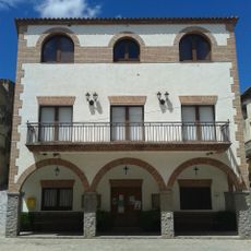
Riudecanyes, municipality of Spain
Location: Baix Camp
Elevation above the sea: 195 m
Part of: Mancomunitat «Serveis Abocador Baix Camp»
Shares border with: Mont-roig del Camp, Riudecols, Botarell, Montbrió del Camp, Vilanova d'Escornalbou, L'Argentera, Duesaigües
Website: http://riudecanyes.cat
GPS coordinates: 41.13017,0.96075
Latest update: March 5, 2025 20:32
Castell d'Escornalbou
3.8 km
Pantà de Riudecanyes
760 m
Viaductes del tren
3.2 km
Sant Mateu de Riudecanyes
28 m
Mas Munter
2.6 km
Torre dels Moros (Riudecols)
3.6 km
El Bres
3 km
Santa Maria de Duesaigües
3.1 km
Cal Brocà
78 m
Sant Llorenç de Botarell
2.5 km
Cal Peyrí
2.7 km
Sant Joan Baptista de Vilanova d'Escornalbou
2.7 km
La Palomera (Vilanova d'Escornalbou)
2.6 km
Molí del Badia
1.5 km
Torre del Gravat
2.8 km
Casa davant de l'església
3.1 km
Antiga Cooperativa de Vilanova d'Escornalbou
2.6 km
Molí del Guasc
689 m
Rentador de Duesaigües
3.1 km
Castell i Torre de Botarell
2.4 km
Molí del Rafel
2.5 km
Casa de la Vila de Riudecanyes
23 m
Molí de la Rafaela
1.5 km
Cal Peyrí Tower
2.7 km
Pont de Riudecanyes
272 m
Presa de Riudecanyes
403 m
Casa de la Vila
2.8 km
Molí de la Vila
2.3 kmReviews
Visited this place? Tap the stars to rate it and share your experience / photos with the community! Try now! You can cancel it anytime.
Discover hidden gems everywhere you go!
From secret cafés to breathtaking viewpoints, skip the crowded tourist spots and find places that match your style. Our app makes it easy with voice search, smart filtering, route optimization, and insider tips from travelers worldwide. Download now for the complete mobile experience.
A unique approach to discovering new places❞
— Le Figaro
All the places worth exploring❞
— France Info
A tailor-made excursion in just a few clicks❞
— 20 Minutes