Setenil de las Bodegas

Log in to your account

AroundUs is a community-driven map of interesting places, built by curious explorers like you. It grows with every review, story, and photo you share.
Connect to save your favorite spots, contribute locations, and create personalized routes.
By continuing, you accept our Terms and Conditions and our Privacy Policy
Add to collection
Map
Suggest a change
Share

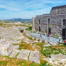
Setenil de las Bodegas, Troglodyte settlement in Sierra de Cádiz, Spain

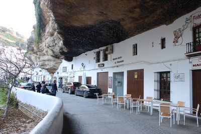
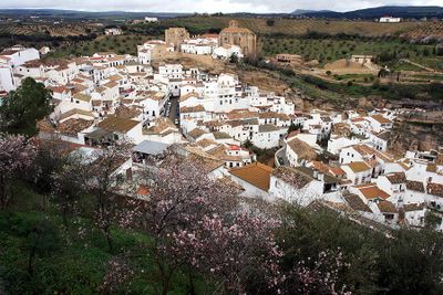
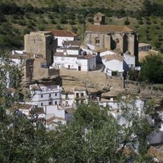
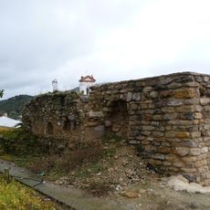
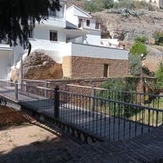
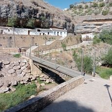
Setenil de las Bodegas is a municipality in Cádiz Province, Spain, where houses stand along a river gorge and sit embedded within limestone rock formations. The buildings use natural overhangs as roofs, while streets wind tightly between cliff faces and residential structures.

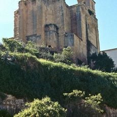
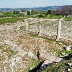
The settlement grew from a 12th-century Moorish fortress and fell to Christian forces in 1484 after repeated sieges using gunpowder artillery. The conquest ended Moorish rule in this part of the Sierra de Cádiz.

The name comes from the Latin 'septem nihil', meaning seven times nothing, a reference to the number of attempts Christian armies made before taking the settlement. Residents today live in homes built directly beneath rock overhangs, with some rooms using the bare stone itself as a ceiling.

The town center holds narrow streets with restaurants serving regional products such as chorizo, pork, and traditional pastries. Visitors should wear sturdy footwear, as some streets run steep and uneven.

Some houses have gardens growing directly on top of the rock overhangs beneath which living spaces sit. In certain cases, the ceiling of one home serves simultaneously as the floor for another family's garden above.

Location: Cádiz Province

Elevation above the sea: 640 m

Part of: Arcos de la Frontera notary district, Mancomunidad de Municipios de la Sierra de Cádiz, Sierra de Cádiz

Shares border with: Alcalá del Valle, Cañete la Real, Ronda, Olvera, Torre Alháquime

Address: C. Cuevas de la Sombra, 7, 11692 Setenil de las Bodegas, Cádiz, Spain

Website: http://setenil.com

GPS coordinates: 36.86417,-5.18139

Latest update: December 12, 2025 17:55

Photos
Hidden sites in Andalusia: troglodyte villages, medieval castles, and natural parks

Andalusia offers many sites away from typical tourist routes. This southern region of Spain is home to ancient troglodyte dwellings in Guadix, mountain villages like Zahara de la Sierra perched around medieval castles, and natural parks such as Cabo de Gata-Níjar extending over 50 kilometers of...

Reviews

Visited this place? Tap the stars to rate it and share your experience / photos with the community! Try now! You can cancel it anytime.

« Setenil de las Bodegas - Troglodyte settlement in Sierra de Cádiz, Spain » is provided by Around Us (aroundus.com). Images and texts are derived from Wikimedia project under a Creative Commons license. You are allowed to copy, distribute, and modify copies of this page, under the conditions set by the license, as long as this note is clearly visible.

Discover hidden gems everywhere you go!

From secret cafés to breathtaking viewpoints, skip the crowded tourist spots and find places that match your style. Our app makes it easy with voice search, smart filtering, route optimization, and insider tips from travelers worldwide. Download now for the complete mobile experience.

Around Us App Screenshot

A unique approach to discovering new places

Le Figaro

All the places worth exploring

France Info

A tailor-made excursion in just a few clicks

20 Minutes