Enable Location

We need your location to show you interesting places around you

Discover nearby places

Find interesting locations and hidden gems around you

Precise directions

Get accurate directions and distances to places

Your location is never shared with other users. It's only used when you tap the location button.

Calatañazor

Log in to your account

Start exploring — it's free

Trusted by 62,261 travelers worldwide

Continue with Google
Continue with Apple
or

We will send you a code to connect

By continuing, you accept our Terms and Conditions and our Privacy Policy

Check your inbox

We've sent a pincode in your inbox. Please enter the code below.

Calatañazor, Medieval municipality in Soria Province, Spain

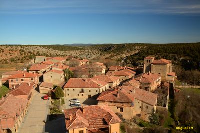
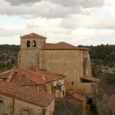
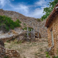
Calatañazor is a municipality in Soria Province built on a limestone hilltop at approximately 1059 meters elevation. Its narrow cobblestone streets connect traditional stone houses with wooden frameworks, forming a cohesive medieval village layout.

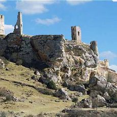
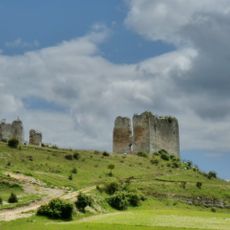
This settlement emerged as a fortified community during the Middle Ages and became the site of a major battle in 1002 when Christian forces defeated Moorish troops in the valley between the town and Abioncillo. That event marked a turning point in Spanish history.

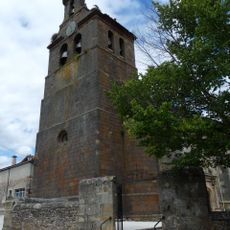
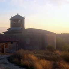
The Church of Santa Maria del Castillo blends Romanesque and Gothic styles, housing religious objects from the 11th century within its stone walls. Visitors can still explore these artistic treasures as they wander through the building today.

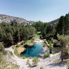
The town is accessible by local roads and can be explored on foot, though the narrow lanes and slopes require comfortable footwear. Two additional hamlets, Aldehuela and Abioncillo, belong to the municipality and offer further opportunities to understand the broader area.

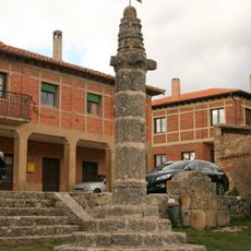
The main square displays an ancient fossil known as the Stone of the Fan, dating back between 11 to 20 million years. Beside this natural wonder stands a medieval justice column, a reminder of the square's former role in local governance.

The community of curious travelers

AroundUs brings together thousands of curated places, local tips, and hidden gems, enriched daily by 60,000 contributors worldwide.

Start exploring
Location
Capital city
Villa de Calatañazor
Elevation above the sea
1,059 m
Part of
Mancomunidade Turística «Tierras del Suroeste Soriano»
Shares border with
Blacos, Cabrejas del Pinar, Abejar, Villaciervos, Golmayo, Rioseco de Soria
GPS coordinates
41.69944,-2.81750
Latest update
December 20, 2025 03:04
« Calatañazor - Medieval municipality in Soria Province, Spain » is provided by Around Us (aroundus.com). Images and texts are derived from Wikimedia project under a Creative Commons license. You are allowed to copy, distribute, and modify copies of this page, under the conditions set by the license, as long as this note is clearly visible.

Discover hidden gems everywhere you go!

From secret cafés to breathtaking viewpoints, skip the crowded tourist spots and find places that match your style. Our app makes it easy with voice search, smart filtering, route optimization, and insider tips from travelers worldwide. Download now for the complete mobile experience.

Around Us App Screenshot

A unique approach to discovering new places

Le Figaro

All the places worth exploring

France Info

A tailor-made excursion in just a few clicks

20 Minutes

Around Us
Travel Guide & Maps
Download

Send to your phone

QR Code
1

Open the camera app on your mobile.

2

Point at the QR code with your camera. A notification will appear.

3

Tap the notification to open the link.