Enable Location

We need your location to show you interesting places around you

Discover nearby places

Find interesting locations and hidden gems around you

Precise directions

Get accurate directions and distances to places

Your location is never shared with other users. It's only used when you tap the location button.

El Astillero

Log in to your account

Start exploring — it's free

Trusted by 62,282 travelers worldwide

Continue with Google
Continue with Apple
or

We will send you a code to connect

By continuing, you accept our Terms and Conditions and our Privacy Policy

Check your inbox

We've sent a pincode in your inbox. Please enter the code below.

El Astillero, municipality of Spain

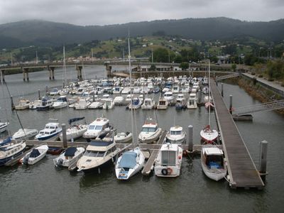
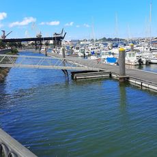
El Astillero is a small town in Cantabria located south of Santander Bay, where shipbuilding history remains visible in its streets, old structures, and green spaces. The area combines quiet residential zones with historical sites, river views, and pathways that follow former railway lines used to transport materials and goods.

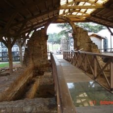
El Astillero developed as a royal shipyard center during the 16th century under King Philip II, where large naval vessels were constructed for the Spanish fleet. The arrival of the railway in 1866 made the town more accessible and eventually transformed it into a summer destination for visitors.

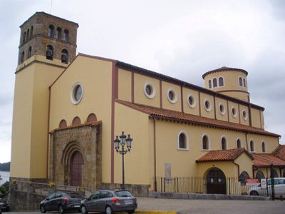
El Astillero's identity is rooted in shipbuilding and maritime work that shaped generations of residents. Walking through the town, you encounter old churches, small museums, and local gatherings where people keep stories of the shipyard era alive.

Getting to El Astillero is straightforward from Santander by car or bus, and most places in town are accessible on foot once you arrive. The pathways are easy to follow and pass through quiet areas, making it comfortable to explore in a few hours or spend a relaxed full day discovering the place.

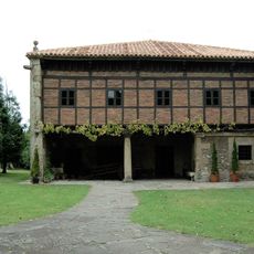
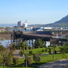
An old iron ore loading dock from the late 1800s remains visible today, revealing industrial activity beyond shipbuilding that once shaped the area. The walking routes also pass by a prehistoric mound called 'el túmulo del vikingo,' believed to be an ancient burial site that holds stories of the region's earliest inhabitants.

The community of curious travelers

AroundUs brings together thousands of curated places, local tips, and hidden gems, enriched daily by 60,000 contributors worldwide.

Start exploring
Location
Capital city
El Astillero
Elevation above the sea
20 m
Shares border with
Real Valle de Camargo, Piélagos, Villaescusa, Medio Cudeyo
GPS coordinates
43.40167,-3.81944
Latest update
February 7, 2026 09:31
« El Astillero - municipality of Spain » is provided by Around Us (aroundus.com). Images and texts are derived from Wikimedia project under a Creative Commons license. You are allowed to copy, distribute, and modify copies of this page, under the conditions set by the license, as long as this note is clearly visible.

Discover hidden gems everywhere you go!

From secret cafés to breathtaking viewpoints, skip the crowded tourist spots and find places that match your style. Our app makes it easy with voice search, smart filtering, route optimization, and insider tips from travelers worldwide. Download now for the complete mobile experience.

Around Us App Screenshot

A unique approach to discovering new places

Le Figaro

All the places worth exploring

France Info

A tailor-made excursion in just a few clicks

20 Minutes

Around Us
Travel Guide & Maps
Download

Send to your phone

QR Code
1

Open the camera app on your mobile.

2

Point at the QR code with your camera. A notification will appear.

3

Tap the notification to open the link.