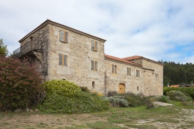
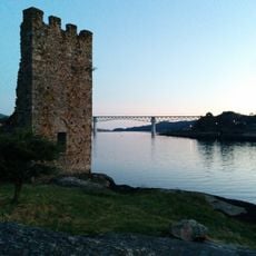
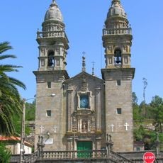
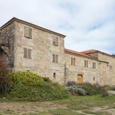
Dodro, municipality in Galician province of A Coruña, Spain
Location: A Coruña Province
Elevation above the sea: 20 m
Part of: intermunicipal commonwealth of the Santiago de Compostela area, O Sar
Shares border with: Padrón, Valga, Rianxo, Lousame, Rois
Website: http://dodro.gal
GPS coordinates: 42.71549,-8.71481
Latest update: March 4, 2025 01:35
Oeste Towers
4.4 km
Casco de Leiro
8.8 km
Ulla River Viaduct (Atlantic axis)
5.5 km
Santuario da Virxe da Escravitude
9.3 km
Lestrobe Towers
4 km
Jardín botánico de Padrón
5.3 km
Castelo da Lúa
10.1 km
Pazo de Dodro
1.7 km
Casa-Museo de Rosalía de Castro
5.7 km
Pazo de Lestrobe
4.4 km
Petroglyphs of Bouza Abadín
1.7 km
Convent of O Carme de Padrón
5 km
Old church of Santa Comba de Louro
3.9 km
Church of Saint Mary of Dodro
2.2 km
Cruz de Avelán
2.2 km
A Torre
10.1 km
Cruceiro de Bustelo
4.7 km
Church of Divino Salvador de Taragoña
10.4 km
La Belle Otero
5.8 km
Biblioteca Pública Municipal de Pontecesures
5.3 km
Galicianos
4.7 km
Biblioteca de la Fundación Pública Gallega Camilo José Cela
5.9 km
Biblioteca Pública Municipal de Padrón
5 km
Atios II
5.1 km
Casa Museo da Fundación Camilo José Cela
5.9 km
Biblioteca Pública Municipal de Catoira
5.4 km
Biblioteca Pública Municipal de Dodro
996 m
Muralla 2012
6.1 kmReviews
Visited this place? Tap the stars to rate it and share your experience / photos with the community! Try now! You can cancel it anytime.
Discover hidden gems everywhere you go!
From secret cafés to breathtaking viewpoints, skip the crowded tourist spots and find places that match your style. Our app makes it easy with voice search, smart filtering, route optimization, and insider tips from travelers worldwide. Download now for the complete mobile experience.
A unique approach to discovering new places❞
— Le Figaro
All the places worth exploring❞
— France Info
A tailor-made excursion in just a few clicks❞
— 20 Minutes