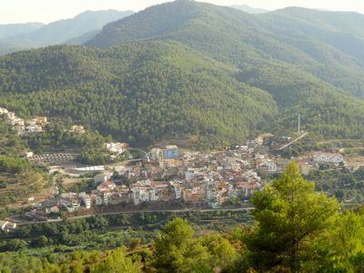
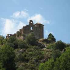
Sueras/Suera, municipality in the comarca of Plana Baixa in the Valencian Community, Spain
Location: Plana Baixa
Capital city: Sueras
Elevation above the sea: 316 m
Shares border with: Alcudia de Veo, Ayódar, Fanzara, Tales, Villamalur
Phone: +34964617033
Website: http://suera.es
GPS coordinates: 39.95194,-0.33167
Latest update: March 3, 2025 11:23
Benitandús
1.7 km
Castell de Maús
2.1 km
Embalse de Onda
1.7 km
Castle of Xinquer
5.9 km
Museo de Ciencias Naturales El Carmen
4.6 km
Castle of Alcúdia de Veo
4.1 km
Ermita de Santa Bàrbara d'Onda
4.4 km
Castell d'Aiòder
6.1 km
Tales Castle
2 km
Església de Sant Miquel Arcàngel de l'Alcúdia de Veo
4.5 km
Castle of Villamalur
5.3 km
Església de l'Assumpció de Suera
36 m
Mare de Déu dels Desemparats de Benitandús
2.5 km
Església de Sant Joan Baptista de Tales
2.1 km
Church of Saint Vincent Ferrer
6.3 km
Campanario del antiguo convento de dominicos de Ayódar
6.4 km
Retablo cerámico de la Virgen de los Desamparados y florero
5.5 km
Church of the Assumption
3.8 km
Iglesia de Santo Domingo de Guzmán, Villamalur
5.6 km
Església de Sant Miquel d'Aín
5.8 km
Església de Santa Anna d'Artesa
3.7 km
Església de la Puríssima Concepció
5.8 km
Església de sant Joan Baptista (Tales)
2.1 km
Town Hall of Suera
78 m
Historical center of Aín
5.8 km
Nevera de las Hoyas
6.5 km
Font de San Ambrosi
5.8 km
Espadà
6.6 kmReviews
Visited this place? Tap the stars to rate it and share your experience / photos with the community! Try now! You can cancel it anytime.
Discover hidden gems everywhere you go!
From secret cafés to breathtaking viewpoints, skip the crowded tourist spots and find places that match your style. Our app makes it easy with voice search, smart filtering, route optimization, and insider tips from travelers worldwide. Download now for the complete mobile experience.
A unique approach to discovering new places❞
— Le Figaro
All the places worth exploring❞
— France Info
A tailor-made excursion in just a few clicks❞
— 20 Minutes