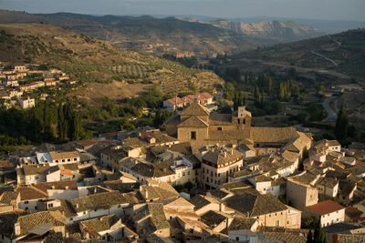
Pastrana, Medieval municipality in Guadalajara Province, Spain
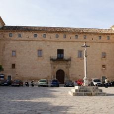
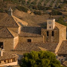
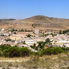
Pastrana is a small medieval municipality in Guadalajara Province situated at 759 meters elevation on a hilltop. Streets follow the original medieval layout with narrow passages, stone buildings, and a central square where historical structures converge.
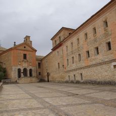
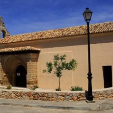
During the 16th century, Pastrana flourished under the patronage of the Princess of Eboli, transforming into a textile manufacturing center. This period left architectural and economic marks that remain visible today.
The name Pastrana comes from Arabic origins, reflecting the area's long settlement history. Residents continue to maintain traditional craftsmanship connected to the town's textile past.
Pastrana is easily reached from Madrid by bus or car in about 90 minutes using the A2 highway. The town itself is walkable, though the hilltop location makes comfortable footwear advisable.
Beneath Pastrana lies a network of medieval cisterns that stored water and distributed it through channels to homes. This underground system was an ingenious solution for water supply in earlier times.
Location: Guadalajara Province
Capital city: Pastrana
Elevation above the sea: 759 m
Part of: komunumaro «Aguas del Río Tajuña», Mancomunitat del «Tajo-Guadiela»
Shares border with: Almonacid de Zorita, Zorita de los Canes, Yebra, Escariche, Escopete, Hueva, Valdeconcha, Sayatón, Buendía
Website: http://pastrana.org
GPS coordinates: 40.41778,-2.92250
Latest update: December 6, 2025 22:06
Bolarque Reservoir
10.8 km
Ruta de las Caras
14.3 km
Palace of Duke of Pastrana
55 m
Castle of Zorita de los Canes-Alcazaba de Zorita
10 km
Colegiata de Pastrana
209 m
Convent of El Carmen, Pastrana
1.5 km
Castle of Anguix
11.2 km
Convento de la Salceda, Peñalver
16 km
Convento de San Antonio, Mondéjar
18.5 km
Puente medieval, Auñón
15.6 km
Church of Nuestra Señora de la Asunción
17.6 km
Pillory of Fuentenovilla
15.5 km
Church of San Juan Bautista
15.6 km
Pillory of Moratilla de los Meleros
9.7 km
Town hall of Fuentelencina
11.7 km
Entrepeñas Dam
16.8 km
Church of La Asunción
14.3 km
Church of San Pedro
16.8 km
Fuente de Abajo, Fuentelencina
11.8 km
Bullring of Pastrana
228 m
Buendía dam
12 km
Plaza de toros de Sacedon
17.7 km
Plaza de toros de Almoguera
14.7 km
Plaza de toros de Almonacid de Zorita
12.1 km
Iglesia de la Asunción, Escopete
7.2 km
Villa de Pastrana
0 m
Silo de Pastrana
189 m
Granero de Sacedón
17.5 kmVisited this place? Tap the stars to rate it and share your experience / photos with the community! Try now! You can cancel it anytime.
Discover hidden gems everywhere you go!
From secret cafés to breathtaking viewpoints, skip the crowded tourist spots and find places that match your style. Our app makes it easy with voice search, smart filtering, route optimization, and insider tips from travelers worldwide. Download now for the complete mobile experience.
A unique approach to discovering new places❞
— Le Figaro
All the places worth exploring❞
— France Info
A tailor-made excursion in just a few clicks❞
— 20 Minutes