Antchola, Mountain summit at French-Spanish border, Pyrénées-Atlantiques and Navarre.
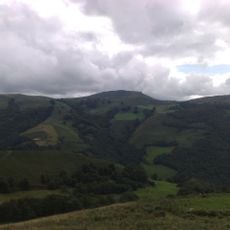
Antchola is a mountain summit in the western Pyrenees rising to 1,119 meters where France and Spain meet. The peak sits amid rolling grassland and rocky outcrops, with views extending across the border regions of both nations.
The mountain marked the boundaries of the historic Kingdom of Navarre, which ruled this region from the early Middle Ages until 1512, when it was divided between France and Spain. This division shaped the modern political divisions that exist here today.
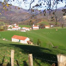
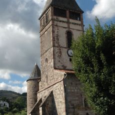
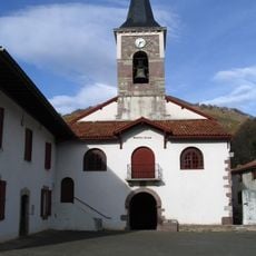
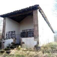
Shepherds work these slopes as their ancestors did, following pastoral traditions rooted in Basque mountain life. The sight of grazing flocks and stone shelters scattered across the grasslands tells the story of how people have lived here for centuries.
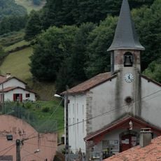
The hike to the summit starts from Banca village and follows a trail of roughly 3 kilometers with steady climbing. Good hiking boots and layered clothing are important since mountain weather can change quickly at this elevation.
At this peak, not only two countries meet but also two distinct geographic regions with their own cultural character. The spot shows clearly how close France's Pyrénées-Atlantiques and Spain's Navarre are to each other, yet remain quite different.
Location: Pyrénées-Atlantiques
Location: Navarre
Location: Lower Navarre
Elevation above the sea: 1,119 m
Website: http://geodesie.ign.fr/fiches/index.php?module=e&action=fichepdf&source=carte&sit_no=64092A
GPS coordinates: 43.14265,-1.40957
Latest update: December 14, 2025 20:00
Baïgorry Valley
5.8 km
Waterfall of Xorroxin
4 km
Mines de cuivre de Banca
3.3 km
Château d'Etchaux
6.5 km
Église de Saint-Étienne-de-Baïgorry
6.3 km
Soalar 1 mendebalde
4.6 km
Église Notre-Dame d'Aldudes
5.1 km
Otsamunho
5.4 km
Église Saint-Pierre de Banca
3.3 km
San Kristobal ermita (Arizkun)
6 km
Eihartzeko munoa
6.6 km
Basabar (dudoso)
3.7 km
Gamioko iturria (dudoso)
4.9 km
Goizemetzko lepoa (dudoso)
5.3 km
Nekaitz
1.8 km
Pagozelai
2.7 km
Soalar 2 ekialde
4.4 km
Oiza (Mizkiritzen borda)
5.5 km
Berdaritz 2 ipar
4.1 km
Burga (dudoso)
3.8 km
Soalar bizkarra
4.5 km
Berdaritz 1 hego (desaparecido)
4.2 km
Goizemetz
5.3 km
Table d'Orientation
6.2 km
Scenic viewpoint
5.8 km
Scenic viewpoint
5.8 km
Borne frontière #102
1.5 km
Scenic viewpoint
5.7 kmVisited this place? Tap the stars to rate it and share your experience / photos with the community! Try now! You can cancel it anytime.
Discover hidden gems everywhere you go!
From secret cafés to breathtaking viewpoints, skip the crowded tourist spots and find places that match your style. Our app makes it easy with voice search, smart filtering, route optimization, and insider tips from travelers worldwide. Download now for the complete mobile experience.
A unique approach to discovering new places❞
— Le Figaro
All the places worth exploring❞
— France Info
A tailor-made excursion in just a few clicks❞
— 20 Minutes