Sant Corneli, Mountain summit in Catalonia, Spain
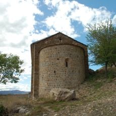
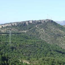
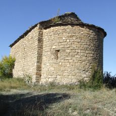
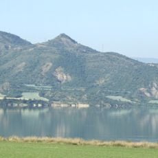
Sant Corneli is a 1,351.4-metre ridge, not a single peak, on the border of the Conca de Dalt and Isona i Conca Dellà municipalities in the Pallars Jussà. It continues east as the Costa Gran toward Abella de la Conca, while several serrats descend north toward Aramunt. The summit holds a geodesic vertex (reference 261088001) and the Romanesque Ermita de Sant Corneli.
Sant Corneli's summit, which overlooks the Conca Dellà, Conca de Dalt and Tremp basins, was the first objective of Franco's armies when they entered the Pallars Jussà in January 1938. From its control they established the front line at its feet, which remained stable throughout 1938. The plain below, the Conca Dellà, saw numerous battles and was heavily destroyed by bombardments. In 1940 a large masonry cross was built on the summit, but it fell shortly afterwards in a strong gale.
The summit holds the Romanesque chapel of Sant Corneli, which gives the mountain its name, and a geodesic vertex marked 261088001. The peak is listed among the 100 cims of the FEEC, a Catalan hiking challenge, so walkers come to sign it off. In 1940 a large masonry cross was built on top; a strong gale soon brought it down.
The summit is reached on foot from Aramunt or from the Conca Dellà side; the top holds a geodesic vertex (reference 261088001) and the Romanesque chapel of Sant Corneli. The ridge continues east towards the Costa Gran and towards Abella de la Conca, so the descent can be planned as a traverse. Snow and wind are possible in winter on this 1,351 m crest.
A large stone cross was built on the summit in 1940, but it fell shortly afterwards in a strong gale. The summit also holds a geodesic vertex, reference 261088001, and the Romanesque chapel of Sant Corneli, and the peak is on the FEEC's list of 100 summits.
The community of curious travelers
AroundUs brings together thousands of curated places, local tips, and hidden gems, enriched daily by 95,118 contributors worldwide.