Chest opened
+${chestReward.xp} XP
Explorer
NOUVEAU ×${chestReward.collectible.quantity}
tapez pour fermer

See the monuments around you in AR Open chests in the app

Around Us is built for your phone — point your camera at the streets and discover the monuments and places around you in augmented reality. Around Us is built for your phone — chests unlock when you walk, explore and capture nearby places.

•

Enable Location

We need your location to show you interesting places around you

Discover nearby places

Find interesting locations and hidden gems around you

Precise directions

Get accurate directions and distances to places

Your location is never shared with other users. It's only used when you tap the location button.

La Zapateira

Log in to your account

Start exploring — it's free

Trusted by 94,210 travelers worldwide

Continue with Google
Continue with Apple
or

We will send you a code to connect

By continuing, you accept our Terms and Conditions and our Privacy Policy

Check your inbox

We've sent a pincode in your inbox. Please enter the code below.

La Zapateira

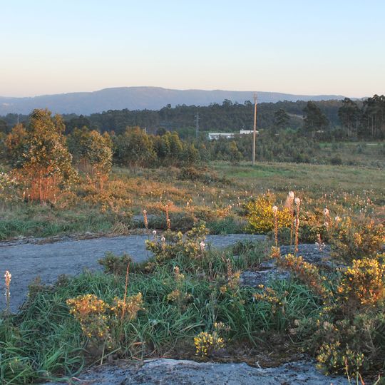
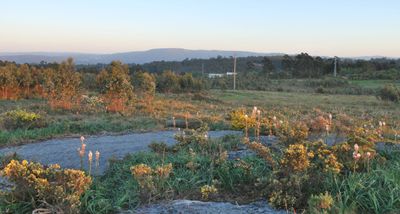
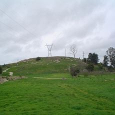
La Zapateira, Mountain summit near A Coruña, Spain.

La Zapateira is a summit of 235.964 metres at the meeting point of A Coruña, Culleredo and Arteixo, its highest point marked by the Castiñeira geodetic vertex in the parish of Rutis. The name now covers the residential area above Penarredonda and the upper buildings of the University of A Coruña's Campus da Zapateira. It separates the basins of the Castro and Trabe streams, which flow to the Burgo estuary.

A necropolis of 33 megalithic mounds, dated to around 3000 BCE, ran some 2.5 km east to west along the ridge from Vilaboa-Rutis to Uxes, between the Trabe and Castro streams. Excavations began in 1935 under the Amantes del Campo society, with Francisco Vales Villamarín and Luís Monteagudo among those involved; the last mound, inside the golf course, was dug in 1976 before its destruction.

The name A Zapateira now covers more than the summit: in A Coruña it designates the residential area above Penarredonda, and the university buildings at the highest point form the Campus da Zapateira. In Culleredo it names the road running past the Sporting Club Casino grounds from Avenida de Nova York to the second AC-14 tunnel.

The summit lies at the junction of A Coruña, Culleredo and Arteixo, reached by road from the Avenida do Alcalde Alfonso Molina; the geodetic marker of Castiñeira stands at the 236-metre high point. The surrounding hills are a TECOR hunting zone active all year, so walkers should keep to forest tracks and wear visible clothing. Much of the old cart road survives only as forest track, and part of it crosses the golf course.

The last of the 33 megalithic mounds was excavated in 1976 inside the golf course, after serving in 1972 as the tee of hole 1 and in 1974 as the tee of hole 3. Luis Monteagudo directed the rescue dig before its destruction.

The community of curious travelers

AroundUs brings together thousands of curated places, local tips, and hidden gems, enriched daily by 94,210 contributors worldwide.
Start exploring
GPS coordinates
43.30717,-8.41054
Latest update
October 31, 2026 20:38
Reviews
Share your experience

No review yet

Discussions
Start a discussion...

No discussion yet

« La Zapateira - Mountain summit near A Coruña, Spain » is provided by Around Us (aroundus.com). Images and texts are derived from Wikimedia project under a Creative Commons license. You are allowed to copy, distribute, and modify copies of this page, under the conditions set by the license, as long as this note is clearly visible.

Discover hidden gems everywhere you go!

From secret cafés to breathtaking viewpoints, skip the crowded tourist spots and find places that match your style. Our app makes it easy with voice search, smart filtering, route optimization, and insider tips from travelers worldwide. Download now for the complete mobile experience.

Around Us App Screenshot
❝

A unique approach to discovering new places❞

— Le Figaro

❝

All the places worth exploring❞

— France Info

❝

A tailor-made excursion in just a few clicks❞

— 20 Minutes

Around Us
Travel Guide & Maps
Download

Send to your phone

QR Code
1

Open the camera app on your mobile.

2

Point at the QR code with your camera. A notification will appear.

3

Tap the notification to open the link.