Enable Location

We need your location to show you interesting places around you

Discover nearby places

Find interesting locations and hidden gems around you

Precise directions

Get accurate directions and distances to places

Your location is never shared with other users. It's only used when you tap the location button.

Issoire

Log in to your account

Start exploring — it's free

Trusted by 62,467 travelers worldwide

Continue with Google
Continue with Apple
or

We will send you a code to connect

By continuing, you accept our Terms and Conditions and our Privacy Policy

Check your inbox

We've sent a pincode in your inbox. Please enter the code below.

Issoire, Medieval commune in Puy-de-Dôme, France

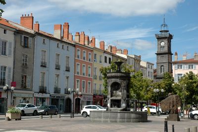
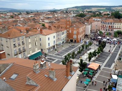
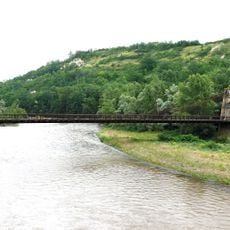
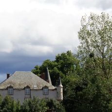
Issoire is a French commune in Puy-de-Dôme that spreads along the Couze River at the point where it joins the Allier, sitting at about 386 meters in elevation. The town features traditional French buildings and green spaces typical of central French communities.

Arvern tribes founded the original settlement, which later became known as Iciodurum under Roman rule and grew into a center of learning. During the Middle Ages, the town maintained its importance as a religious and administrative hub for the region.

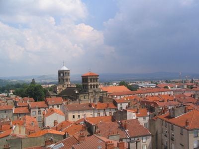
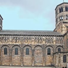
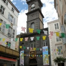
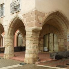
The Saint-Austremoine church shapes the town's character with its Romanesque facade, where visitors notice carved details and rounded arches that define the local skyline. The site remains tied to Saint Austremoine's memory, a connection that has influenced how locals understand their community's roots.

The railway station sits roughly 40 kilometers southeast of Clermont-Ferrand and connects the town to other cities via the Paris-Lyon-Méditerranée line. When visiting, you'll find that spring and autumn offer comfortable weather for walking around, while summer can be warm and winter quite cool.

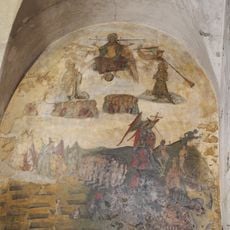
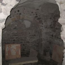
The Saint-Austremoine church was built directly over an older chapel that held the tomb of Saint Austremoine, making the site an important pilgrimage destination. This layering of religiously significant buildings shows how sacred meaning remained attached to the same ground for centuries.

The community of curious travelers

AroundUs brings together thousands of curated places, local tips, and hidden gems, enriched daily by 60,000 contributors worldwide.

Start exploring
Elevation above the sea
398 m
Shares border with
Bergonne, Le Broc, Orbeil, Pardines, Parentignat, Perrier, Saint-Yvoine, Solignat
Phone
GPS coordinates
45.54417,3.24889
Latest update
December 14, 2025 17:45
« Issoire - Medieval commune in Puy-de-Dôme, France » is provided by Around Us (aroundus.com). Images and texts are derived from Wikimedia project under a Creative Commons license. You are allowed to copy, distribute, and modify copies of this page, under the conditions set by the license, as long as this note is clearly visible.

Discover hidden gems everywhere you go!

From secret cafés to breathtaking viewpoints, skip the crowded tourist spots and find places that match your style. Our app makes it easy with voice search, smart filtering, route optimization, and insider tips from travelers worldwide. Download now for the complete mobile experience.

Around Us App Screenshot

A unique approach to discovering new places

Le Figaro

All the places worth exploring

France Info

A tailor-made excursion in just a few clicks

20 Minutes

Around Us
Travel Guide & Maps
Download

Send to your phone

QR Code
1

Open the camera app on your mobile.

2

Point at the QR code with your camera. A notification will appear.

3

Tap the notification to open the link.