Place de la République

Log in to your account

AroundUs is a community-driven map of interesting places, built by curious explorers like you. It grows with every review, story, and photo you share.
Connect to save your favorite spots, contribute locations, and create personalized routes.
By continuing, you accept our Terms and Conditions and our Privacy Policy
Add to collection
Map
Suggest a change
Share

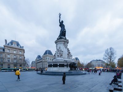
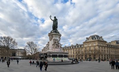
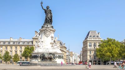
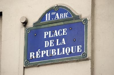
Place de la République, Central square in 3rd arrondissement, Paris, France

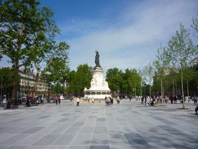
Place de la République stretches 283 meters long and 119 meters wide, connecting the 3rd, 10th, and 11th arrondissements of Paris. At its center stands a tall bronze statue surrounded by open surfaces and wide walkways where people move on foot or on skateboards.

The square took shape in 1883 as part of an urban redesign under the Third Republic. Since then, it has witnessed political gatherings and turning points that have shaped modern France.

This square serves as a gathering point for demonstrations and carries a name rooted in the political ideal that has shaped France since the Revolution. Skateboarders use the smooth surfaces while families rest on benches along the wide pedestrian paths.

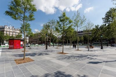
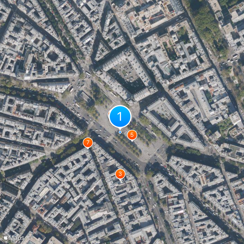
Five metro lines and many bus routes intersect here, making the location an accessible hub in the eastern center. The open layout eases crossing on foot in all directions, even with a stroller or wheelchair.

The redesign in 2013 removed fences and cars and opened the space for pedestrians and wheeled sports alike. This transformation drew skaters from across Europe who practice on the smooth stone surfaces.

Location: 3rd arrondissement of Paris

Location: 10th arrondissement of Paris

Location: 11th arrondissement of Paris

Location: Quartier des Arts-et-Métiers

Location: Quartier des Enfants-Rouges

Location: Quartier de la Porte-Saint-Martin

Location: Quartier de la Folie-Méricourt

Inception: 1883

Length: 283 m

Width: 119 m

Accessibility: Wheelchair accessible

Part of: road network of Paris

Shares border with: avenue de la Porte-de-Vanves, avenue de la République, boulevard Adolphe-Pinard, boulevard de Magenta, Boulevard du Temple, boulevard Saint-Martin, boulevard Voltaire, Passage Vendôme, rue du Temple, rue Ernest-Renan, rue René-Boulanger, rue du Faubourg-du-Temple

Address: Place de la République, Paris, France

Website: http://placedelarepublique.paris.fr

GPS coordinates: 48.86728,2.36406

Latest update: December 5, 2025 16:33

Photos
Reviews

Visited this place? Tap the stars to rate it and share your experience / photos with the community! Try now! You can cancel it anytime.

« Place de la République - Central square in 3rd arrondissement, Paris, France » is provided by Around Us (aroundus.com). Images and texts are derived from Wikimedia project under a Creative Commons license. You are allowed to copy, distribute, and modify copies of this page, under the conditions set by the license, as long as this note is clearly visible.

Discover hidden gems everywhere you go!

From secret cafés to breathtaking viewpoints, skip the crowded tourist spots and find places that match your style. Our app makes it easy with voice search, smart filtering, route optimization, and insider tips from travelers worldwide. Download now for the complete mobile experience.

Around Us App Screenshot

A unique approach to discovering new places

Le Figaro

All the places worth exploring

France Info

A tailor-made excursion in just a few clicks

20 Minutes