Enable Location

We need your location to show you interesting places around you

Discover nearby places

Find interesting locations and hidden gems around you

Precise directions

Get accurate directions and distances to places

Your location is never shared with other users. It's only used when you tap the location button.

Champagnole

Log in to your account

Start exploring — it's free

Trusted by 61,566 travelers worldwide

Continue with Google
Continue with Apple
or

We will send you a code to connect

By continuing, you accept our Terms and Conditions and our Privacy Policy

Check your inbox

We've sent a pincode in your inbox. Please enter the code below.

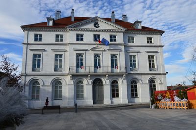
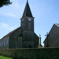
Champagnole, Administrative commune in Jura, France

Description

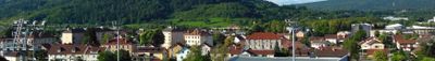
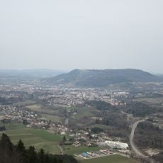
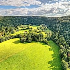
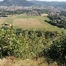
Champagnole is a town in the Jura region that sits along the Ain River and nestles below Mont Rivel. The settlement clusters around the riverbank with forested hillsides rising in the background.

History

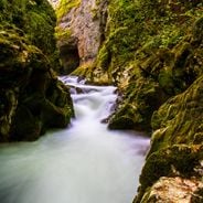
The town grew from a small settlement in the late 1700s into a center of industrial activity during the 1800s and 1900s. Water from the Ain River powered factories that processed metals and timber, which became the backbone of local employment.

Culture

Timber work shaped the community for generations, with craftspeople dedicating themselves to furniture making and traditional box crafting that remains visible in local workshops today. These skills continue to define how residents connect to their surroundings and trade.

Practical

A Saturday market offers fresh local products from regional producers throughout the week. The town has sports facilities for rugby, football, and tennis if you want to stay active during a visit.

Did you know?

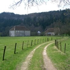
The nearby Forges de Syam is a remarkable metalworking site where water from the Ain has powered machinery for generations. Few visitors realize that this historic workshop still stands as a testament to how craftspeople harnessed river energy.

Location
Elevation above the sea
563 m
Shares border with
Ardon, Bourg-de-Sirod, Cize, Crotenay, Équevillon, Monnet-la-Ville, Montrond, Ney, Pont-du-Navoy, Sapois, Syam, Vannoz
Address
39300 Champagnole, France
Phone
GPS coordinates
46.74722,5.90722
Latest update
December 20, 2025 11:29

AroundUs brings together thousands of curated places, local tips, and hidden gems, enriched daily by 60,000 contributors worldwide. Discover all places nearby (Jura).

Visit Jura: natural sites, historic villages, and mountain resorts

The Jura department features varied landscapes with mountain ranges, limestone plateaus, and forested valleys. The terrain has shaped notable geological sites: the Hérisson waterfalls stretch over nearly 4 kilometers with 31 waterfalls, the Baume-les-Messieurs Reculée forms a closed valley with...

« Champagnole - Administrative commune in Jura, France » is provided by Around Us (aroundus.com). Images and texts are derived from Wikimedia project under a Creative Commons license. You are allowed to copy, distribute, and modify copies of this page, under the conditions set by the license, as long as this note is clearly visible.

Discover hidden gems everywhere you go!

From secret cafés to breathtaking viewpoints, skip the crowded tourist spots and find places that match your style. Our app makes it easy with voice search, smart filtering, route optimization, and insider tips from travelers worldwide. Download now for the complete mobile experience.

Around Us App Screenshot

A unique approach to discovering new places

Le Figaro

All the places worth exploring

France Info

A tailor-made excursion in just a few clicks

20 Minutes

Around Us
Travel Guide & Maps
Download

Send to your phone

QR Code
1

Open the camera app on your mobile.

2

Point at the QR code with your camera. A notification will appear.

3

Tap the notification to open the link.