Enable Location

We need your location to show you interesting places around you

Discover nearby places

Find interesting locations and hidden gems around you

Precise directions

Get accurate directions and distances to places

Your location is never shared with other users. It's only used when you tap the location button.

La Couvertoirade

Log in to your account

Start exploring — it's free

Trusted by 62,479 travelers worldwide

Continue with Google
Continue with Apple
or

We will send you a code to connect

By continuing, you accept our Terms and Conditions and our Privacy Policy

Check your inbox

We've sent a pincode in your inbox. Please enter the code below.

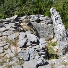
La Couvertoirade, Medieval fortified village in Causse du Larzac, France

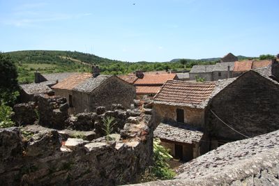
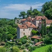
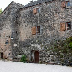
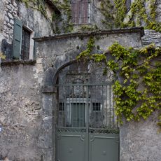
La Couvertoirade is a fortified village on the Causse du Larzac where stone walls frame narrow streets lined with old stone houses. The site includes twin defensive towers, a restored windmill structure, and a church that visitors can explore today.

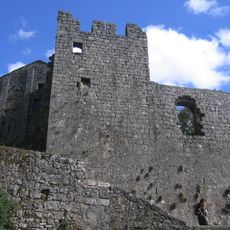
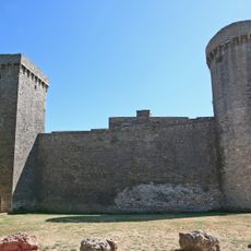
The village was founded in the 12th century by Knights Templar who built a fortress there. After their order was dissolved in 1312, the Knights of St John constructed the defensive walls that surround it today.

The village keeps local crafts alive through workshops in pottery and weaving housed within the old stone buildings. Visitors can watch artisans work and see how these traditional skills remain part of daily life.

The village is best explored on foot, walking through the narrow streets to see the different sections of the fortification. The tourist office in Nant can arrange guided tours if you want to learn more about the history and buildings.

The village houses an old château built by the Templars, representing one of the few surviving structures from this military order. The building still shows the original layout and construction methods that were typical for their fortified settlements.

The community of curious travelers

AroundUs brings together thousands of curated places, local tips, and hidden gems, enriched daily by 60,000 contributors worldwide.

Start exploring
Location
Location
Location
arrondissement of Millau
Elevation above the sea
773 m
Shares border with
Cornus, L'Hospitalet-du-Larzac, Nant, Sainte-Eulalie-de-Cernon, Sauclières, Campestre-et-Luc, Le Caylar, Le Cros, Les Rives
Phone
GPS coordinates
43.91278,3.31639
Latest update
December 20, 2025 12:27
Medieval villages in Occitanie: Cathar castles, limestone gorges, historical sites

Occitanie encompasses an architectural and natural heritage that reflects many centuries of history. Medieval villages are nestled in valleys and on heights, while castles and monasteries tell of the era of the Cathars and religious orders. The region also features remarkable geological formations:...

« La Couvertoirade - Medieval fortified village in Causse du Larzac, France » is provided by Around Us (aroundus.com). Images and texts are derived from Wikimedia project under a Creative Commons license. You are allowed to copy, distribute, and modify copies of this page, under the conditions set by the license, as long as this note is clearly visible.

Discover hidden gems everywhere you go!

From secret cafés to breathtaking viewpoints, skip the crowded tourist spots and find places that match your style. Our app makes it easy with voice search, smart filtering, route optimization, and insider tips from travelers worldwide. Download now for the complete mobile experience.

Around Us App Screenshot

A unique approach to discovering new places

Le Figaro

All the places worth exploring

France Info

A tailor-made excursion in just a few clicks

20 Minutes

Around Us
Travel Guide & Maps
Download

Send to your phone

QR Code
1

Open the camera app on your mobile.

2

Point at the QR code with your camera. A notification will appear.

3

Tap the notification to open the link.