Enable Location

We need your location to show you interesting places around you

Discover nearby places

Find interesting locations and hidden gems around you

Precise directions

Get accurate directions and distances to places

Your location is never shared with other users. It's only used when you tap the location button.

La Ferté-Bernard

Log in to your account

Start exploring — it's free

Trusted by 62,464 travelers worldwide

Continue with Google
Continue with Apple
or

We will send you a code to connect

By continuing, you accept our Terms and Conditions and our Privacy Policy

Check your inbox

We've sent a pincode in your inbox. Please enter the code below.

La Ferté-Bernard

La Ferté-Bernard, Administrative commune in Sarthe, France

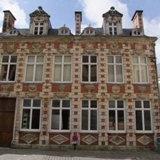
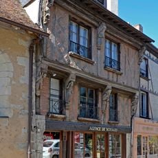
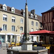
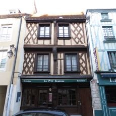
La Ferté-Bernard is a commune in the Sarthe region of northwestern France, crisscrossed by waterways with medieval stone buildings lining its narrow streets. The water channels define how the town is organized and connect different sections of the center.

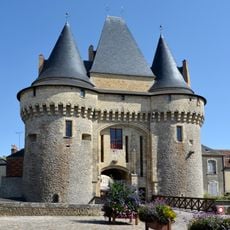
The settlement began as an 11th-century fortress and served as a defensive position. It gained prominence in 1424 when it resisted a four-month English siege, becoming a local symbol of resistance.

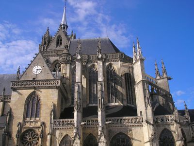
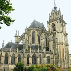
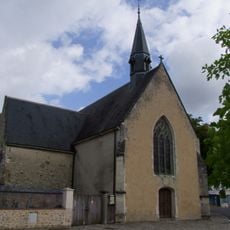
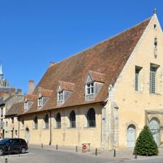
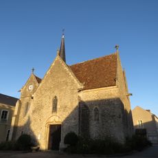
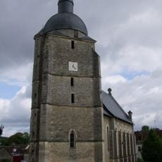
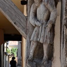
The Notre-Dame des Marais church displays a mix of Gothic and Renaissance architectural styles that reflect regional building traditions. Its presence shapes how the town center looks and reveals the craftsmanship of earlier generations.

Visitors can rent electric boats to explore the water channels throughout the town. Boat stations are located at multiple points in the center, making it easy to access different areas by water.

A medieval dragon legend called the Peluda is said to emerge from the Huisne River and adds a mythical dimension to the place. This tale remains woven into local folklore and continues to capture the imagination of visitors.

The community of curious travelers

AroundUs brings together thousands of curated places, local tips, and hidden gems, enriched daily by 60,000 contributors worldwide.

Start exploring
Location
Elevation above the sea
104 m
Shares border with
Saint-Martin-des-Monts, Saint-Aubin-des-Coudrais, Dehault, La Chapelle-du-Bois, Souvigné-sur-Même, Préval, Cherré-Au
Address
72400 La Ferté-Bernard, France
Phone
GPS coordinates
48.18667,0.65444
Latest update
December 20, 2025 11:23
« La Ferté-Bernard - Administrative commune in Sarthe, France » is provided by Around Us (aroundus.com). Images and texts are derived from Wikimedia project under a Creative Commons license. You are allowed to copy, distribute, and modify copies of this page, under the conditions set by the license, as long as this note is clearly visible.

Discover hidden gems everywhere you go!

From secret cafés to breathtaking viewpoints, skip the crowded tourist spots and find places that match your style. Our app makes it easy with voice search, smart filtering, route optimization, and insider tips from travelers worldwide. Download now for the complete mobile experience.

Around Us App Screenshot

A unique approach to discovering new places

Le Figaro

All the places worth exploring

France Info

A tailor-made excursion in just a few clicks

20 Minutes

Around Us
Travel Guide & Maps
Download

Send to your phone

QR Code
1

Open the camera app on your mobile.

2

Point at the QR code with your camera. A notification will appear.

3

Tap the notification to open the link.