Réotier, Mountain commune in Hautes-Alpes, France
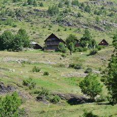
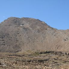
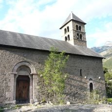
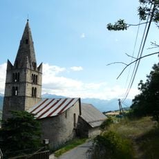
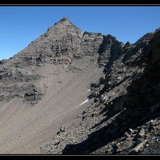
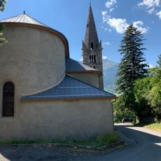
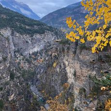
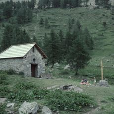
Réotier is a commune situated between mountain ranges in the Hautes-Alpes region, with elevations spanning from around 870 to 3,000 meters. The settlement overlooks the Durance River valley and the fortified complex of Mont-Dauphin in southeastern France.
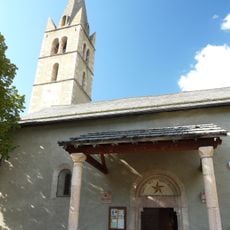
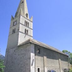
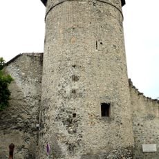
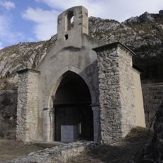
The village developed in an alpine borderland region where trade and defense were historically important concerns. Its proximity to Mont-Dauphin, a strategic fortress, shaped the settlement's evolution over the centuries.
The place carries an Occitan name that reflects the regional linguistic heritage of the area. Local residents maintain their connection to traditional crafts and customs through regular community gatherings.
The location is accessible via mountain roads and paths that offer varying conditions depending on the season. Visitors should prepare for changeable weather and steep terrain throughout the area.
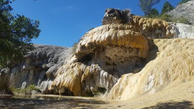
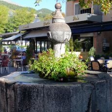
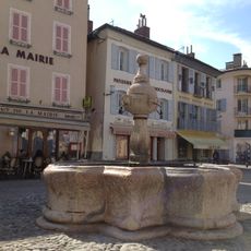
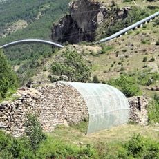
The place is known for its petrifying fountains, where mineral-rich water gradually creates limestone formations over time. This natural geological feature develops slowly through the chemical composition of the springs.
The community of curious travelers
AroundUs brings together thousands of curated places, local tips, and hidden gems, enriched daily by 60,000 contributors worldwide.
Dormillouse
14.1 km
Fort du Mont-Dauphin
2.8 km
Couvent des Cordeliers d'Embrun
13.3 km
Tête de Vautisse
9.3 km
Église Notre-Dame-d'Aquilon
4.7 km
Église Saint-Louis de Mont-Dauphin
2.6 km
Église Saint Apollinaire à L'Argentière-la-Bessée
14 km
Chapelle Saint-Jean à L'Argentière-la-Bessée
13.9 km
Église Saint-Marcellin
7.3 km
Petit Pinier
15.3 km
Mesure banale de grains en pierre de Mont-Dauphin
2.8 km
Église Saint-André de Saint-André-d'Embrun
9.7 km
Église Saint-Antoine d'Eygliers
3.8 km
Gorges du Guil (Hautes-Alpes)
4.3 km
Église Saint-Crépin-et-Saint-Crépinien de Saint-Crépin
4.9 km
Église Saint-Nicolas-et-Sainte-Luce de Risoul
4.3 km
Église Saint-Laurent
9.5 km
Chapelle des Pénitents
4.7 km
Monument du 26 juillet 1944 du maquis du canton de Guillestre
965 m
Chapelle des Seyeres
14 km
Fontaine, place Saint-Marcellin
13.2 km
Fontaine, place Eugène-Barthelon
13.4 km
Tour d'Eygliers
4.7 km
Église Vieille de Saint-Crépin
5.4 km
Temple de Dormillouse de Freissinières
14.2 km
Pertuis Rostan
14.2 km
Maison Giraud
14 km
Immeuble, 39 rue Clovis-Hugues, Embrun
13.4 kmDiscover hidden gems everywhere you go!
From secret cafés to breathtaking viewpoints, skip the crowded tourist spots and find places that match your style. Our app makes it easy with voice search, smart filtering, route optimization, and insider tips from travelers worldwide. Download now for the complete mobile experience.
A unique approach to discovering new places❞
— Le Figaro
All the places worth exploring❞
— France Info
A tailor-made excursion in just a few clicks❞
— 20 Minutes