Enable Location

We need your location to show you interesting places around you

Discover nearby places

Find interesting locations and hidden gems around you

Precise directions

Get accurate directions and distances to places

Your location is never shared with other users. It's only used when you tap the location button.

Seuil de Naurouze

Log in to your account

Start exploring — it's free

Trusted by 61,909 travelers worldwide

Continue with Google
Continue with Apple
or

We will send you a code to connect

By continuing, you accept our Terms and Conditions and our Privacy Policy

Check your inbox

We've sent a pincode in your inbox. Please enter the code below.

Seuil de Naurouze

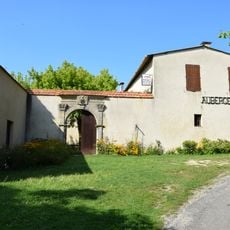
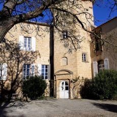
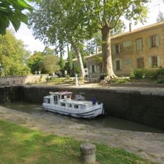
Seuil de Naurouze, Water divide and historical site in Montferrand, France

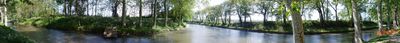
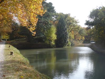
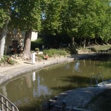
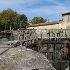
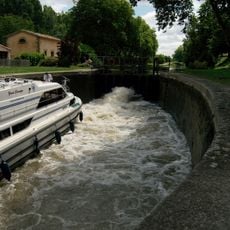
The Seuil de Naurouze is a water divide point in Montferrand where the canal reaches its highest elevation. At this location, water naturally separates, with two lock systems directing flow in different directions.

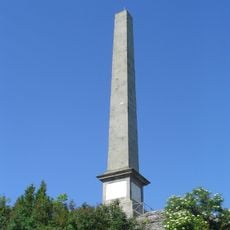
Pierre-Paul Riquet chose this spot in the 17th century as the crucial hub for his ambitious canal project. The site with its distinctive basin was later honored with a monument that preserves the importance of this two-sea connection.

The monument dedicated to Riquet has defined this place since the 19th century and honors the canal's creator. You can see carved reliefs showing mythological figures that represent the connection between the two seas.

The location sits on an elevated area reachable by paths and trails that run through the surrounding landscape. Visitors can easily view and explore the locks and monument from the walking paths nearby.

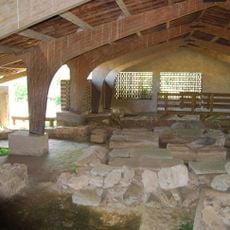
Few visitors realize this basin can be seen as one of the oldest still-functioning examples of 17th-century hydraulic engineering. The fact that water naturally splits here into two directions without artificial force shows the genius of Riquet's natural and technical planning.

The community of curious travelers

AroundUs brings together thousands of curated places, local tips, and hidden gems, enriched daily by 60,000 contributors worldwide.

Start exploring
Location
Elevation above the sea
189 m
Accessibility
Wheelchair accessible
GPS coordinates
43.35076,1.81888
Latest update
December 7, 2025 20:40
« Seuil de Naurouze - Water divide and historical site in Montferrand, France » is provided by Around Us (aroundus.com). Images and texts are derived from Wikimedia project under a Creative Commons license. You are allowed to copy, distribute, and modify copies of this page, under the conditions set by the license, as long as this note is clearly visible.

Discover hidden gems everywhere you go!

From secret cafés to breathtaking viewpoints, skip the crowded tourist spots and find places that match your style. Our app makes it easy with voice search, smart filtering, route optimization, and insider tips from travelers worldwide. Download now for the complete mobile experience.

Around Us App Screenshot

A unique approach to discovering new places

Le Figaro

All the places worth exploring

France Info

A tailor-made excursion in just a few clicks

20 Minutes

Around Us
Travel Guide & Maps
Download

Send to your phone

QR Code
1

Open the camera app on your mobile.

2

Point at the QR code with your camera. A notification will appear.

3

Tap the notification to open the link.