Enable Location

We need your location to show you interesting places around you

Discover nearby places

Find interesting locations and hidden gems around you

Precise directions

Get accurate directions and distances to places

Your location is never shared with other users. It's only used when you tap the location button.

Sentier des Merisiers

Log in to your account

Start exploring — it's free

Trusted by 62,495 travelers worldwide

Continue with Google
Continue with Apple
or

We will send you a code to connect

By continuing, you accept our Terms and Conditions and our Privacy Policy

Check your inbox

We've sent a pincode in your inbox. Please enter the code below.

Sentier des Merisiers

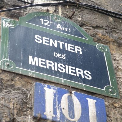
Sentier des Merisiers, trail in Paris, France

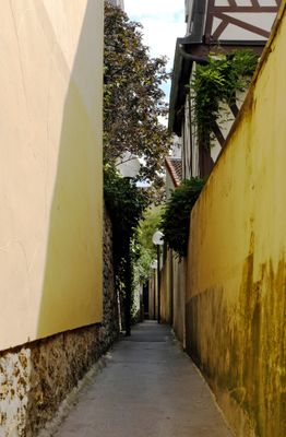
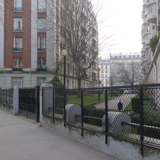
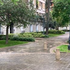
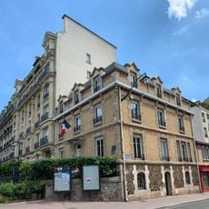
The Sentier des Merisiers is a narrow pedestrian path in the 12th arrondissement of Paris, stretching about 100 meters with a width of just 1 meter, winding through the Bel-Air neighborhood. The trail connects Boulevard Soult to Rue du Niger and is lined with small houses, gardens, and old walls.

The path was established around 1857 and formally became part of Paris in 1863 when the city incorporated the nearby village of Saint-Mandé. Until the 1980s, it remained poorly lit at night and was considered unsafe, until improved lighting was installed.

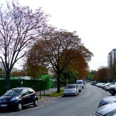
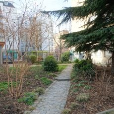
The path takes its name possibly from wild cherry trees that once grew here or from an old place name on historical maps. Today, locals and visitors appreciate this hidden corner for its quiet character and the sense of discovery it offers within the neighborhood.

The path is easily accessible by tram line 3a, which stops at Alexandra David-Néel station and connects to other parts of the city. A walk through takes just a few minutes since the path is only 100 meters long, making it suitable for a brief stop or photography.

This is one of the narrowest paths in Paris, measuring just 87 centimeters in some sections, making the walk a tight squeeze. The confinement is enhanced by old buildings and hidden gardens behind the houses that give the place a secret quality.

The community of curious travelers

AroundUs brings together thousands of curated places, local tips, and hidden gems, enriched daily by 60,000 contributors worldwide.

Start exploring
Inception
1857
Length
100 m
Width
1 m
Part of
road network of Paris
Shares border with
boulevard Soult, rue du Niger
GPS coordinates
48.84320,2.40922
Latest update
February 9, 2026 08:23
« Sentier des Merisiers - trail in Paris, France » is provided by Around Us (aroundus.com). Images and texts are derived from Wikimedia project under a Creative Commons license. You are allowed to copy, distribute, and modify copies of this page, under the conditions set by the license, as long as this note is clearly visible.

Discover hidden gems everywhere you go!

From secret cafés to breathtaking viewpoints, skip the crowded tourist spots and find places that match your style. Our app makes it easy with voice search, smart filtering, route optimization, and insider tips from travelers worldwide. Download now for the complete mobile experience.

Around Us App Screenshot

A unique approach to discovering new places

Le Figaro

All the places worth exploring

France Info

A tailor-made excursion in just a few clicks

20 Minutes

Around Us
Travel Guide & Maps
Download

Send to your phone

QR Code
1

Open the camera app on your mobile.

2

Point at the QR code with your camera. A notification will appear.

3

Tap the notification to open the link.