Enable Location

We need your location to show you interesting places around you

Discover nearby places

Find interesting locations and hidden gems around you

Precise directions

Get accurate directions and distances to places

Your location is never shared with other users. It's only used when you tap the location button.

Stromberg

Log in to your account

Start exploring — it's free

Trusted by 62,852 travelers worldwide

Continue with Google
Continue with Apple
or

We will send you a code to connect

By continuing, you accept our Terms and Conditions and our Privacy Policy

Check your inbox

We've sent a pincode in your inbox. Please enter the code below.

Stromberg

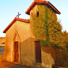
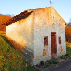
Stromberg, Natural summit in Grand Est, France.

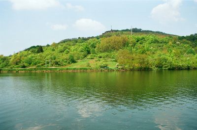
Stromberg is a mountain summit reaching 314 meters in an elliptical shape, positioned along the French-Luxembourg border in the Moselle department. Two telecommunications towers occupy the peak, delivering network coverage to the surrounding communities of Schengen and Contz-les-Bains.

The site has long served as a natural boundary between France and Luxembourg. Protection measures began on both sides starting in 1993 to preserve the area.

Residents of Contz-les-Bains practice a tradition of rolling a flaming wheel down the slope on Saint John's Eve to predict the wine harvest outcome. This ancient ritual ties the local community to their wine-growing heritage and the seasonal cycle.

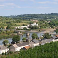
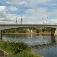
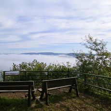
Walking paths on the hill are accessible and offer views of the Moselle valley and border region. Allow time to reach the peak where the telecommunications towers stand and take in the surroundings.

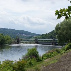
This formation is a remnant hill isolated by deep ravines on its western and northern sides. The Moselle River flows along its southern and eastern base, creating a distinctive geographical setting.

The community of curious travelers

AroundUs brings together thousands of curated places, local tips, and hidden gems, enriched daily by 60,000 contributors worldwide.

Start exploring
Location
Elevation above the sea
312 m
GPS coordinates
49.44993,6.35581
Latest update
December 14, 2025 17:04
« Stromberg - Natural summit in Grand Est, France » is provided by Around Us (aroundus.com). Images and texts are derived from Wikimedia project under a Creative Commons license. You are allowed to copy, distribute, and modify copies of this page, under the conditions set by the license, as long as this note is clearly visible.

Discover hidden gems everywhere you go!

From secret cafés to breathtaking viewpoints, skip the crowded tourist spots and find places that match your style. Our app makes it easy with voice search, smart filtering, route optimization, and insider tips from travelers worldwide. Download now for the complete mobile experience.

Around Us App Screenshot

A unique approach to discovering new places

Le Figaro

All the places worth exploring

France Info

A tailor-made excursion in just a few clicks

20 Minutes

Around Us
Travel Guide & Maps
Download

Send to your phone

QR Code
1

Open the camera app on your mobile.

2

Point at the QR code with your camera. A notification will appear.

3

Tap the notification to open the link.