Enable Location

We need your location to show you interesting places around you

Discover nearby places

Find interesting locations and hidden gems around you

Precise directions

Get accurate directions and distances to places

Your location is never shared with other users. It's only used when you tap the location button.

Pannonhalma

Log in to your account

Start exploring — it's free

Trusted by 62,038 travelers worldwide

Continue with Google
Continue with Apple
or

We will send you a code to connect

By continuing, you accept our Terms and Conditions and our Privacy Policy

Check your inbox

We've sent a pincode in your inbox. Please enter the code below.

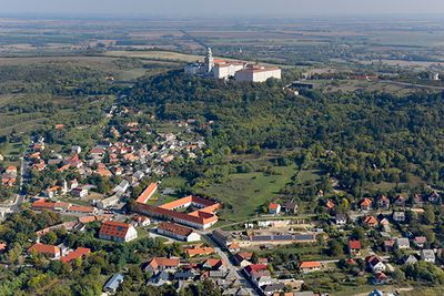
Pannonhalma, Administrative district in Győr-Moson-Sopron County, Hungary

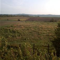
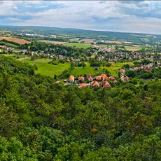
Pannonhalma is an administrative district in western Hungary containing one town and sixteen surrounding villages. The area spans several hundred square kilometers of mixed rural and settled landscape.

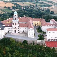
The area gained importance in the late 10th century when a Benedictine monastery was established by a ruling prince. This monastery later developed into a major center of religious and political influence throughout the medieval period.

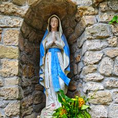
The area shows strong religious traditions in how locals use public spaces and buildings. The Benedictine monastery serves as a spiritual and cultural center where the community gathers for celebrations and ceremonies.

The district can be accessed via regional road networks linking neighboring administrative areas. Visitors should note that the area consists of multiple scattered settlements, making personal transportation helpful for exploring different villages.

The monastery was founded by a ruling prince and later became a landowner with extensive territories. This accumulation of power made it one of the most influential religious institutions of its era.

The community of curious travelers

AroundUs brings together thousands of curated places, local tips, and hidden gems, enriched daily by 60,000 contributors worldwide.

Start exploring
Shares border with
Pázmándfalu, Nyalka, Tarjánpuszta, Ravazd, Sokorópátka, Tényő, Écs, Nyúl, Győrság
GPS coordinates
47.54861,17.74833
Latest update
December 23, 2025 21:05
« Pannonhalma - Administrative district in Győr-Moson-Sopron County, Hungary » is provided by Around Us (aroundus.com). Images and texts are derived from Wikimedia project under a Creative Commons license. You are allowed to copy, distribute, and modify copies of this page, under the conditions set by the license, as long as this note is clearly visible.

Discover hidden gems everywhere you go!

From secret cafés to breathtaking viewpoints, skip the crowded tourist spots and find places that match your style. Our app makes it easy with voice search, smart filtering, route optimization, and insider tips from travelers worldwide. Download now for the complete mobile experience.

Around Us App Screenshot

A unique approach to discovering new places

Le Figaro

All the places worth exploring

France Info

A tailor-made excursion in just a few clicks

20 Minutes

Around Us
Travel Guide & Maps
Download

Send to your phone

QR Code
1

Open the camera app on your mobile.

2

Point at the QR code with your camera. A notification will appear.

3

Tap the notification to open the link.