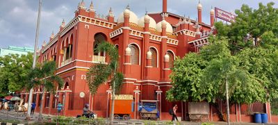
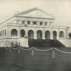
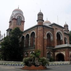
Chepauk Palace, Indo-Saracenic palace in Chepauk, India.
The red brick compound consists of two principal sections, Kalas Mahal and Humayun Mahal, linked by a corridor spanning approximately 6,100 square meters (66,000 square feet). The structure features high ceilings, ornamental columns, and geometric facade details characteristic of the Indo-Saracenic style popular in colonial South India.
Nawab Muhammed Ali Khan Wallajah commissioned the compound in 1768 after abandoning earlier plans to build within Fort St George due to insufficient space. The complex served as the official residence of the Arcot Nawabs until British annexation of the princely state in the early nineteenth century. Later, the Madras government repurposed portions of the compound for administrative functions, and the site has undergone several restoration phases in recent decades.
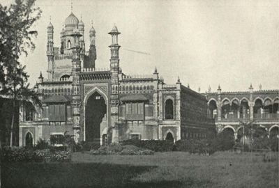
This palace represents the architectural blend of Indian craftsmanship with European design, showcasing detailed woodwork, expansive arches, and traditional lime mortar methods common during the Nawab era. Serving as the residence of the Arcot Nawabs, the compound functioned as a center of regional authority and represented Muslim ruler influence within South Indian society during British colonial presence. The structure reflects the political and social dynamics of eighteenth-century Madras.
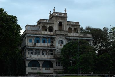
Recent restoration projects focus on converting Kalas Mahal into offices for the National Green Tribunal while maintaining original architectural features. The compound sits in the Chepauk area of Chennai, accessible via Walajah Road, and is well connected by public transport including local buses and metro services. Visitors should verify access policies beforehand, as portions of the compound house government offices with restricted entry during weekdays.
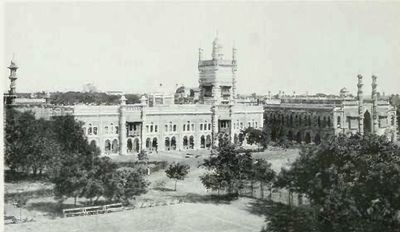
The original grounds spanned approximately 47 hectares (117 acres) and included dedicated areas for keeping elephants within the garden spaces. The outer walls also enclosed a private mosque and housing quarters for court staff, making the compound a self-contained fortified settlement within the growing city of Madras. A network of underground chambers beneath portions of the structure remains largely unexplored and undocumented by architectural surveys.
The community of curious travelers
AroundUs brings together thousands of curated places, local tips, and hidden gems, enriched daily by 60,000 contributors worldwide.