Enable Location

We need your location to show you interesting places around you

Discover nearby places

Find interesting locations and hidden gems around you

Precise directions

Get accurate directions and distances to places

Your location is never shared with other users. It's only used when you tap the location button.

Stopselzieher-Klettersteig

Log in to your account

Start exploring — it's free

Trusted by 61,380 travelers worldwide

Continue with Google
Continue with Apple
or

We will send you a code to connect

By continuing, you accept our Terms and Conditions and our Privacy Policy

Check your inbox

We've sent a pincode in your inbox. Please enter the code below.

Stopselzieher-Klettersteig

Stopselzieher-Klettersteig, Via ferrata route in Tyrol, Austria

Description

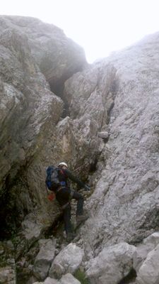
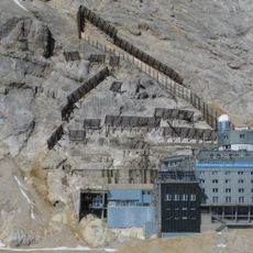
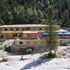
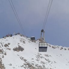
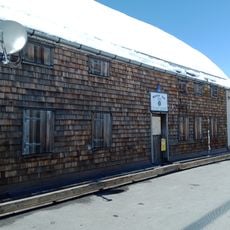
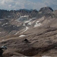
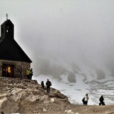
The Stopselzieher-Klettersteig is a via ferrata in Tyrol that guides climbers across steep rock faces and secured metal cables throughout its course. The route passes several mountain huts positioned at different elevations, providing shelter and rest points for those ascending.

History

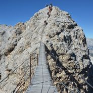
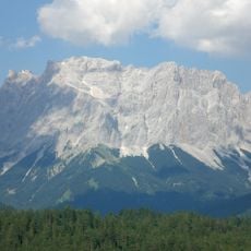
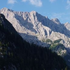
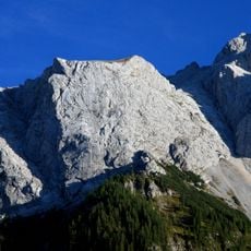
The route was created as an alternative climbing path to reach Germany's highest peak from Austrian territory, making use of natural rock formations. Modern safety equipment was integrated into the existing landscape to enable this connection.

Culture

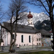
This climbing route sits within a region where mountaineering is woven into daily life and local identity. Visitors regularly encounter other climbers and find evidence of the strong traditions that connect people to these rock faces.

Practical

This is a demanding climb that requires good physical fitness and proper safety equipment, including sturdy footwear with firm grip. Starting early in the day allows time to complete the route safely before darkness falls.

Did you know?

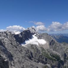
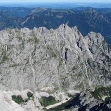
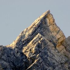
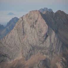
The route offers viewpoints that reveal how the surrounding landscape looks from different elevations, providing insight into the geography of the entire Zugspitz region. These perspectives help visitors understand the scale and structure of the mountains they are ascending through.

Location
GPS coordinates
47.42333,10.97028
Latest update
December 12, 2025 14:20

AroundUs brings together thousands of curated places, local tips, and hidden gems, enriched daily by 60,000 contributors worldwide. Discover all places nearby (Tyrol).

Via ferrata in Europe: Dolomites, Alps, climbing routes

Via ferrata routes in the Alps combine steel cables, metal rungs, and bridges into protected climbing paths through alpine rock faces. The routes extend through the Dolomites, French Alps, Austrian Ötztal, and Swiss mountain regions between 2,600 and 9,800 feet in elevation. Routes such as the Ivano...

« Stopselzieher-Klettersteig - Via ferrata route in Tyrol, Austria » is provided by Around Us (aroundus.com). Images and texts are derived from Wikimedia project under a Creative Commons license. You are allowed to copy, distribute, and modify copies of this page, under the conditions set by the license, as long as this note is clearly visible.

Discover hidden gems everywhere you go!

From secret cafés to breathtaking viewpoints, skip the crowded tourist spots and find places that match your style. Our app makes it easy with voice search, smart filtering, route optimization, and insider tips from travelers worldwide. Download now for the complete mobile experience.

Around Us App Screenshot

A unique approach to discovering new places

Le Figaro

All the places worth exploring

France Info

A tailor-made excursion in just a few clicks

20 Minutes

Around Us
Travel Guide & Maps
Download

Send to your phone

QR Code
1

Open the camera app on your mobile.

2

Point at the QR code with your camera. A notification will appear.

3

Tap the notification to open the link.