·

Enable Location

We need your location to show you interesting places around you

Discover nearby places

Find interesting locations and hidden gems around you

Precise directions

Get accurate directions and distances to places

Your location is never shared with other users. It's only used when you tap the location button.

Alpe Kanis

Log in to your account

Start exploring — it's free

Trusted by 62,669 travelers worldwide

Continue with Google
Continue with Apple
or

We will send you a code to connect

By continuing, you accept our Terms and Conditions and our Privacy Policy

Check your inbox

We've sent a pincode in your inbox. Please enter the code below.

Alpe Kanis

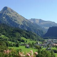
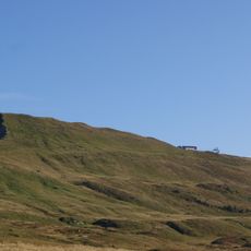
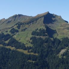
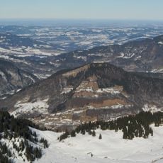
Alpe Kanis, alpine pasture below the Kanisfluh (mountain) in the municipality Mellau, Vorarlberg, Austria

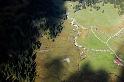
Alpe Kanis is a mountain pasture near Mellau situated at about 1,500 meters (4,900 feet) elevation below the Kanisfluh peak, characterized by green meadows and simple wooden and stone structures. The property spans roughly 110 hectares of grazing land and hosts approximately 50 cattle along with calves, pigs, horses, and goats during the summer months.

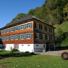
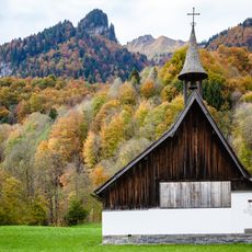
Alpe Kanis has been used as a mountain pasture for over 100 years, with its buildings dating back to this early period of alpine farming. Historical photographs from the early 20th century document the traditional way of life and show how families shaped this landscape across multiple generations.

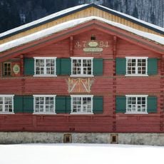
Alpe Kanis takes its name from the Kanisfluh mountain above and remains central to local identity in Mellau. The pasture continues to serve the community as a working farm where traditional cheese production and animal husbandry practices are maintained by families who have worked the land for generations.

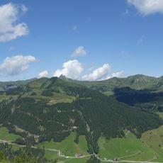
A walking trail from Mellau reaches the alpe in about 20 minutes, with longer routes connecting multiple mountain farms available for more extended hikes. Visitors should bring weather-appropriate clothing with warm layers, as mountain weather can change quickly and conditions are often cooler than in the valley below.

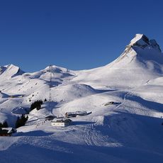
During winter, the trail to the alpe becomes a popular route for snowshoeing and cross-country skiing, with the landscape taking on a completely different character. This seasonal transformation offers visitors entirely different natural experiences depending on when they visit.

The community of curious travelers

AroundUs brings together thousands of curated places, local tips, and hidden gems, enriched daily by 60,000 contributors worldwide.

Start exploring
Location
Elevation above the sea
1,463 m
GPS coordinates
47.32355,9.89931
Latest update
January 23, 2026 13:22
Vorarlberg in Austria: what to see in Bregenz, in the Bregenzerwald and in Feldkirch

Vorarlberg in Austria: what to see in Bregenz, in the Bregenzerwald and in Feldkirch

« Alpe Kanis - alpine pasture below the Kanisfluh (mountain) in the municipality Mellau, Vorarlberg, Austria » is provided by Around Us (aroundus.com). Images and texts are derived from Wikimedia project under a Creative Commons license. You are allowed to copy, distribute, and modify copies of this page, under the conditions set by the license, as long as this note is clearly visible.

Discover hidden gems everywhere you go!

From secret cafés to breathtaking viewpoints, skip the crowded tourist spots and find places that match your style. Our app makes it easy with voice search, smart filtering, route optimization, and insider tips from travelers worldwide. Download now for the complete mobile experience.

Around Us App Screenshot

A unique approach to discovering new places

Le Figaro

All the places worth exploring

France Info

A tailor-made excursion in just a few clicks

20 Minutes

Around Us
Travel Guide & Maps
Download

Send to your phone

QR Code
1

Open the camera app on your mobile.

2

Point at the QR code with your camera. A notification will appear.

3

Tap the notification to open the link.