Zeche Karl, Archaeological mining site in Wuppertal, Germany
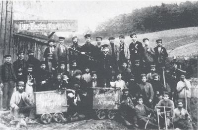
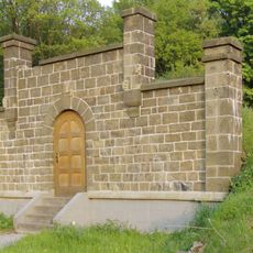
Zeche Karl is a former coal mine in Wuppertal that survives today as an archaeological site with preserved mining structures and equipment remains. The foundations, shaft openings, and technical installations give a sense of how mining operations functioned during its working years.
The mine was established during the 19th century industrial expansion and played a role in developing the local economy of Wuppertal. It represents a period when coal extraction was a major employer and shaped the region's growth.
The designation as an archaeological monument reflects how mining shaped the identity of the region for generations. Walking through the site, visitors encounter traces of an industry that was central to local life and community.
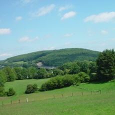
The site is located within Wuppertal and can be reached on foot, though some sections are visible from a distance due to protective barriers. It is helpful to check in advance which parts of the area can be accessed, as safety regulations protect the archaeological remains.
The preserved shaft structures reveal distinctive mining techniques from that era that differed from other European operations. Experts can observe how innovative the engineering solutions were for the period by studying the remains of the extraction equipment.
The community of curious travelers
AroundUs brings together thousands of curated places, local tips, and hidden gems, enriched daily by 60,000 contributors worldwide.