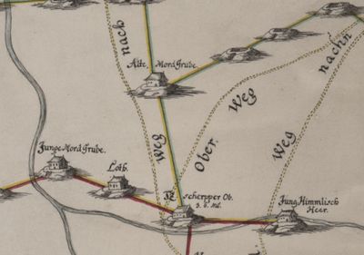
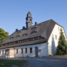
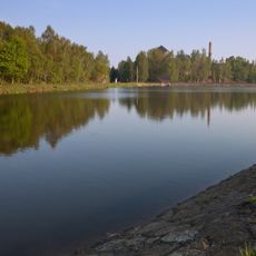
Alte Mordgrube, Mining heritage site in Brand-Erbisdorf, Germany.
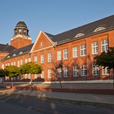
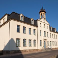
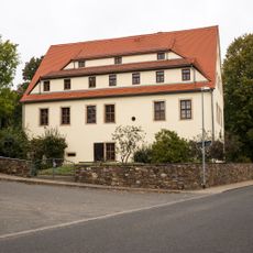
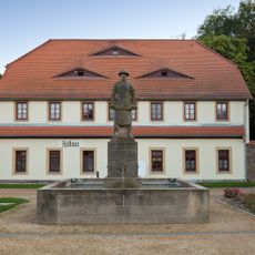
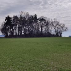
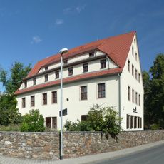
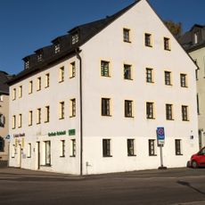
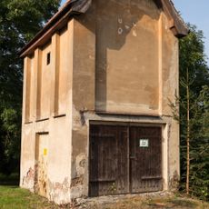
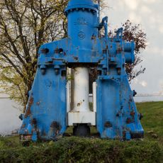
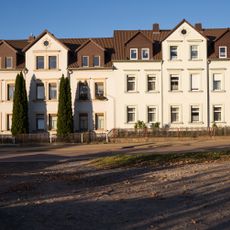
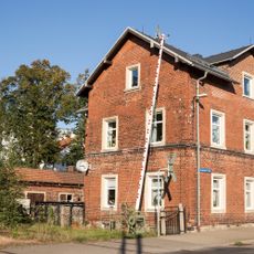
Alte Mordgrube is a former silver and lead mine in Brand-Erbisdorf, Saxony, preserving structures from its industrial past. The complex includes a water pump house, administrative buildings, and a central courtyard approximately 40 by 40 meters in size.
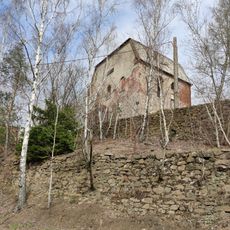
The mine was established in 1560 and became significant to Saxony's economy for centuries. Operations continued until 1896, when silver and lead extraction finally ceased.
The site reflects its changing roles across different periods, from industrial workplace to place of remembrance. A monument in the courtyard commemorates workers from the Stecher leather factory who died in World War I, showing how the space served new purposes after mining ended.
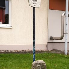
Access to the site is through the street 'An der Zugspitze', with the entrance between the prayer house and administrative building. The courtyard layout is straightforward to navigate, making it easy to explore the different structures.
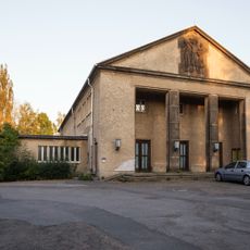
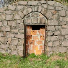
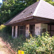
The site contains a rare 19th-century coe structure, a distinctive shaft covering that supplied water power to the mining operation. Such constructions are seldom found elsewhere, making this one of the few surviving examples.
Location: Brand-Erbisdorf
Inception: 1560
Part of: Liste der Kulturdenkmale in Brand-Erbisdorf, Freiberg Mining Landscape, Brander Revier
Address: Brand-Erbisdorf
GPS coordinates: 50.87009,13.33659
Latest update: December 9, 2025 20:22
Elite vehicles
1.3 km
Lother Teich
1.4 km
Theater der Freundschaft
1 km
Schulgebäude Albertstraße 4; 6
993 m
Einigkeit Fundgrube
1.2 km
Grenzstein mit der Bezeichnung B Turnerstraße 5 (gegenüber)
1.1 km
Wohn- und Geschäftshaus Bahnhofstraße 20
744 m
Buttermilchtor; Goldene Pforte Schacht; Brander Revier (Sachgesamtheit) Brand-Erbisdorf
1.3 km
Huthaus; Alte Mordgrube Fundgrube; Vereinigt Feld bei Brand; Königliche Mittelgrube; Lederwerke Moritz Stecher; Alte Mordgrube (Sachgesamtheit); Brander Revier (Sachgesamtheit) Brand-Erbisdorf
0 m
Town hall in Brand-Erbisdorf
1.1 km
Eisenbahnbrücke Brandsteig; Eisenbahnstrecke Berthelsdorf – Großhartmannsdorf mit Abzw Brand – Langenau Brand-Erbisdorf
920 m
Gasthof in offener Bebauung Markt 4
1 km
Wegestein Berthelsdorf/Erzgeb.
708 m
Bahnhof Brand-Erbisdorf; Eisenbahnstrecke Berthelsdorf – Großhartmannsdorf mit Abzw Brand – Langenau Brand-Erbisdorf
743 m
Ehemals Amtsgericht, heute Polizeigebäude Hauptstraße 19
1.1 km
Huthaus und Scheidebank Am Beschert Glück 29; 29b
1.1 km
Halde Am Graben
1.4 km
Konstantinschacht Berthelsdorf/Erzgeb.
749 m
Hörnig Schacht; Huthaus Einigkeit; Vergnügte Anweisung samt Reußen; Einigkeit Fundgrube; Brander Revier (Sachgesamtheit) Brand-Erbisdorf
1.2 km
Grubenanlage Hauptstraße 70; 72
944 m
Wasserlaufsanlage Am Graben
1.4 km
Wartehalle An der Zugspitze
360 m
Wohn- und Geschäftshaus in offener Bebauung Markt 6
975 m
Wegestein Brand-Erbisdorf
513 m
Transformatorenhäuschen Brand-Erbisdorf
1.4 km
Gesenkhammer; Pressund Schmiedewerk (ehem.) Brand-Erbisdorf
600 m
Mietshaus in halboffener Bebauung Berthelsdorfer Straße 2
689 m
Ehemaliges Bahnmeistereigebäude, später Wohnhaus und Nebengebäude Berthelsdorfer Straße 1
719 mVisited this place? Tap the stars to rate it and share your experience / photos with the community! Try now! You can cancel it anytime.
Discover hidden gems everywhere you go!
From secret cafés to breathtaking viewpoints, skip the crowded tourist spots and find places that match your style. Our app makes it easy with voice search, smart filtering, route optimization, and insider tips from travelers worldwide. Download now for the complete mobile experience.
A unique approach to discovering new places❞
— Le Figaro
All the places worth exploring❞
— France Info
A tailor-made excursion in just a few clicks❞
— 20 Minutes