Waldenburg, municipality in Baden-Württemberg, Germany
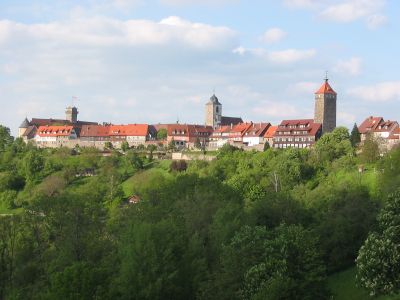
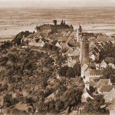
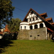
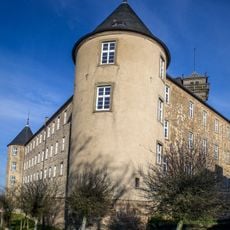
Waldenburg is a town in the Hohenlohe region that sits on a hill surrounded by green fields and forests. The old town center features timber-framed buildings, narrow streets, and a historic town hall, while Waldenburger Schloss stands at the town's entrance.
Waldenburg was founded around 1250 and later became the residence of the princes of Hohenlohe-Waldenburg. The town was nearly destroyed during the Second World War but was quickly rebuilt after 1945, with the Phönixbrunnen fountain serving as a symbol of this recovery.
The town served as a residence for the princes of Hohenlohe-Waldenburg, and this role shaped its identity and buildings over centuries. Today, residents keep local traditions alive through festivals and community events that celebrate the region's heritage in simple, meaningful ways.
The old town is compact and easy to explore on foot, with marked walking paths through the historic center and the old fortress area called Bastei. The town is easily accessible by car via highways and by train, and offers a range of accommodation options including hotels, apartments, and a nearby camping site.
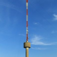
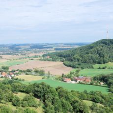
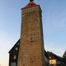
A water tower stands guard over the town from above and is one of the oldest structures, giving the place a special character. Visitors can climb the nearby Lachnersturm tower via about 100 medieval stone steps to view the Hohenlohe plain below.
The community of curious travelers
AroundUs brings together thousands of curated places, local tips, and hidden gems, enriched daily by 60,000 contributors worldwide.