Spaichingen, Administrative center in Tuttlingen, Germany.
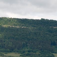
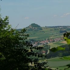
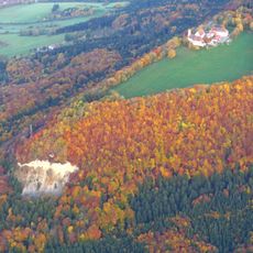
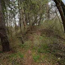
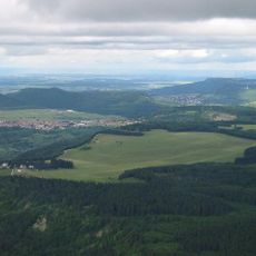
Spaichingen is a town in Baden-Württemberg situated on hilly terrain surrounded by forest. The landscape sits at roughly 660 meters elevation and features a green, nature-filled setting with several districts.
The settlement received a deed of gift from the St. Gallen monastery in 791 and remained under Austrian rule for over 400 years. This long period under foreign control shaped the area's economic and political development.
The Fasnet carnival starts each November 11th with traditional costume parades and songs passed down through families. These celebrations shape the town's character and bring locals and visitors together.
The town has two train stations and several bus lines offering connections to nearby cities. Visitors will find regular public transport options for exploring the region.
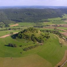
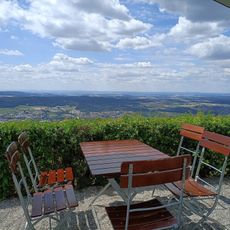
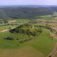
The Dreifaltigkeitsberg rises to 985 meters above sea level and marks the highest point within the town's boundaries. This prominent peak offers hikers a viewpoint over the surrounding landscape.
Location: Tuttlingen
Location: Spaichingen VVG
Elevation above the sea: 660 m
Shares border with: Balgheim, Böttingen, Rietheim-Weilheim, Hausen ob Verena, Gunningen, Trossingen, Aldingen, Denkingen
Website: https://spaichingen.de
GPS coordinates: 48.07307,8.73919
Latest update: December 20, 2025 11:24
Hohenkarpfen
3.9 km
Dreifaltigkeitsberg
2 km
Burg Hohenkarpfen
3.9 km
Dreifaltigkeitsberg
2 kmBurg Baldenberg
2 km
Hohenkarpfen
3.9 km
Albtrauf zwischen Balgheim und Gosheim mit Dreifaltigkeitsberg, Klippeneck und Lemberg
3.8 km
Burgstall Schlößlesbühl
2.7 km
Freibad Spaichingen
1.2 kmTrosselbach-, Hagenbach- und Primtal
5.5 km
Klippeneck
3.8 km
Gewerbemuseum Spaichingen
193 mSommerschafweide mit Baum- und Heckenbeständen südlich der Straße Trossingen-Aldingen im Gewand Auwasen
5 kmHeckenlandschaft oberhalb der Hausener Mühle in Heeräcker, Ried, Buchreute und Schildbühl
3.1 kmSommerschafweide mit Baum- und Heckenbeständen in den Gewanden Brühl und Menishalde
5 km
Hohenkarpfen
3.8 km1 Stieleiche
4.2 kmGehrn
2.9 kmStaufelberg
3 kmStieleichen-Kirsche-Gruppe
2.7 km1 Linde bei der Davidsmühle
1.4 km1 Eibe
2.2 km2 Stieleichen
4.4 km1 Stieleiche
5 km1 Stieleiche
4.3 km1 Linde an der Schuraer Str.
3.5 kmStieleichengruppe (9 Bäume)
2.9 km"Verena-Mühle"
1.3 kmVisited this place? Tap the stars to rate it and share your experience / photos with the community! Try now! You can cancel it anytime.
Discover hidden gems everywhere you go!
From secret cafés to breathtaking viewpoints, skip the crowded tourist spots and find places that match your style. Our app makes it easy with voice search, smart filtering, route optimization, and insider tips from travelers worldwide. Download now for the complete mobile experience.
A unique approach to discovering new places❞
— Le Figaro
All the places worth exploring❞
— France Info
A tailor-made excursion in just a few clicks❞
— 20 Minutes