Enable Location

We need your location to show you interesting places around you

Discover nearby places

Find interesting locations and hidden gems around you

Precise directions

Get accurate directions and distances to places

Your location is never shared with other users. It's only used when you tap the location button.

Vallendar

Log in to your account

Start exploring — it's free

Trusted by 62,061 travelers worldwide

Continue with Google
Continue with Apple
or

We will send you a code to connect

By continuing, you accept our Terms and Conditions and our Privacy Policy

Check your inbox

We've sent a pincode in your inbox. Please enter the code below.

Vallendar, Administrative municipality in Rhineland-Palatinate, Germany.

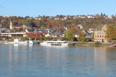
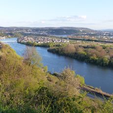
Vallendar is a municipality in Rhineland-Palatinate that sits along the eastern Rhine riverbank, mixing residential neighborhoods with commercial areas. The town has distinct districts and benefits from its proximity to the larger city of Koblenz nearby.

The earliest records mention it between 830 and 840 AD as property of the Archbishop of Trier. In 1856 it gained municipal status under Prussian rule, establishing its modern administrative structure.

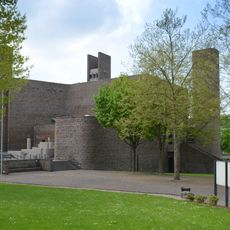
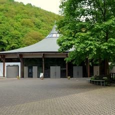
The Schoenstatt Movement established its spiritual center here, shaping the character of the town and drawing pilgrims and visitors seeking religious connection. This faith-based community remains a defining presence in daily life.

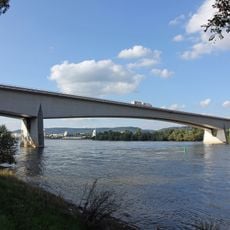
The town connects easily via the B42 highway and the Rheinstrecke railway line with direct access to Koblenz. Visitors will find good train connections and road access for exploring the area.

The WHU Otto Beisheim School of Management is based here and ranks among the leading business schools in German-speaking countries. This renowned institution shapes the town's educational character and attracts students from around the world.

The community of curious travelers

AroundUs brings together thousands of curated places, local tips, and hidden gems, enriched daily by 60,000 contributors worldwide.

Start exploring
Location
Elevation above the sea
99 m
GPS coordinates
50.40028,7.61722
Latest update
December 20, 2025 01:39
« Vallendar - Administrative municipality in Rhineland-Palatinate, Germany » is provided by Around Us (aroundus.com). Images and texts are derived from Wikimedia project under a Creative Commons license. You are allowed to copy, distribute, and modify copies of this page, under the conditions set by the license, as long as this note is clearly visible.

Discover hidden gems everywhere you go!

From secret cafés to breathtaking viewpoints, skip the crowded tourist spots and find places that match your style. Our app makes it easy with voice search, smart filtering, route optimization, and insider tips from travelers worldwide. Download now for the complete mobile experience.

Around Us App Screenshot

A unique approach to discovering new places

Le Figaro

All the places worth exploring

France Info

A tailor-made excursion in just a few clicks

20 Minutes

Around Us
Travel Guide & Maps
Download

Send to your phone

QR Code
1

Open the camera app on your mobile.

2

Point at the QR code with your camera. A notification will appear.

3

Tap the notification to open the link.